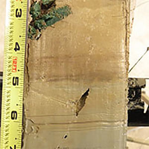
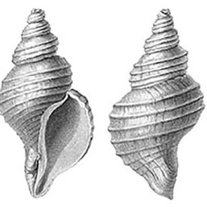
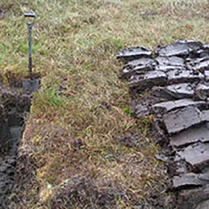
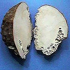
Below is a list of currently available WGs. To join a WG, do so on your LinkedEarth wiki profile page.
Loading map...
{"format":"leaflet","minzoom":1,"maxzoom":14,"limit":500,"offset":0,"link":"all","sort":[""],"order":[],"headers":"show","mainlabel":"","intro":"","outro":"","searchlabel":"... further results","default":"","geoservice":"geonames","width":"auto","height":"350px","centre":false,"title":"","label":"","icon":"","visitedicon":"","lines":[],"polygons":[],"circles":[],"rectangles":[],"wmsoverlay":false,"copycoords":false,"static":false,"zoom":1,"defzoom":14,"layer":"OpenStreetMap","overlaylayers":[],"resizable":false,"enablefullscreen":false,"markercluster":true,"clustermaxzoom":20,"clusterzoomonclick":true,"clustermaxradius":80,"clusterspiderfy":true,"showtitle":false,"hidenamespace":false,"template":"LiPDLocation","userparam":"","activeicon":"","pagelabel":false,"ajaxcoordproperty":"","ajaxquery":"","locations":[{"text":"\u003Cp\u003E\u003Cb\u003E\u003Ca href=\"/A7.Oppo.2005\" title=\"A7.Oppo.2005\"\u003EA7.Oppo.2005\u003C/a\u003E\u003C/b\u003E\n\u003C/p\u003E\u003Cp\u003EArchive Type: {{{2}}}\n\u003C/p\u003E","title":"A7.Oppo.2005.Location","link":"","lat":28.02,"lon":127.02,"icon":""},{"text":"\u003Cp\u003E\u003Cb\u003E\u003Ca href=\"/Afr-ColdAirCave.Sundqvist.2013\" title=\"Afr-ColdAirCave.Sundqvist.2013\"\u003EAfr-ColdAirCave.Sundqvist.2013\u003C/a\u003E\u003C/b\u003E\n\u003C/p\u003E\u003Cp\u003EArchive Type: Cold Air Cave\n\u003C/p\u003E","title":"Afr-ColdAirCave.Sundqvist.2013.Location","link":"","lat":-24,"lon":29.18,"icon":""},{"text":"\u003Cp\u003E\u003Cb\u003E\u003Ca href=\"/Afr-LakeMalawi.Powers.2011\" title=\"Afr-LakeMalawi.Powers.2011\"\u003EAfr-LakeMalawi.Powers.2011\u003C/a\u003E\u003C/b\u003E\n\u003C/p\u003E\u003Cp\u003EArchive Type: Lake Malawi\n\u003C/p\u003E","title":"Afr-LakeMalawi.Powers.2011.Location","link":"","lat":-10.0033,"lon":34.2883,"icon":""},{"text":"\u003Cp\u003E\u003Cb\u003E\u003Ca href=\"/Afr-LakeTanganyika.Tierney.2010\" title=\"Afr-LakeTanganyika.Tierney.2010\"\u003EAfr-LakeTanganyika.Tierney.2010\u003C/a\u003E\u003C/b\u003E\n\u003C/p\u003E\u003Cp\u003EArchive Type: Lake Tanganyika\n\u003C/p\u003E","title":"Afr-LakeTanganyika.Tierney.2010.Location","link":"","lat":-6.03,"lon":28.53,"icon":""},{"text":"\u003Cp\u003E\u003Cb\u003E\u003Ca href=\"/Afr-P178-15P.Tierney.2015\" title=\"Afr-P178-15P.Tierney.2015\"\u003EAfr-P178-15P.Tierney.2015\u003C/a\u003E\u003C/b\u003E\n\u003C/p\u003E\u003Cp\u003EArchive Type: P178-15P\n\u003C/p\u003E","title":"Afr-P178-15P.Tierney.2015.Location","link":"","lat":11.955,"lon":44.3,"icon":""},{"text":"\u003Cp\u003E\u003Cb\u003E\u003Ca href=\"/Ant-BerknerIsland.Mulvaney.2002\" title=\"Ant-BerknerIsland.Mulvaney.2002\"\u003EAnt-BerknerIsland.Mulvaney.2002\u003C/a\u003E\u003C/b\u003E\n\u003C/p\u003E\u003Cp\u003EArchive Type: Berkner Island (South)\n\u003C/p\u003E","title":"Ant-BerknerIsland.Mulvaney.2002.Location","link":"","lat":-79.57,"lon":-45.72,"icon":""},{"text":"\u003Cp\u003E\u003Cb\u003E\u003Ca href=\"/Ant-CoastalDML.Thamban.2012\" title=\"Ant-CoastalDML.Thamban.2012\"\u003EAnt-CoastalDML.Thamban.2012\u003C/a\u003E\u003C/b\u003E\n\u003C/p\u003E\u003Cp\u003EArchive Type: Coastal DML\n\u003C/p\u003E","title":"Ant-CoastalDML.Thamban.2012.Location","link":"","lat":-70.86,"lon":11.54,"icon":""},{"text":"\u003Cp\u003E\u003Cb\u003E\u003Ca href=\"/Ant-DSS.DahlJensen.1999\" title=\"Ant-DSS.DahlJensen.1999\"\u003EAnt-DSS.DahlJensen.1999\u003C/a\u003E\u003C/b\u003E\n\u003C/p\u003E\u003Cp\u003EArchive Type: DSS\n\u003C/p\u003E","title":"Ant-DSS.DahlJensen.1999.Location","link":"","lat":-66.77,"lon":112.807,"icon":""},{"text":"\u003Cp\u003E\u003Cb\u003E\u003Ca href=\"/Ant-DSS.Moy.2012\" title=\"Ant-DSS.Moy.2012\"\u003EAnt-DSS.Moy.2012\u003C/a\u003E\u003C/b\u003E\n\u003C/p\u003E\u003Cp\u003EArchive Type: DSS\n\u003C/p\u003E","title":"Ant-DSS.Moy.2012.Location","link":"","lat":-66.77,"lon":112.807,"icon":""},{"text":"\u003Cp\u003E\u003Cb\u003E\u003Ca href=\"/Ant-DomeC.Jouzel.2001\" title=\"Ant-DomeC.Jouzel.2001\"\u003EAnt-DomeC.Jouzel.2001\u003C/a\u003E\u003C/b\u003E\n\u003C/p\u003E\u003Cp\u003EArchive Type: Dome C\n\u003C/p\u003E","title":"Ant-DomeC.Jouzel.2001.Location","link":"","lat":-75.1,"lon":123.39,"icon":""},{"text":"\u003Cp\u003E\u003Cb\u003E\u003Ca href=\"/Ant-DomeC.Stenni.2001\" title=\"Ant-DomeC.Stenni.2001\"\u003EAnt-DomeC.Stenni.2001\u003C/a\u003E\u003C/b\u003E\n\u003C/p\u003E\u003Cp\u003EArchive Type: Dome C\n\u003C/p\u003E","title":"Ant-DomeC.Stenni.2001.Location","link":"","lat":-75.1,"lon":123.39,"icon":""},{"text":"\u003Cp\u003E\u003Cb\u003E\u003Ca href=\"/Ant-DomeF1993.Uemura.2014\" title=\"Ant-DomeF1993.Uemura.2014\"\u003EAnt-DomeF1993.Uemura.2014\u003C/a\u003E\u003C/b\u003E\n\u003C/p\u003E\u003Cp\u003EArchive Type: Dome F 1993\n\u003C/p\u003E","title":"Ant-DomeF1993.Uemura.2014.Location","link":"","lat":-77.32,"lon":39.7,"icon":""},{"text":"\u003Cp\u003E\u003Cb\u003E\u003Ca href=\"/Ant-DomeF2001.Uemura.2008\" title=\"Ant-DomeF2001.Uemura.2008\"\u003EAnt-DomeF2001.Uemura.2008\u003C/a\u003E\u003C/b\u003E\n\u003C/p\u003E\u003Cp\u003EArchive Type: Dome F 2001\n\u003C/p\u003E","title":"Ant-DomeF2001.Uemura.2008.Location","link":"","lat":-77.32,"lon":39.7,"icon":""},{"text":"\u003Cp\u003E\u003Cb\u003E\u003Ca href=\"/Ant-Ferrigno.Thomas.2013\" title=\"Ant-Ferrigno.Thomas.2013\"\u003EAnt-Ferrigno.Thomas.2013\u003C/a\u003E\u003C/b\u003E\n\u003C/p\u003E\u003Cp\u003EArchive Type: Ferrigno\n\u003C/p\u003E","title":"Ant-Ferrigno.Thomas.2013.Location","link":"","lat":-74.57,"lon":-86.9,"icon":""},{"text":"\u003Cp\u003E\u003Cb\u003E\u003Ca href=\"/Ant-JamesRossIsland.Mulvaney.2013\" title=\"Ant-JamesRossIsland.Mulvaney.2013\"\u003EAnt-JamesRossIsland.Mulvaney.2013\u003C/a\u003E\u003C/b\u003E\n\u003C/p\u003E\u003Cp\u003EArchive Type: James Ross Island\n\u003C/p\u003E","title":"Ant-JamesRossIsland.Mulvaney.2013.Location","link":"","lat":-64.2017,"lon":-57.685,"icon":""},{"text":"\u003Cp\u003E\u003Cb\u003E\u003Ca href=\"/Ant-MES.Rhodes.2012\" title=\"Ant-MES.Rhodes.2012\"\u003EAnt-MES.Rhodes.2012\u003C/a\u003E\u003C/b\u003E\n\u003C/p\u003E\u003Cp\u003EArchive Type: MES\n\u003C/p\u003E","title":"Ant-MES.Rhodes.2012.Location","link":"","lat":-77.515,"lon":167.6765,"icon":""},{"text":"\u003Cp\u003E\u003Cb\u003E\u003Ca href=\"/Ant-PlateauRemote.Mosley-Thompson.2013\" title=\"Ant-PlateauRemote.Mosley-Thompson.2013\"\u003EAnt-PlateauRemote.Mosley-Thompson.2013\u003C/a\u003E\u003C/b\u003E\n\u003C/p\u003E\u003Cp\u003EArchive Type: Plateau Remote\n\u003C/p\u003E","title":"Ant-PlateauRemote.Mosley-Thompson.2013.Location","link":"","lat":-84,"lon":43,"icon":""},{"text":"\u003Cp\u003E\u003Cb\u003E\u003Ca href=\"/Ant-SipleStation.Mosley-Thompson.1990\" title=\"Ant-SipleStation.Mosley-Thompson.1990\"\u003EAnt-SipleStation.Mosley-Thompson.1990\u003C/a\u003E\u003C/b\u003E\n\u003C/p\u003E\u003Cp\u003EArchive Type: Siple Station\n\u003C/p\u003E","title":"Ant-SipleStation.Mosley-Thompson.1990.Location","link":"","lat":-75.92,"lon":-84.25,"icon":""},{"text":"\u003Cp\u003E\u003Cb\u003E\u003Ca href=\"/Ant-SiteDML05.Graf.2002\" title=\"Ant-SiteDML05.Graf.2002\"\u003EAnt-SiteDML05.Graf.2002\u003C/a\u003E\u003C/b\u003E\n\u003C/p\u003E\u003Cp\u003EArchive Type: Site DML05\n\u003C/p\u003E","title":"Ant-SiteDML05.Graf.2002.Location","link":"","lat":-75,"lon":-0.01,"icon":""},{"text":"\u003Cp\u003E\u003Cb\u003E\u003Ca href=\"/Ant-SiteDML07.Graf.2002\" title=\"Ant-SiteDML07.Graf.2002\"\u003EAnt-SiteDML07.Graf.2002\u003C/a\u003E\u003C/b\u003E\n\u003C/p\u003E\u003Cp\u003EArchive Type: Site DML07\n\u003C/p\u003E","title":"Ant-SiteDML07.Graf.2002.Location","link":"","lat":-75.58,"lon":-3.43,"icon":""},{"text":"\u003Cp\u003E\u003Cb\u003E\u003Ca href=\"/Ant-SiteDML17.Graf.2002\" title=\"Ant-SiteDML17.Graf.2002\"\u003EAnt-SiteDML17.Graf.2002\u003C/a\u003E\u003C/b\u003E\n\u003C/p\u003E\u003Cp\u003EArchive Type: Site DML17\n\u003C/p\u003E","title":"Ant-SiteDML17.Graf.2002.Location","link":"","lat":-75.17,"lon":6.5,"icon":""},{"text":"\u003Cp\u003E\u003Cb\u003E\u003Ca href=\"/Ant-TALDICE.Stenni.2010\" title=\"Ant-TALDICE.Stenni.2010\"\u003EAnt-TALDICE.Stenni.2010\u003C/a\u003E\u003C/b\u003E\n\u003C/p\u003E\u003Cp\u003EArchive Type: TALDICE\n\u003C/p\u003E","title":"Ant-TALDICE.Stenni.2010.Location","link":"","lat":-72.82,"lon":159.18,"icon":""},{"text":"\u003Cp\u003E\u003Cb\u003E\u003Ca href=\"/Ant-TalosDome.Stenni.2002\" title=\"Ant-TalosDome.Stenni.2002\"\u003EAnt-TalosDome.Stenni.2002\u003C/a\u003E\u003C/b\u003E\n\u003C/p\u003E\u003Cp\u003EArchive Type: Talos Dome\n\u003C/p\u003E","title":"Ant-TalosDome.Stenni.2002.Location","link":"","lat":-72.8,"lon":159.06,"icon":""},{"text":"\u003Cp\u003E\u003Cb\u003E\u003Ca href=\"/Ant-TaylorDome.Steig.2000\" title=\"Ant-TaylorDome.Steig.2000\"\u003EAnt-TaylorDome.Steig.2000\u003C/a\u003E\u003C/b\u003E\n\u003C/p\u003E\u003Cp\u003EArchive Type: Taylor Dome\n\u003C/p\u003E","title":"Ant-TaylorDome.Steig.2000.Location","link":"","lat":-77.78,"lon":158.72,"icon":""},{"text":"\u003Cp\u003E\u003Cb\u003E\u003Ca href=\"/Ant-US-ITASE-2000-1.Steig.2013\" title=\"Ant-US-ITASE-2000-1.Steig.2013\"\u003EAnt-US-ITASE-2000-1.Steig.2013\u003C/a\u003E\u003C/b\u003E\n\u003C/p\u003E\u003Cp\u003EArchive Type: US-ITASE-2000-1\n\u003C/p\u003E","title":"Ant-US-ITASE-2000-1.Steig.2013.Location","link":"","lat":-79.3838,"lon":-111.24,"icon":""},{"text":"\u003Cp\u003E\u003Cb\u003E\u003Ca href=\"/Ant-US-ITASE-2002-4.Steig.2013\" title=\"Ant-US-ITASE-2002-4.Steig.2013\"\u003EAnt-US-ITASE-2002-4.Steig.2013\u003C/a\u003E\u003C/b\u003E\n\u003C/p\u003E\u003Cp\u003EArchive Type: US-ITASE-2002-4\n\u003C/p\u003E","title":"Ant-US-ITASE-2002-4.Steig.2013.Location","link":"","lat":-86.5,"lon":-107.99,"icon":""},{"text":"\u003Cp\u003E\u003Cb\u003E\u003Ca href=\"/Ant-VLG.Bertler.2011\" title=\"Ant-VLG.Bertler.2011\"\u003EAnt-VLG.Bertler.2011\u003C/a\u003E\u003C/b\u003E\n\u003C/p\u003E\u003Cp\u003EArchive Type: VLG\n\u003C/p\u003E","title":"Ant-VLG.Bertler.2011.Location","link":"","lat":-77.3302,"lon":162.5332,"icon":""},{"text":"\u003Cp\u003E\u003Cb\u003E\u003Ca href=\"/Ant-Vostok.Ekaykin.2014\" title=\"Ant-Vostok.Ekaykin.2014\"\u003EAnt-Vostok.Ekaykin.2014\u003C/a\u003E\u003C/b\u003E\n\u003C/p\u003E\u003Cp\u003EArchive Type: Vostok\n\u003C/p\u003E","title":"Ant-Vostok.Ekaykin.2014.Location","link":"","lat":-78.2785,"lon":104.8005,"icon":""},{"text":"\u003Cp\u003E\u003Cb\u003E\u003Ca href=\"/Ant-WAIS-Divide.Severinghaus.2012\" title=\"Ant-WAIS-Divide.Severinghaus.2012\"\u003EAnt-WAIS-Divide.Severinghaus.2012\u003C/a\u003E\u003C/b\u003E\n\u003C/p\u003E\u003Cp\u003EArchive Type: WAIS-Divide\n\u003C/p\u003E","title":"Ant-WAIS-Divide.Severinghaus.2012.Location","link":"","lat":-79.463,"lon":-112.125,"icon":""},{"text":"\u003Cp\u003E\u003Cb\u003E\u003Ca href=\"/Ant-WDC05A.Steig.2013\" title=\"Ant-WDC05A.Steig.2013\"\u003EAnt-WDC05A.Steig.2013\u003C/a\u003E\u003C/b\u003E\n\u003C/p\u003E\u003Cp\u003EArchive Type: WDC05A\n\u003C/p\u003E","title":"Ant-WDC05A.Steig.2013.Location","link":"","lat":-79.46,"lon":-112.09,"icon":""},{"text":"\u003Cp\u003E\u003Cb\u003E\u003Ca href=\"/Ant-WDC06A.Steig.2013\" title=\"Ant-WDC06A.Steig.2013\"\u003EAnt-WDC06A.Steig.2013\u003C/a\u003E\u003C/b\u003E\n\u003C/p\u003E\u003Cp\u003EArchive Type: WDC06A\n\u003C/p\u003E","title":"Ant-WDC06A.Steig.2013.Location","link":"","lat":-79.46,"lon":-112.09,"icon":""},{"text":"\u003Cp\u003E\u003Cb\u003E\u003Ca href=\"/Arc-Agassiz.Vinther.2008\" title=\"Arc-Agassiz.Vinther.2008\"\u003EArc-Agassiz.Vinther.2008\u003C/a\u003E\u003C/b\u003E\n\u003C/p\u003E\u003Cp\u003EArchive Type: Agassiz\n\u003C/p\u003E","title":"Arc-Agassiz.Vinther.2008.Location","link":"","lat":80.7,"lon":-73.1,"icon":""},{"text":"\u003Cp\u003E\u003Cb\u003E\u003Ca href=\"/Arc-AkademiiNaukIceCap.Opel.2013\" title=\"Arc-AkademiiNaukIceCap.Opel.2013\"\u003EArc-AkademiiNaukIceCap.Opel.2013\u003C/a\u003E\u003C/b\u003E\n\u003C/p\u003E\u003Cp\u003EArchive Type: Akademii Nauk Ice Cap, Severnaya Zemlya (Russian Arctic)\n\u003C/p\u003E","title":"Arc-AkademiiNaukIceCap.Opel.2013.Location","link":"","lat":80.52,"lon":94.82,"icon":""},{"text":"\u003Cp\u003E\u003Cb\u003E\u003Ca href=\"/Arc-Arjeplog.Bjorklund.2014\" title=\"Arc-Arjeplog.Bjorklund.2014\"\u003EArc-Arjeplog.Bjorklund.2014\u003C/a\u003E\u003C/b\u003E\n\u003C/p\u003E\u003Cp\u003EArchive Type: Arjeplog\n\u003C/p\u003E","title":"Arc-Arjeplog.Bjorklund.2014.Location","link":"","lat":66.3,"lon":18.2,"icon":""},{"text":"\u003Cp\u003E\u003Cb\u003E\u003Ca href=\"/Arc-Armarnaes.Bjorklund.2012\" title=\"Arc-Armarnaes.Bjorklund.2012\"\u003EArc-Armarnaes.Bjorklund.2012\u003C/a\u003E\u003C/b\u003E\n\u003C/p\u003E\u003Cp\u003EArchive Type: Armarnaes\n\u003C/p\u003E","title":"Arc-Armarnaes.Bjorklund.2012.Location","link":"","lat":65.9,"lon":16.1,"icon":""},{"text":"\u003Cp\u003E\u003Cb\u003E\u003Ca href=\"/Arc-Austfonna.Isaksson.2005\" title=\"Arc-Austfonna.Isaksson.2005\"\u003EArc-Austfonna.Isaksson.2005\u003C/a\u003E\u003C/b\u003E\n\u003C/p\u003E\u003Cp\u003EArchive Type: Austfonna\n\u003C/p\u003E","title":"Arc-Austfonna.Isaksson.2005.Location","link":"","lat":79.83,"lon":24.02,"icon":""},{"text":"\u003Cp\u003E\u003Cb\u003E\u003Ca href=\"/Arc-Avam-Taimyr.Briffa.2008\" title=\"Arc-Avam-Taimyr.Briffa.2008\"\u003EArc-Avam-Taimyr.Briffa.2008\u003C/a\u003E\u003C/b\u003E\n\u003C/p\u003E\u003Cp\u003EArchive Type: Avam-Taimyr\n\u003C/p\u003E","title":"Arc-Avam-Taimyr.Briffa.2008.Location","link":"","lat":72,"lon":101,"icon":""},{"text":"\u003Cp\u003E\u003Cb\u003E\u003Ca href=\"/Arc-BigRoundLake.Thomas.2009\" title=\"Arc-BigRoundLake.Thomas.2009\"\u003EArc-BigRoundLake.Thomas.2009\u003C/a\u003E\u003C/b\u003E\n\u003C/p\u003E\u003Cp\u003EArchive Type: Big Round Lake\n\u003C/p\u003E","title":"Arc-BigRoundLake.Thomas.2009.Location","link":"","lat":69.87,"lon":-68.83,"icon":""},{"text":"\u003Cp\u003E\u003Cb\u003E\u003Ca href=\"/Arc-BlueLake.Bird.2008\" title=\"Arc-BlueLake.Bird.2008\"\u003EArc-BlueLake.Bird.2008\u003C/a\u003E\u003C/b\u003E\n\u003C/p\u003E\u003Cp\u003EArchive Type: Blue Lake\n\u003C/p\u003E","title":"Arc-BlueLake.Bird.2008.Location","link":"","lat":68.09,"lon":-150.47,"icon":""},{"text":"\u003Cp\u003E\u003Cb\u003E\u003Ca href=\"/Arc-CampCentury.Fisher.1969\" title=\"Arc-CampCentury.Fisher.1969\"\u003EArc-CampCentury.Fisher.1969\u003C/a\u003E\u003C/b\u003E\n\u003C/p\u003E\u003Cp\u003EArchive Type: Camp Century\n\u003C/p\u003E","title":"Arc-CampCentury.Fisher.1969.Location","link":"","lat":77.17,"lon":-61.13,"icon":""},{"text":"\u003Cp\u003E\u003Cb\u003E\u003Ca href=\"/Arc-Crete.Vinther.2010\" title=\"Arc-Crete.Vinther.2010\"\u003EArc-Crete.Vinther.2010\u003C/a\u003E\u003C/b\u003E\n\u003C/p\u003E\u003Cp\u003EArchive Type: Crete\n\u003C/p\u003E","title":"Arc-Crete.Vinther.2010.Location","link":"","lat":71.12,"lon":-37.32,"icon":""},{"text":"\u003Cp\u003E\u003Cb\u003E\u003Ca href=\"/Arc-DevonIceCap.Fisher.1983\" title=\"Arc-DevonIceCap.Fisher.1983\"\u003EArc-DevonIceCap.Fisher.1983\u003C/a\u003E\u003C/b\u003E\n\u003C/p\u003E\u003Cp\u003EArchive Type: Devon Ice Cap\n\u003C/p\u003E","title":"Arc-DevonIceCap.Fisher.1983.Location","link":"","lat":75.33,"lon":-82.5,"icon":""},{"text":"\u003Cp\u003E\u003Cb\u003E\u003Ca href=\"/Arc-Dye.Vinther.2010\" title=\"Arc-Dye.Vinther.2010\"\u003EArc-Dye.Vinther.2010\u003C/a\u003E\u003C/b\u003E\n\u003C/p\u003E\u003Cp\u003EArchive Type: Dye\n\u003C/p\u003E","title":"Arc-Dye.Vinther.2010.Location","link":"","lat":65.18,"lon":-43.83,"icon":""},{"text":"\u003Cp\u003E\u003Cb\u003E\u003Ca href=\"/Arc-Forfjorddalen.McCarroll.2013\" title=\"Arc-Forfjorddalen.McCarroll.2013\"\u003EArc-Forfjorddalen.McCarroll.2013\u003C/a\u003E\u003C/b\u003E\n\u003C/p\u003E\u003Cp\u003EArchive Type: Forfjorddalen\n\u003C/p\u003E","title":"Arc-Forfjorddalen.McCarroll.2013.Location","link":"","lat":68.73,"lon":15.73,"icon":""},{"text":"\u003Cp\u003E\u003Cb\u003E\u003Ca href=\"/Arc-GISP2.Grootes.1997\" title=\"Arc-GISP2.Grootes.1997\"\u003EArc-GISP2.Grootes.1997\u003C/a\u003E\u003C/b\u003E\n\u003C/p\u003E\u003Cp\u003EArchive Type: GISP2\n\u003C/p\u003E","title":"Arc-GISP2.Grootes.1997.Location","link":"","lat":72.1,"lon":-38.08,"icon":""},{"text":"\u003Cp\u003E\u003Cb\u003E\u003Ca href=\"/Arc-GRIP.Vinther.2010\" title=\"Arc-GRIP.Vinther.2010\"\u003EArc-GRIP.Vinther.2010\u003C/a\u003E\u003C/b\u003E\n\u003C/p\u003E\u003Cp\u003EArchive Type: GRIP\n\u003C/p\u003E","title":"Arc-GRIP.Vinther.2010.Location","link":"","lat":72.58,"lon":-37.64,"icon":""},{"text":"\u003Cp\u003E\u003Cb\u003E\u003Ca href=\"/Arc-GulfofAlaska.Wilson.2014\" title=\"Arc-GulfofAlaska.Wilson.2014\"\u003EArc-GulfofAlaska.Wilson.2014\u003C/a\u003E\u003C/b\u003E\n\u003C/p\u003E\u003Cp\u003EArchive Type: Gulf of Alaska\n\u003C/p\u003E","title":"Arc-GulfofAlaska.Wilson.2014.Location","link":"","lat":61.03,"lon":-146.59,"icon":""},{"text":"\u003Cp\u003E\u003Cb\u003E\u003Ca href=\"/Arc-HalletLake.McKay.2008\" title=\"Arc-HalletLake.McKay.2008\"\u003EArc-HalletLake.McKay.2008\u003C/a\u003E\u003C/b\u003E\n\u003C/p\u003E\u003Cp\u003EArchive Type: Hallet Lake\n\u003C/p\u003E","title":"Arc-HalletLake.McKay.2008.Location","link":"","lat":61.5,"lon":-146.2,"icon":""},{"text":"\u003Cp\u003E\u003Cb\u003E\u003Ca href=\"/Arc-HudsonLake.Clegg.2011\" title=\"Arc-HudsonLake.Clegg.2011\"\u003EArc-HudsonLake.Clegg.2011\u003C/a\u003E\u003C/b\u003E\n\u003C/p\u003E\u003Cp\u003EArchive Type: Hudson Lake\n\u003C/p\u003E","title":"Arc-HudsonLake.Clegg.2011.Location","link":"","lat":61.9,"lon":-145.66,"icon":""},{"text":"\u003Cp\u003E\u003Cb\u003E\u003Ca href=\"/Arc-Hv%C3%ADt%C3%A1rvatn.Larsen.2011\" title=\"Arc-Hv\u00edt\u00e1rvatn.Larsen.2011\"\u003EArc-Hv\u00edt\u00e1rvatn.Larsen.2011\u003C/a\u003E\u003C/b\u003E\n\u003C/p\u003E\u003Cp\u003EArchive Type: Hv\u00edt\u00e1rvatn\n\u003C/p\u003E","title":"Arc-Hv\u00edt\u00e1rvatn.Larsen.2011.Location","link":"","lat":64.6,"lon":-19.8,"icon":""},{"text":"\u003Cp\u003E\u003Cb\u003E\u003Ca href=\"/Arc-Iceland.Bergthorsson.1969\" title=\"Arc-Iceland.Bergthorsson.1969\"\u003EArc-Iceland.Bergthorsson.1969\u003C/a\u003E\u003C/b\u003E\n\u003C/p\u003E\u003Cp\u003EArchive Type: Iceland\n\u003C/p\u003E","title":"Arc-Iceland.Bergthorsson.1969.Location","link":"","lat":64.77,"lon":-18.37,"icon":""},{"text":"\u003Cp\u003E\u003Cb\u003E\u003Ca href=\"/Arc-Indigirka.Hughes.1999\" title=\"Arc-Indigirka.Hughes.1999\"\u003EArc-Indigirka.Hughes.1999\u003C/a\u003E\u003C/b\u003E\n\u003C/p\u003E\u003Cp\u003EArchive Type: Indigirka\n\u003C/p\u003E","title":"Arc-Indigirka.Hughes.1999.Location","link":"","lat":69.5,"lon":147,"icon":""},{"text":"\u003Cp\u003E\u003Cb\u003E\u003Ca href=\"/Arc-Kittelfjall.Bjorklund.2012\" title=\"Arc-Kittelfjall.Bjorklund.2012\"\u003EArc-Kittelfjall.Bjorklund.2012\u003C/a\u003E\u003C/b\u003E\n\u003C/p\u003E\u003Cp\u003EArchive Type: Kittelfjall\n\u003C/p\u003E","title":"Arc-Kittelfjall.Bjorklund.2012.Location","link":"","lat":65.2,"lon":15.5,"icon":""},{"text":"\u003Cp\u003E\u003Cb\u003E\u003Ca href=\"/Arc-Kongressvatnet.D%27Andrea.2012\" title=\"Arc-Kongressvatnet.D'Andrea.2012\"\u003EArc-Kongressvatnet.D'Andrea.2012\u003C/a\u003E\u003C/b\u003E\n\u003C/p\u003E\u003Cp\u003EArchive Type: Kongressvatnet\n\u003C/p\u003E","title":"Arc-Kongressvatnet.D'Andrea.2012.Location","link":"","lat":78.0217,"lon":13.9311,"icon":""},{"text":"\u003Cp\u003E\u003Cb\u003E\u003Ca href=\"/Arc-Laanila.Lindholm.2013\" title=\"Arc-Laanila.Lindholm.2013\"\u003EArc-Laanila.Lindholm.2013\u003C/a\u003E\u003C/b\u003E\n\u003C/p\u003E\u003Cp\u003EArchive Type: Laanila\n\u003C/p\u003E","title":"Arc-Laanila.Lindholm.2013.Location","link":"","lat":68.49166667,"lon":27.33333333,"icon":""},{"text":"\u003Cp\u003E\u003Cb\u003E\u003Ca href=\"/Arc-LakeC2.Lamoureux.1996\" title=\"Arc-LakeC2.Lamoureux.1996\"\u003EArc-LakeC2.Lamoureux.1996\u003C/a\u003E\u003C/b\u003E\n\u003C/p\u003E\u003Cp\u003EArchive Type: Lake C2\n\u003C/p\u003E","title":"Arc-LakeC2.Lamoureux.1996.Location","link":"","lat":82.83,"lon":-77.9,"icon":""},{"text":"\u003Cp\u003E\u003Cb\u003E\u003Ca href=\"/Arc-LakeDonardBaffinIsland.Moore.2001\" title=\"Arc-LakeDonardBaffinIsland.Moore.2001\"\u003EArc-LakeDonardBaffinIsland.Moore.2001\u003C/a\u003E\u003C/b\u003E\n\u003C/p\u003E\u003Cp\u003EArchive Type: Lake Donard Baffin Island\n\u003C/p\u003E","title":"Arc-LakeDonardBaffinIsland.Moore.2001.Location","link":"","lat":66.73,"lon":-61.35,"icon":""},{"text":"\u003Cp\u003E\u003Cb\u003E\u003Ca href=\"/Arc-LakeE.D%27Andrea.2011\" title=\"Arc-LakeE.D'Andrea.2011\"\u003EArc-LakeE.D'Andrea.2011\u003C/a\u003E\u003C/b\u003E\n\u003C/p\u003E\u003Cp\u003EArchive Type: Lake E\n\u003C/p\u003E","title":"Arc-LakeE.D'Andrea.2011.Location","link":"","lat":67,"lon":-50.7,"icon":""},{"text":"\u003Cp\u003E\u003Cb\u003E\u003Ca href=\"/Arc-LakeLehmilampi.Haltia-Hovi.2007\" title=\"Arc-LakeLehmilampi.Haltia-Hovi.2007\"\u003EArc-LakeLehmilampi.Haltia-Hovi.2007\u003C/a\u003E\u003C/b\u003E\n\u003C/p\u003E\u003Cp\u003EArchive Type: Lake Lehmilampi\n\u003C/p\u003E","title":"Arc-LakeLehmilampi.Haltia-Hovi.2007.Location","link":"","lat":63.62,"lon":29.1,"icon":""},{"text":"\u003Cp\u003E\u003Cb\u003E\u003Ca href=\"/Arc-LakeNatauj%C3%A4rvi.Ojala.2005\" title=\"Arc-LakeNatauj\u00e4rvi.Ojala.2005\"\u003EArc-LakeNatauj\u00e4rvi.Ojala.2005\u003C/a\u003E\u003C/b\u003E\n\u003C/p\u003E\u003Cp\u003EArchive Type: Lake Natauj\u00e4rvi\n\u003C/p\u003E","title":"Arc-LakeNatauj\u00e4rvi.Ojala.2005.Location","link":"","lat":61.81,"lon":24.68,"icon":""},{"text":"\u003Cp\u003E\u003Cb\u003E\u003Ca href=\"/Arc-LenaRiver.McDonald.1998\" title=\"Arc-LenaRiver.McDonald.1998\"\u003EArc-LenaRiver.McDonald.1998\u003C/a\u003E\u003C/b\u003E\n\u003C/p\u003E\u003Cp\u003EArchive Type: Lena River\n\u003C/p\u003E","title":"Arc-LenaRiver.McDonald.1998.Location","link":"","lat":70.67,"lon":125.87,"icon":""},{"text":"\u003Cp\u003E\u003Cb\u003E\u003Ca href=\"/Arc-Lomonosovfonna.Divine.2011\" title=\"Arc-Lomonosovfonna.Divine.2011\"\u003EArc-Lomonosovfonna.Divine.2011\u003C/a\u003E\u003C/b\u003E\n\u003C/p\u003E\u003Cp\u003EArchive Type: Lomonosovfonna , Svalbard\n\u003C/p\u003E","title":"Arc-Lomonosovfonna.Divine.2011.Location","link":"","lat":78.8647,"lon":17.425,"icon":""},{"text":"\u003Cp\u003E\u003Cb\u003E\u003Ca href=\"/Arc-LowerMurrayLake.Cook.2008\" title=\"Arc-LowerMurrayLake.Cook.2008\"\u003EArc-LowerMurrayLake.Cook.2008\u003C/a\u003E\u003C/b\u003E\n\u003C/p\u003E\u003Cp\u003EArchive Type: Lower Murray Lake\n\u003C/p\u003E","title":"Arc-LowerMurrayLake.Cook.2008.Location","link":"","lat":81.35,"lon":-69.53,"icon":""},{"text":"\u003Cp\u003E\u003Cb\u003E\u003Ca href=\"/Arc-MD992275.Jiang.2005\" title=\"Arc-MD992275.Jiang.2005\"\u003EArc-MD992275.Jiang.2005\u003C/a\u003E\u003C/b\u003E\n\u003C/p\u003E\u003Cp\u003EArchive Type: MD992275\n\u003C/p\u003E","title":"Arc-MD992275.Jiang.2005.Location","link":"","lat":66.55,"lon":-17.7,"icon":""},{"text":"\u003Cp\u003E\u003Cb\u003E\u003Ca href=\"/Arc-MackenzieDelta.Porter.2013\" title=\"Arc-MackenzieDelta.Porter.2013\"\u003EArc-MackenzieDelta.Porter.2013\u003C/a\u003E\u003C/b\u003E\n\u003C/p\u003E\u003Cp\u003EArchive Type: Mackenzie Delta\n\u003C/p\u003E","title":"Arc-MackenzieDelta.Porter.2013.Location","link":"","lat":68.625,"lon":-133.87,"icon":""},{"text":"\u003Cp\u003E\u003Cb\u003E\u003Ca href=\"/Arc-NGTB16.Schwager.1998\" title=\"Arc-NGTB16.Schwager.1998\"\u003EArc-NGTB16.Schwager.1998\u003C/a\u003E\u003C/b\u003E\n\u003C/p\u003E\u003Cp\u003EArchive Type: NGT B16\n\u003C/p\u003E","title":"Arc-NGTB16.Schwager.1998.Location","link":"","lat":73.94,"lon":-37.63,"icon":""},{"text":"\u003Cp\u003E\u003Cb\u003E\u003Ca href=\"/Arc-PennyIceCapP96.Fisher.1998\" title=\"Arc-PennyIceCapP96.Fisher.1998\"\u003EArc-PennyIceCapP96.Fisher.1998\u003C/a\u003E\u003C/b\u003E\n\u003C/p\u003E\u003Cp\u003EArchive Type: Penny Ice Cap P96\n\u003C/p\u003E","title":"Arc-PennyIceCapP96.Fisher.1998.Location","link":"","lat":67.25,"lon":-66.75,"icon":""},{"text":"\u003Cp\u003E\u003Cb\u003E\u003Ca href=\"/Arc-PennyIceCapP96.Okuyama.2003\" title=\"Arc-PennyIceCapP96.Okuyama.2003\"\u003EArc-PennyIceCapP96.Okuyama.2003\u003C/a\u003E\u003C/b\u003E\n\u003C/p\u003E\u003Cp\u003EArchive Type: Penny Ice Cap P96\n\u003C/p\u003E","title":"Arc-PennyIceCapP96.Okuyama.2003.Location","link":"","lat":67.25,"lon":-65.75,"icon":""},{"text":"\u003Cp\u003E\u003Cb\u003E\u003Ca href=\"/Arc-PolarUrals.Wilson.2015\" title=\"Arc-PolarUrals.Wilson.2015\"\u003EArc-PolarUrals.Wilson.2015\u003C/a\u003E\u003C/b\u003E\n\u003C/p\u003E\u003Cp\u003EArchive Type: Polar Urals\n\u003C/p\u003E","title":"Arc-PolarUrals.Wilson.2015.Location","link":"","lat":66.9,"lon":65.6,"icon":""},{"text":"\u003Cp\u003E\u003Cb\u003E\u003Ca href=\"/Arc-PrinceOfWales.Kinnard.2011\" title=\"Arc-PrinceOfWales.Kinnard.2011\"\u003EArc-PrinceOfWales.Kinnard.2011\u003C/a\u003E\u003C/b\u003E\n\u003C/p\u003E\u003Cp\u003EArchive Type: Prince-of-Wales, Ellesmere Isl.\n\u003C/p\u003E","title":"Arc-PrinceOfWales.Kinnard.2011.Location","link":"","lat":78.4,"lon":-80.4,"icon":""},{"text":"\u003Cp\u003E\u003Cb\u003E\u003Ca href=\"/Arc-SoperLake.Hughen.2000\" title=\"Arc-SoperLake.Hughen.2000\"\u003EArc-SoperLake.Hughen.2000\u003C/a\u003E\u003C/b\u003E\n\u003C/p\u003E\u003Cp\u003EArchive Type: Soper Lake, Baffin Island, Canada\n\u003C/p\u003E","title":"Arc-SoperLake.Hughen.2000.Location","link":"","lat":62.917,"lon":-69.883,"icon":""},{"text":"\u003Cp\u003E\u003Cb\u003E\u003Ca href=\"/Arc-StoreggaSlide.Sejrup.2011\" title=\"Arc-StoreggaSlide.Sejrup.2011\"\u003EArc-StoreggaSlide.Sejrup.2011\u003C/a\u003E\u003C/b\u003E\n\u003C/p\u003E\u003Cp\u003EArchive Type: Storegga Slide\n\u003C/p\u003E","title":"Arc-StoreggaSlide.Sejrup.2011.Location","link":"","lat":63.76,"lon":5.26,"icon":""},{"text":"\u003Cp\u003E\u003Cb\u003E\u003Ca href=\"/Arc-Tjeggelvas.Bjorklund.2012\" title=\"Arc-Tjeggelvas.Bjorklund.2012\"\u003EArc-Tjeggelvas.Bjorklund.2012\u003C/a\u003E\u003C/b\u003E\n\u003C/p\u003E\u003Cp\u003EArchive Type: Tjeggelvas\n\u003C/p\u003E","title":"Arc-Tjeggelvas.Bjorklund.2012.Location","link":"","lat":66.6,"lon":17.6,"icon":""},{"text":"\u003Cp\u003E\u003Cb\u003E\u003Ca href=\"/Arc-Tornetrask.Melvin.2012\" title=\"Arc-Tornetrask.Melvin.2012\"\u003EArc-Tornetrask.Melvin.2012\u003C/a\u003E\u003C/b\u003E\n\u003C/p\u003E\u003Cp\u003EArchive Type: Tornetrask\n\u003C/p\u003E","title":"Arc-Tornetrask.Melvin.2012.Location","link":"","lat":68.26,"lon":19.6,"icon":""},{"text":"\u003Cp\u003E\u003Cb\u003E\u003Ca href=\"/Arc-V%C3%B8ringPlateau.Berner.2011\" title=\"Arc-V\u00f8ringPlateau.Berner.2011\"\u003EArc-V\u00f8ringPlateau.Berner.2011\u003C/a\u003E\u003C/b\u003E\n\u003C/p\u003E\u003Cp\u003EArchive Type: V\u00f8ring Plateau\n\u003C/p\u003E","title":"Arc-V\u00f8ringPlateau.Berner.2011.Location","link":"","lat":66.97,"lon":7.64,"icon":""},{"text":"\u003Cp\u003E\u003Cb\u003E\u003Ca href=\"/Arc-WindyDome.Henderson.2011\" title=\"Arc-WindyDome.Henderson.2011\"\u003EArc-WindyDome.Henderson.2011\u003C/a\u003E\u003C/b\u003E\n\u003C/p\u003E\u003Cp\u003EArchive Type: Windy Dome\n\u003C/p\u003E","title":"Arc-WindyDome.Henderson.2011.Location","link":"","lat":80.783,"lon":65.63,"icon":""},{"text":"\u003Cp\u003E\u003Cb\u003E\u003Ca href=\"/Arc-Yamalia.Briffa.2013\" title=\"Arc-Yamalia.Briffa.2013\"\u003EArc-Yamalia.Briffa.2013\u003C/a\u003E\u003C/b\u003E\n\u003C/p\u003E\u003Cp\u003EArchive Type: Yamalia\n\u003C/p\u003E","title":"Arc-Yamalia.Briffa.2013.Location","link":"","lat":66.8,"lon":68,"icon":""},{"text":"\u003Cp\u003E\u003Cb\u003E\u003Ca href=\"/Arc-Yukon.D%27Arrigo.2006\" title=\"Arc-Yukon.D'Arrigo.2006\"\u003EArc-Yukon.D'Arrigo.2006\u003C/a\u003E\u003C/b\u003E\n\u003C/p\u003E\u003Cp\u003EArchive Type: Yukon\n\u003C/p\u003E","title":"Arc-Yukon.D'Arrigo.2006.Location","link":"","lat":67.9,"lon":-140.7,"icon":""},{"text":"\u003Cp\u003E\u003Cb\u003E\u003Ca href=\"/Asi-AltaiAktru.Cook.2005\" title=\"Asi-AltaiAktru.Cook.2005\"\u003EAsi-AltaiAktru.Cook.2005\u003C/a\u003E\u003C/b\u003E\n\u003C/p\u003E\u003Cp\u003EArchive Type: Altai Mt., Aktru Valley\n\u003C/p\u003E","title":"Asi-AltaiAktru.Cook.2005.Location","link":"","lat":50.08,"lon":87.77,"icon":""},{"text":"\u003Cp\u003E\u003Cb\u003E\u003Ca href=\"/Asi-AltaiDjasator.Cook.2011\" title=\"Asi-AltaiDjasator.Cook.2011\"\u003EAsi-AltaiDjasator.Cook.2011\u003C/a\u003E\u003C/b\u003E\n\u003C/p\u003E\u003Cp\u003EArchive Type: Altai Mt., Djasator\n\u003C/p\u003E","title":"Asi-AltaiDjasator.Cook.2011.Location","link":"","lat":49.62,"lon":88.1,"icon":""},{"text":"\u003Cp\u003E\u003Cb\u003E\u003Ca href=\"/Asi-AltaiJablonsky.Cook.2000\" title=\"Asi-AltaiJablonsky.Cook.2000\"\u003EAsi-AltaiJablonsky.Cook.2000\u003C/a\u003E\u003C/b\u003E\n\u003C/p\u003E\u003Cp\u003EArchive Type: Altai Mt., Jablonsky Pass.\n\u003C/p\u003E","title":"Asi-AltaiJablonsky.Cook.2000.Location","link":"","lat":50.87,"lon":85.23,"icon":""},{"text":"\u003Cp\u003E\u003Cb\u003E\u003Ca href=\"/Asi-AltaiKorumdu.Cook.2005\" title=\"Asi-AltaiKorumdu.Cook.2005\"\u003EAsi-AltaiKorumdu.Cook.2005\u003C/a\u003E\u003C/b\u003E\n\u003C/p\u003E\u003Cp\u003EArchive Type: Altai Mt., Korumdu Valley\n\u003C/p\u003E","title":"Asi-AltaiKorumdu.Cook.2005.Location","link":"","lat":50.14,"lon":87.72,"icon":""},{"text":"\u003Cp\u003E\u003Cb\u003E\u003Ca href=\"/Asi-AltaiKuraisky.Cook.2011\" title=\"Asi-AltaiKuraisky.Cook.2011\"\u003EAsi-AltaiKuraisky.Cook.2011\u003C/a\u003E\u003C/b\u003E\n\u003C/p\u003E\u003Cp\u003EArchive Type: Altai Mt., Kuraisky Ridge\n\u003C/p\u003E","title":"Asi-AltaiKuraisky.Cook.2011.Location","link":"","lat":50.3,"lon":87.83,"icon":""},{"text":"\u003Cp\u003E\u003Cb\u003E\u003Ca href=\"/Asi-AltaiKuraiskySteppe.Cook.2011\" title=\"Asi-AltaiKuraiskySteppe.Cook.2011\"\u003EAsi-AltaiKuraiskySteppe.Cook.2011\u003C/a\u003E\u003C/b\u003E\n\u003C/p\u003E\u003Cp\u003EArchive Type: Altai Mt., Kuraisky Steppe\n\u003C/p\u003E","title":"Asi-AltaiKuraiskySteppe.Cook.2011.Location","link":"","lat":50.27,"lon":87.83,"icon":""},{"text":"\u003Cp\u003E\u003Cb\u003E\u003Ca href=\"/Asi-AltaiSamakhaSteppe.Cook.2011\" title=\"Asi-AltaiSamakhaSteppe.Cook.2011\"\u003EAsi-AltaiSamakhaSteppe.Cook.2011\u003C/a\u003E\u003C/b\u003E\n\u003C/p\u003E\u003Cp\u003EArchive Type: Altai Mt., Samakha Steppe\n\u003C/p\u003E","title":"Asi-AltaiSamakhaSteppe.Cook.2011.Location","link":"","lat":49.72,"lon":87.28,"icon":""},{"text":"\u003Cp\u003E\u003Cb\u003E\u003Ca href=\"/Asi-AltaiTjute.Cook.2011\" title=\"Asi-AltaiTjute.Cook.2011\"\u003EAsi-AltaiTjute.Cook.2011\u003C/a\u003E\u003C/b\u003E\n\u003C/p\u003E\u003Cp\u003EArchive Type: Altai Mt., Tjute Valley\n\u003C/p\u003E","title":"Asi-AltaiTjute.Cook.2011.Location","link":"","lat":50.12,"lon":87.92,"icon":""},{"text":"\u003Cp\u003E\u003Cb\u003E\u003Ca href=\"/Asi-AltaiUlaganValley.Cook.2011\" title=\"Asi-AltaiUlaganValley.Cook.2011\"\u003EAsi-AltaiUlaganValley.Cook.2011\u003C/a\u003E\u003C/b\u003E\n\u003C/p\u003E\u003Cp\u003EArchive Type: Altai Mt., Ulagan Valley\n\u003C/p\u003E","title":"Asi-AltaiUlaganValley.Cook.2011.Location","link":"","lat":50.68,"lon":87.97,"icon":""},{"text":"\u003Cp\u003E\u003Cb\u003E\u003Ca href=\"/Asi-AltaiUstUlaganLake.Cook.2005\" title=\"Asi-AltaiUstUlaganLake.Cook.2005\"\u003EAsi-AltaiUstUlaganLake.Cook.2005\u003C/a\u003E\u003C/b\u003E\n\u003C/p\u003E\u003Cp\u003EArchive Type: Altai Mt., Ust Ulagan Lake\n\u003C/p\u003E","title":"Asi-AltaiUstUlaganLake.Cook.2005.Location","link":"","lat":50.48,"lon":87.67,"icon":""},{"text":"\u003Cp\u003E\u003Cb\u003E\u003Ca href=\"/Asi-BARELC.PAGES2k.2013\" title=\"Asi-BARELC.PAGES2k.2013\"\u003EAsi-BARELC.PAGES2k.2013\u003C/a\u003E\u003C/b\u003E\n\u003C/p\u003E\u003Cp\u003EArchive Type: BARELC\n\u003C/p\u003E","title":"Asi-BARELC.PAGES2k.2013.Location","link":"","lat":33.75,"lon":107.8,"icon":""},{"text":"\u003Cp\u003E\u003Cb\u003E\u003Ca href=\"/Asi-BHUTSP.PAGES2k.2013\" title=\"Asi-BHUTSP.PAGES2k.2013\"\u003EAsi-BHUTSP.PAGES2k.2013\u003C/a\u003E\u003C/b\u003E\n\u003C/p\u003E\u003Cp\u003EArchive Type: BHUTSP\n\u003C/p\u003E","title":"Asi-BHUTSP.PAGES2k.2013.Location","link":"","lat":27.45,"lon":90,"icon":""},{"text":"\u003Cp\u003E\u003Cb\u003E\u003Ca href=\"/Asi-BHUTTD.PAGES2k.2013\" title=\"Asi-BHUTTD.PAGES2k.2013\"\u003EAsi-BHUTTD.PAGES2k.2013\u003C/a\u003E\u003C/b\u003E\n\u003C/p\u003E\u003Cp\u003EArchive Type: BHUTTD\n\u003C/p\u003E","title":"Asi-BHUTTD.PAGES2k.2013.Location","link":"","lat":27.67,"lon":90.72,"icon":""},{"text":"\u003Cp\u003E\u003Cb\u003E\u003Ca href=\"/Asi-BT001.Cook.2010\" title=\"Asi-BT001.Cook.2010\"\u003EAsi-BT001.Cook.2010\u003C/a\u003E\u003C/b\u003E\n\u003C/p\u003E\u003Cp\u003EArchive Type: BT001\n\u003C/p\u003E","title":"Asi-BT001.Cook.2010.Location","link":"","lat":27.58,"lon":90.65,"icon":""},{"text":"\u003Cp\u003E\u003Cb\u003E\u003Ca href=\"/Asi-BT002.Cook.2010\" title=\"Asi-BT002.Cook.2010\"\u003EAsi-BT002.Cook.2010\u003C/a\u003E\u003C/b\u003E\n\u003C/p\u003E\u003Cp\u003EArchive Type: BT002\n\u003C/p\u003E","title":"Asi-BT002.Cook.2010.Location","link":"","lat":27.67,"lon":90.73,"icon":""},{"text":"\u003Cp\u003E\u003Cb\u003E\u003Ca href=\"/Asi-BT003.Cook.2010\" title=\"Asi-BT003.Cook.2010\"\u003EAsi-BT003.Cook.2010\u003C/a\u003E\u003C/b\u003E\n\u003C/p\u003E\u003Cp\u003EArchive Type: BT003\n\u003C/p\u003E","title":"Asi-BT003.Cook.2010.Location","link":"","lat":27.7,"lon":90.77,"icon":""},{"text":"\u003Cp\u003E\u003Cb\u003E\u003Ca href=\"/Asi-BT004.Cook.2010\" title=\"Asi-BT004.Cook.2010\"\u003EAsi-BT004.Cook.2010\u003C/a\u003E\u003C/b\u003E\n\u003C/p\u003E\u003Cp\u003EArchive Type: BT004\n\u003C/p\u003E","title":"Asi-BT004.Cook.2010.Location","link":"","lat":27.7,"lon":90.68,"icon":""},{"text":"\u003Cp\u003E\u003Cb\u003E\u003Ca href=\"/Asi-BT005.Cook.2010\" title=\"Asi-BT005.Cook.2010\"\u003EAsi-BT005.Cook.2010\u003C/a\u003E\u003C/b\u003E\n\u003C/p\u003E\u003Cp\u003EArchive Type: BT005\n\u003C/p\u003E","title":"Asi-BT005.Cook.2010.Location","link":"","lat":27.45,"lon":90.15,"icon":""},{"text":"\u003Cp\u003E\u003Cb\u003E\u003Ca href=\"/Asi-BT006.Cook.2010\" title=\"Asi-BT006.Cook.2010\"\u003EAsi-BT006.Cook.2010\u003C/a\u003E\u003C/b\u003E\n\u003C/p\u003E\u003Cp\u003EArchive Type: BT006\n\u003C/p\u003E","title":"Asi-BT006.Cook.2010.Location","link":"","lat":27.63,"lon":90.13,"icon":""},{"text":"\u003Cp\u003E\u003Cb\u003E\u003Ca href=\"/Asi-BT008.Cook.2010\" title=\"Asi-BT008.Cook.2010\"\u003EAsi-BT008.Cook.2010\u003C/a\u003E\u003C/b\u003E\n\u003C/p\u003E\u003Cp\u003EArchive Type: BT008\n\u003C/p\u003E","title":"Asi-BT008.Cook.2010.Location","link":"","lat":27.58,"lon":90.65,"icon":""},{"text":"\u003Cp\u003E\u003Cb\u003E\u003Ca href=\"/Asi-BT009.Cook.2010\" title=\"Asi-BT009.Cook.2010\"\u003EAsi-BT009.Cook.2010\u003C/a\u003E\u003C/b\u003E\n\u003C/p\u003E\u003Cp\u003EArchive Type: BT009\n\u003C/p\u003E","title":"Asi-BT009.Cook.2010.Location","link":"","lat":27.42,"lon":90.97,"icon":""},{"text":"\u003Cp\u003E\u003Cb\u003E\u003Ca href=\"/Asi-BT010.Cook.2010\" title=\"Asi-BT010.Cook.2010\"\u003EAsi-BT010.Cook.2010\u003C/a\u003E\u003C/b\u003E\n\u003C/p\u003E\u003Cp\u003EArchive Type: BT010\n\u003C/p\u003E","title":"Asi-BT010.Cook.2010.Location","link":"","lat":27.25,"lon":89.38,"icon":""},{"text":"\u003Cp\u003E\u003Cb\u003E\u003Ca href=\"/Asi-BT011.Cook.2010\" title=\"Asi-BT011.Cook.2010\"\u003EAsi-BT011.Cook.2010\u003C/a\u003E\u003C/b\u003E\n\u003C/p\u003E\u003Cp\u003EArchive Type: BT011\n\u003C/p\u003E","title":"Asi-BT011.Cook.2010.Location","link":"","lat":27.45,"lon":90.15,"icon":""},{"text":"\u003Cp\u003E\u003Cb\u003E\u003Ca href=\"/Asi-BT018.Cook.2010\" title=\"Asi-BT018.Cook.2010\"\u003EAsi-BT018.Cook.2010\u003C/a\u003E\u003C/b\u003E\n\u003C/p\u003E\u003Cp\u003EArchive Type: BT018\n\u003C/p\u003E","title":"Asi-BT018.Cook.2010.Location","link":"","lat":27.95,"lon":89.75,"icon":""},{"text":"\u003Cp\u003E\u003Cb\u003E\u003Ca href=\"/Asi-BURGPW.PAGES2k.2013\" title=\"Asi-BURGPW.PAGES2k.2013\"\u003EAsi-BURGPW.PAGES2k.2013\u003C/a\u003E\u003C/b\u003E\n\u003C/p\u003E\u003Cp\u003EArchive Type: BURGPW\n\u003C/p\u003E","title":"Asi-BURGPW.PAGES2k.2013.Location","link":"","lat":28.77,"lon":83.73,"icon":""},{"text":"\u003Cp\u003E\u003Cb\u003E\u003Ca href=\"/Asi-CENTIB.PAGES2k.2013\" title=\"Asi-CENTIB.PAGES2k.2013\"\u003EAsi-CENTIB.PAGES2k.2013\u003C/a\u003E\u003C/b\u003E\n\u003C/p\u003E\u003Cp\u003EArchive Type: CENTIB\n\u003C/p\u003E","title":"Asi-CENTIB.PAGES2k.2013.Location","link":"","lat":29.35,"lon":92,"icon":""},{"text":"\u003Cp\u003E\u003Cb\u003E\u003Ca href=\"/Asi-CHIN004.Wu.2013\" title=\"Asi-CHIN004.Wu.2013\"\u003EAsi-CHIN004.Wu.2013\u003C/a\u003E\u003C/b\u003E\n\u003C/p\u003E\u003Cp\u003EArchive Type: CHIN004\n\u003C/p\u003E","title":"Asi-CHIN004.Wu.2013.Location","link":"","lat":34.48,"lon":110.08,"icon":""},{"text":"\u003Cp\u003E\u003Cb\u003E\u003Ca href=\"/Asi-CHIN005.Sheppard.2013\" title=\"Asi-CHIN005.Sheppard.2013\"\u003EAsi-CHIN005.Sheppard.2013\u003C/a\u003E\u003C/b\u003E\n\u003C/p\u003E\u003Cp\u003EArchive Type: CHIN005\n\u003C/p\u003E","title":"Asi-CHIN005.Sheppard.2013.Location","link":"","lat":37,"lon":98.08,"icon":""},{"text":"\u003Cp\u003E\u003Cb\u003E\u003Ca href=\"/Asi-CHIN006.Sheppard.2013\" title=\"Asi-CHIN006.Sheppard.2013\"\u003EAsi-CHIN006.Sheppard.2013\u003C/a\u003E\u003C/b\u003E\n\u003C/p\u003E\u003Cp\u003EArchive Type: CHIN006\n\u003C/p\u003E","title":"Asi-CHIN006.Sheppard.2013.Location","link":"","lat":36.3,"lon":98.08,"icon":""},{"text":"\u003Cp\u003E\u003Cb\u003E\u003Ca href=\"/Asi-CHIN016.Li.2010\" title=\"Asi-CHIN016.Li.2010\"\u003EAsi-CHIN016.Li.2010\u003C/a\u003E\u003C/b\u003E\n\u003C/p\u003E\u003Cp\u003EArchive Type: CHIN016\n\u003C/p\u003E","title":"Asi-CHIN016.Li.2010.Location","link":"","lat":31.78,"lon":101.92,"icon":""},{"text":"\u003Cp\u003E\u003Cb\u003E\u003Ca href=\"/Asi-CHIN017.Li.2010\" title=\"Asi-CHIN017.Li.2010\"\u003EAsi-CHIN017.Li.2010\u003C/a\u003E\u003C/b\u003E\n\u003C/p\u003E\u003Cp\u003EArchive Type: CHIN017\n\u003C/p\u003E","title":"Asi-CHIN017.Li.2010.Location","link":"","lat":28.9,"lon":99.75,"icon":""},{"text":"\u003Cp\u003E\u003Cb\u003E\u003Ca href=\"/Asi-CHIN018.Li.2010\" title=\"Asi-CHIN018.Li.2010\"\u003EAsi-CHIN018.Li.2010\u003C/a\u003E\u003C/b\u003E\n\u003C/p\u003E\u003Cp\u003EArchive Type: CHIN018\n\u003C/p\u003E","title":"Asi-CHIN018.Li.2010.Location","link":"","lat":29.28,"lon":100.08,"icon":""},{"text":"\u003Cp\u003E\u003Cb\u003E\u003Ca href=\"/Asi-CHIN019.Li.2010\" title=\"Asi-CHIN019.Li.2010\"\u003EAsi-CHIN019.Li.2010\u003C/a\u003E\u003C/b\u003E\n\u003C/p\u003E\u003Cp\u003EArchive Type: CHIN019\n\u003C/p\u003E","title":"Asi-CHIN019.Li.2010.Location","link":"","lat":29.15,"lon":99.93,"icon":""},{"text":"\u003Cp\u003E\u003Cb\u003E\u003Ca href=\"/Asi-CHIN020.Li.2010\" title=\"Asi-CHIN020.Li.2010\"\u003EAsi-CHIN020.Li.2010\u003C/a\u003E\u003C/b\u003E\n\u003C/p\u003E\u003Cp\u003EArchive Type: CHIN020\n\u003C/p\u003E","title":"Asi-CHIN020.Li.2010.Location","link":"","lat":30.23,"lon":100.27,"icon":""},{"text":"\u003Cp\u003E\u003Cb\u003E\u003Ca href=\"/Asi-CHIN021.Li.2010\" title=\"Asi-CHIN021.Li.2010\"\u003EAsi-CHIN021.Li.2010\u003C/a\u003E\u003C/b\u003E\n\u003C/p\u003E\u003Cp\u003EArchive Type: CHIN021\n\u003C/p\u003E","title":"Asi-CHIN021.Li.2010.Location","link":"","lat":28.98,"lon":99.93,"icon":""},{"text":"\u003Cp\u003E\u003Cb\u003E\u003Ca href=\"/Asi-CHIN026.Wright.2010\" title=\"Asi-CHIN026.Wright.2010\"\u003EAsi-CHIN026.Wright.2010\u003C/a\u003E\u003C/b\u003E\n\u003C/p\u003E\u003Cp\u003EArchive Type: CHIN026\n\u003C/p\u003E","title":"Asi-CHIN026.Wright.2010.Location","link":"","lat":27.62,"lon":99.8,"icon":""},{"text":"\u003Cp\u003E\u003Cb\u003E\u003Ca href=\"/Asi-CHIN029.Krusic.2010\" title=\"Asi-CHIN029.Krusic.2010\"\u003EAsi-CHIN029.Krusic.2010\u003C/a\u003E\u003C/b\u003E\n\u003C/p\u003E\u003Cp\u003EArchive Type: CHIN029\n\u003C/p\u003E","title":"Asi-CHIN029.Krusic.2010.Location","link":"","lat":43.85,"lon":93.3,"icon":""},{"text":"\u003Cp\u003E\u003Cb\u003E\u003Ca href=\"/Asi-CHIN037.Fan.2013\" title=\"Asi-CHIN037.Fan.2013\"\u003EAsi-CHIN037.Fan.2013\u003C/a\u003E\u003C/b\u003E\n\u003C/p\u003E\u003Cp\u003EArchive Type: CHIN037\n\u003C/p\u003E","title":"Asi-CHIN037.Fan.2013.Location","link":"","lat":27.58,"lon":99.35,"icon":""},{"text":"\u003Cp\u003E\u003Cb\u003E\u003Ca href=\"/Asi-CHIN038.Fan.2013\" title=\"Asi-CHIN038.Fan.2013\"\u003EAsi-CHIN038.Fan.2013\u003C/a\u003E\u003C/b\u003E\n\u003C/p\u003E\u003Cp\u003EArchive Type: CHIN038\n\u003C/p\u003E","title":"Asi-CHIN038.Fan.2013.Location","link":"","lat":27.58,"lon":99.28,"icon":""},{"text":"\u003Cp\u003E\u003Cb\u003E\u003Ca href=\"/Asi-CHIN039.Fan.2013\" title=\"Asi-CHIN039.Fan.2013\"\u003EAsi-CHIN039.Fan.2013\u003C/a\u003E\u003C/b\u003E\n\u003C/p\u003E\u003Cp\u003EArchive Type: CHIN039\n\u003C/p\u003E","title":"Asi-CHIN039.Fan.2013.Location","link":"","lat":28.03,"lon":99.02,"icon":""},{"text":"\u003Cp\u003E\u003Cb\u003E\u003Ca href=\"/Asi-CHIN040.Fan.2013\" title=\"Asi-CHIN040.Fan.2013\"\u003EAsi-CHIN040.Fan.2013\u003C/a\u003E\u003C/b\u003E\n\u003C/p\u003E\u003Cp\u003EArchive Type: CHIN040\n\u003C/p\u003E","title":"Asi-CHIN040.Fan.2013.Location","link":"","lat":28.03,"lon":98.98,"icon":""},{"text":"\u003Cp\u003E\u003Cb\u003E\u003Ca href=\"/Asi-CHIN041.Fan.2013\" title=\"Asi-CHIN041.Fan.2013\"\u003EAsi-CHIN041.Fan.2013\u003C/a\u003E\u003C/b\u003E\n\u003C/p\u003E\u003Cp\u003EArchive Type: CHIN041\n\u003C/p\u003E","title":"Asi-CHIN041.Fan.2013.Location","link":"","lat":27.88,"lon":98.4,"icon":""},{"text":"\u003Cp\u003E\u003Cb\u003E\u003Ca href=\"/Asi-CHIN042.Brauning.2013\" title=\"Asi-CHIN042.Brauning.2013\"\u003EAsi-CHIN042.Brauning.2013\u003C/a\u003E\u003C/b\u003E\n\u003C/p\u003E\u003Cp\u003EArchive Type: CHIN042\n\u003C/p\u003E","title":"Asi-CHIN042.Brauning.2013.Location","link":"","lat":31.95,"lon":98.87,"icon":""},{"text":"\u003Cp\u003E\u003Cb\u003E\u003Ca href=\"/Asi-CHIN043.Brauning.2013\" title=\"Asi-CHIN043.Brauning.2013\"\u003EAsi-CHIN043.Brauning.2013\u003C/a\u003E\u003C/b\u003E\n\u003C/p\u003E\u003Cp\u003EArchive Type: CHIN043\n\u003C/p\u003E","title":"Asi-CHIN043.Brauning.2013.Location","link":"","lat":29.3,"lon":91.97,"icon":""},{"text":"\u003Cp\u003E\u003Cb\u003E\u003Ca href=\"/Asi-CHIN044.Brauning.2013\" title=\"Asi-CHIN044.Brauning.2013\"\u003EAsi-CHIN044.Brauning.2013\u003C/a\u003E\u003C/b\u003E\n\u003C/p\u003E\u003Cp\u003EArchive Type: CHIN044\n\u003C/p\u003E","title":"Asi-CHIN044.Brauning.2013.Location","link":"","lat":29.07,"lon":93.95,"icon":""},{"text":"\u003Cp\u003E\u003Cb\u003E\u003Ca href=\"/Asi-CHIN045.Brauning.2013\" title=\"Asi-CHIN045.Brauning.2013\"\u003EAsi-CHIN045.Brauning.2013\u003C/a\u003E\u003C/b\u003E\n\u003C/p\u003E\u003Cp\u003EArchive Type: CHIN045\n\u003C/p\u003E","title":"Asi-CHIN045.Brauning.2013.Location","link":"","lat":29.62,"lon":94.67,"icon":""},{"text":"\u003Cp\u003E\u003Cb\u003E\u003Ca href=\"/Asi-CHIN046.Brauning.2013\" title=\"Asi-CHIN046.Brauning.2013\"\u003EAsi-CHIN046.Brauning.2013\u003C/a\u003E\u003C/b\u003E\n\u003C/p\u003E\u003Cp\u003EArchive Type: CHIN046\n\u003C/p\u003E","title":"Asi-CHIN046.Brauning.2013.Location","link":"","lat":31.12,"lon":97.03,"icon":""},{"text":"\u003Cp\u003E\u003Cb\u003E\u003Ca href=\"/Asi-CHIN047.Brauning.2013\" title=\"Asi-CHIN047.Brauning.2013\"\u003EAsi-CHIN047.Brauning.2013\u003C/a\u003E\u003C/b\u003E\n\u003C/p\u003E\u003Cp\u003EArchive Type: CHIN047\n\u003C/p\u003E","title":"Asi-CHIN047.Brauning.2013.Location","link":"","lat":31.12,"lon":97.03,"icon":""},{"text":"\u003Cp\u003E\u003Cb\u003E\u003Ca href=\"/Asi-CHIN048.Brauning.2013\" title=\"Asi-CHIN048.Brauning.2013\"\u003EAsi-CHIN048.Brauning.2013\u003C/a\u003E\u003C/b\u003E\n\u003C/p\u003E\u003Cp\u003EArchive Type: CHIN048\n\u003C/p\u003E","title":"Asi-CHIN048.Brauning.2013.Location","link":"","lat":30.3,"lon":91.52,"icon":""},{"text":"\u003Cp\u003E\u003Cb\u003E\u003Ca href=\"/Asi-CHIN049.Brauning.2013\" title=\"Asi-CHIN049.Brauning.2013\"\u003EAsi-CHIN049.Brauning.2013\u003C/a\u003E\u003C/b\u003E\n\u003C/p\u003E\u003Cp\u003EArchive Type: CHIN049\n\u003C/p\u003E","title":"Asi-CHIN049.Brauning.2013.Location","link":"","lat":31.23,"lon":96.48,"icon":""},{"text":"\u003Cp\u003E\u003Cb\u003E\u003Ca href=\"/Asi-CHIN050.Shao.2013\" title=\"Asi-CHIN050.Shao.2013\"\u003EAsi-CHIN050.Shao.2013\u003C/a\u003E\u003C/b\u003E\n\u003C/p\u003E\u003Cp\u003EArchive Type: CHIN050\n\u003C/p\u003E","title":"Asi-CHIN050.Shao.2013.Location","link":"","lat":37.47,"lon":97.23,"icon":""},{"text":"\u003Cp\u003E\u003Cb\u003E\u003Ca href=\"/Asi-CHIN051.Shao.2013\" title=\"Asi-CHIN051.Shao.2013\"\u003EAsi-CHIN051.Shao.2013\u003C/a\u003E\u003C/b\u003E\n\u003C/p\u003E\u003Cp\u003EArchive Type: CHIN051\n\u003C/p\u003E","title":"Asi-CHIN051.Shao.2013.Location","link":"","lat":37.47,"lon":97.22,"icon":""},{"text":"\u003Cp\u003E\u003Cb\u003E\u003Ca href=\"/Asi-CHIN052.Shao.2013\" title=\"Asi-CHIN052.Shao.2013\"\u003EAsi-CHIN052.Shao.2013\u003C/a\u003E\u003C/b\u003E\n\u003C/p\u003E\u003Cp\u003EArchive Type: CHIN052\n\u003C/p\u003E","title":"Asi-CHIN052.Shao.2013.Location","link":"","lat":37.45,"lon":97.53,"icon":""},{"text":"\u003Cp\u003E\u003Cb\u003E\u003Ca href=\"/Asi-CHIN053.Shao.2013\" title=\"Asi-CHIN053.Shao.2013\"\u003EAsi-CHIN053.Shao.2013\u003C/a\u003E\u003C/b\u003E\n\u003C/p\u003E\u003Cp\u003EArchive Type: CHIN053\n\u003C/p\u003E","title":"Asi-CHIN053.Shao.2013.Location","link":"","lat":37.43,"lon":98.05,"icon":""},{"text":"\u003Cp\u003E\u003Cb\u003E\u003Ca href=\"/Asi-CHIN054.Shao.2013\" title=\"Asi-CHIN054.Shao.2013\"\u003EAsi-CHIN054.Shao.2013\u003C/a\u003E\u003C/b\u003E\n\u003C/p\u003E\u003Cp\u003EArchive Type: CHIN054\n\u003C/p\u003E","title":"Asi-CHIN054.Shao.2013.Location","link":"","lat":37.45,"lon":97.78,"icon":""},{"text":"\u003Cp\u003E\u003Cb\u003E\u003Ca href=\"/Asi-CHIN055.Shao.2013\" title=\"Asi-CHIN055.Shao.2013\"\u003EAsi-CHIN055.Shao.2013\u003C/a\u003E\u003C/b\u003E\n\u003C/p\u003E\u003Cp\u003EArchive Type: CHIN055\n\u003C/p\u003E","title":"Asi-CHIN055.Shao.2013.Location","link":"","lat":37.52,"lon":97.05,"icon":""},{"text":"\u003Cp\u003E\u003Cb\u003E\u003Ca href=\"/Asi-CHIN056.Shao.2013\" title=\"Asi-CHIN056.Shao.2013\"\u003EAsi-CHIN056.Shao.2013\u003C/a\u003E\u003C/b\u003E\n\u003C/p\u003E\u003Cp\u003EArchive Type: CHIN056\n\u003C/p\u003E","title":"Asi-CHIN056.Shao.2013.Location","link":"","lat":34.47,"lon":110.08,"icon":""},{"text":"\u003Cp\u003E\u003Cb\u003E\u003Ca href=\"/Asi-CHIN057.Shao.2013\" title=\"Asi-CHIN057.Shao.2013\"\u003EAsi-CHIN057.Shao.2013\u003C/a\u003E\u003C/b\u003E\n\u003C/p\u003E\u003Cp\u003EArchive Type: CHIN057\n\u003C/p\u003E","title":"Asi-CHIN057.Shao.2013.Location","link":"","lat":34.47,"lon":110.08,"icon":""},{"text":"\u003Cp\u003E\u003Cb\u003E\u003Ca href=\"/Asi-CHIN058.Shao.2013\" title=\"Asi-CHIN058.Shao.2013\"\u003EAsi-CHIN058.Shao.2013\u003C/a\u003E\u003C/b\u003E\n\u003C/p\u003E\u003Cp\u003EArchive Type: CHIN058\n\u003C/p\u003E","title":"Asi-CHIN058.Shao.2013.Location","link":"","lat":34.47,"lon":110.08,"icon":""},{"text":"\u003Cp\u003E\u003Cb\u003E\u003Ca href=\"/Asi-CHIN059.Shao.2013\" title=\"Asi-CHIN059.Shao.2013\"\u003EAsi-CHIN059.Shao.2013\u003C/a\u003E\u003C/b\u003E\n\u003C/p\u003E\u003Cp\u003EArchive Type: CHIN059\n\u003C/p\u003E","title":"Asi-CHIN059.Shao.2013.Location","link":"","lat":33.8,"lon":96.13,"icon":""},{"text":"\u003Cp\u003E\u003Cb\u003E\u003Ca href=\"/Asi-CHIN060.Shao.2013\" title=\"Asi-CHIN060.Shao.2013\"\u003EAsi-CHIN060.Shao.2013\u003C/a\u003E\u003C/b\u003E\n\u003C/p\u003E\u003Cp\u003EArchive Type: CHIN060\n\u003C/p\u003E","title":"Asi-CHIN060.Shao.2013.Location","link":"","lat":37.32,"lon":98.4,"icon":""},{"text":"\u003Cp\u003E\u003Cb\u003E\u003Ca href=\"/Asi-CHIN061.Shao.2013\" title=\"Asi-CHIN061.Shao.2013\"\u003EAsi-CHIN061.Shao.2013\u003C/a\u003E\u003C/b\u003E\n\u003C/p\u003E\u003Cp\u003EArchive Type: CHIN061\n\u003C/p\u003E","title":"Asi-CHIN061.Shao.2013.Location","link":"","lat":37.03,"lon":98.63,"icon":""},{"text":"\u003Cp\u003E\u003Cb\u003E\u003Ca href=\"/Asi-CHIN062.Shao.2013\" title=\"Asi-CHIN062.Shao.2013\"\u003EAsi-CHIN062.Shao.2013\u003C/a\u003E\u003C/b\u003E\n\u003C/p\u003E\u003Cp\u003EArchive Type: CHIN062\n\u003C/p\u003E","title":"Asi-CHIN062.Shao.2013.Location","link":"","lat":37.03,"lon":98.67,"icon":""},{"text":"\u003Cp\u003E\u003Cb\u003E\u003Ca href=\"/Asi-CHIN063.Shao.2013\" title=\"Asi-CHIN063.Shao.2013\"\u003EAsi-CHIN063.Shao.2013\u003C/a\u003E\u003C/b\u003E\n\u003C/p\u003E\u003Cp\u003EArchive Type: CHIN063\n\u003C/p\u003E","title":"Asi-CHIN063.Shao.2013.Location","link":"","lat":36.75,"lon":98.22,"icon":""},{"text":"\u003Cp\u003E\u003Cb\u003E\u003Ca href=\"/Asi-CHIN064.Shao.2013\" title=\"Asi-CHIN064.Shao.2013\"\u003EAsi-CHIN064.Shao.2013\u003C/a\u003E\u003C/b\u003E\n\u003C/p\u003E\u003Cp\u003EArchive Type: CHIN064\n\u003C/p\u003E","title":"Asi-CHIN064.Shao.2013.Location","link":"","lat":36.68,"lon":98.42,"icon":""},{"text":"\u003Cp\u003E\u003Cb\u003E\u003Ca href=\"/Asi-CHIN065.Shao.2013\" title=\"Asi-CHIN065.Shao.2013\"\u003EAsi-CHIN065.Shao.2013\u003C/a\u003E\u003C/b\u003E\n\u003C/p\u003E\u003Cp\u003EArchive Type: CHIN065\n\u003C/p\u003E","title":"Asi-CHIN065.Shao.2013.Location","link":"","lat":32.67,"lon":95.72,"icon":""},{"text":"\u003Cp\u003E\u003Cb\u003E\u003Ca href=\"/Asi-CHIN066.Shao.2013\" title=\"Asi-CHIN066.Shao.2013\"\u003EAsi-CHIN066.Shao.2013\u003C/a\u003E\u003C/b\u003E\n\u003C/p\u003E\u003Cp\u003EArchive Type: CHIN066\n\u003C/p\u003E","title":"Asi-CHIN066.Shao.2013.Location","link":"","lat":33.72,"lon":96.28,"icon":""},{"text":"\u003Cp\u003E\u003Cb\u003E\u003Ca href=\"/Asi-CentralChina.Wang.1998\" title=\"Asi-CentralChina.Wang.1998\"\u003EAsi-CentralChina.Wang.1998\u003C/a\u003E\u003C/b\u003E\n\u003C/p\u003E\u003Cp\u003EArchive Type: Central China\n\u003C/p\u003E","title":"Asi-CentralChina.Wang.1998.Location","link":"","lat":29,"lon":113,"icon":""},{"text":"\u003Cp\u003E\u003Cb\u003E\u003Ca href=\"/Asi-DEZQIN.PAGES2k.2013\" title=\"Asi-DEZQIN.PAGES2k.2013\"\u003EAsi-DEZQIN.PAGES2k.2013\u003C/a\u003E\u003C/b\u003E\n\u003C/p\u003E\u003Cp\u003EArchive Type: DEZQIN\n\u003C/p\u003E","title":"Asi-DEZQIN.PAGES2k.2013.Location","link":"","lat":34.75,"lon":100.82,"icon":""},{"text":"\u003Cp\u003E\u003Cb\u003E\u003Ca href=\"/Asi-DQHZHO.PAGES2k.2013\" title=\"Asi-DQHZHO.PAGES2k.2013\"\u003EAsi-DQHZHO.PAGES2k.2013\u003C/a\u003E\u003C/b\u003E\n\u003C/p\u003E\u003Cp\u003EArchive Type: DQHZHO\n\u003C/p\u003E","title":"Asi-DQHZHO.PAGES2k.2013.Location","link":"","lat":35,"lon":100.07,"icon":""},{"text":"\u003Cp\u003E\u003Cb\u003E\u003Ca href=\"/Asi-DUSHJP.PAGES2k.2013\" title=\"Asi-DUSHJP.PAGES2k.2013\"\u003EAsi-DUSHJP.PAGES2k.2013\u003C/a\u003E\u003C/b\u003E\n\u003C/p\u003E\u003Cp\u003EArchive Type: DUSHJP\n\u003C/p\u003E","title":"Asi-DUSHJP.PAGES2k.2013.Location","link":"","lat":36.65,"lon":98.08,"icon":""},{"text":"\u003Cp\u003E\u003Cb\u003E\u003Ca href=\"/Asi-Dasuopu.Thompson.2000\" title=\"Asi-Dasuopu.Thompson.2000\"\u003EAsi-Dasuopu.Thompson.2000\u003C/a\u003E\u003C/b\u003E\n\u003C/p\u003E\u003Cp\u003EArchive Type: Dasuopu\n\u003C/p\u003E","title":"Asi-Dasuopu.Thompson.2000.Location","link":"","lat":28.38,"lon":85.72,"icon":""},{"text":"\u003Cp\u003E\u003Cb\u003E\u003Ca href=\"/Asi-ENEPAB.PAGES2k.2013\" title=\"Asi-ENEPAB.PAGES2k.2013\"\u003EAsi-ENEPAB.PAGES2k.2013\u003C/a\u003E\u003C/b\u003E\n\u003C/p\u003E\u003Cp\u003EArchive Type: ENEPAB\n\u003C/p\u003E","title":"Asi-ENEPAB.PAGES2k.2013.Location","link":"","lat":27.73,"lon":87.2,"icon":""},{"text":"\u003Cp\u003E\u003Cb\u003E\u003Ca href=\"/Asi-ESPERG.PAGES2k.2013\" title=\"Asi-ESPERG.PAGES2k.2013\"\u003EAsi-ESPERG.PAGES2k.2013\u003C/a\u003E\u003C/b\u003E\n\u003C/p\u003E\u003Cp\u003EArchive Type: ESPERG\n\u003C/p\u003E","title":"Asi-ESPERG.PAGES2k.2013.Location","link":"","lat":40.17,"lon":72.58,"icon":""},{"text":"\u003Cp\u003E\u003Cb\u003E\u003Ca href=\"/Asi-ESPPAK.PAGES2k.2013\" title=\"Asi-ESPPAK.PAGES2k.2013\"\u003EAsi-ESPPAK.PAGES2k.2013\u003C/a\u003E\u003C/b\u003E\n\u003C/p\u003E\u003Cp\u003EArchive Type: ESPPAK\n\u003C/p\u003E","title":"Asi-ESPPAK.PAGES2k.2013.Location","link":"","lat":35.17,"lon":75.5,"icon":""},{"text":"\u003Cp\u003E\u003Cb\u003E\u003Ca href=\"/Asi-EastChina.Wang.1990\" title=\"Asi-EastChina.Wang.1990\"\u003EAsi-EastChina.Wang.1990\u003C/a\u003E\u003C/b\u003E\n\u003C/p\u003E\u003Cp\u003EArchive Type: East China\n\u003C/p\u003E","title":"Asi-EastChina.Wang.1990.Location","link":"","lat":30,"lon":117.5,"icon":""},{"text":"\u003Cp\u003E\u003Cb\u003E\u003Ca href=\"/Asi-EastChina.Wang.1998\" title=\"Asi-EastChina.Wang.1998\"\u003EAsi-EastChina.Wang.1998\u003C/a\u003E\u003C/b\u003E\n\u003C/p\u003E\u003Cp\u003EArchive Type: East China region\n\u003C/p\u003E","title":"Asi-EastChina.Wang.1998.Location","link":"","lat":34,"lon":120,"icon":""},{"text":"\u003Cp\u003E\u003Cb\u003E\u003Ca href=\"/Asi-Fujian.Wang.1998\" title=\"Asi-Fujian.Wang.1998\"\u003EAsi-Fujian.Wang.1998\u003C/a\u003E\u003C/b\u003E\n\u003C/p\u003E\u003Cp\u003EArchive Type: Fujian and Taiwan\n\u003C/p\u003E","title":"Asi-Fujian.Wang.1998.Location","link":"","lat":24,"lon":121,"icon":""},{"text":"\u003Cp\u003E\u003Cb\u003E\u003Ca href=\"/Asi-GANGCD.PAGES2k.2013\" title=\"Asi-GANGCD.PAGES2k.2013\"\u003EAsi-GANGCD.PAGES2k.2013\u003C/a\u003E\u003C/b\u003E\n\u003C/p\u003E\u003Cp\u003EArchive Type: GANGCD\n\u003C/p\u003E","title":"Asi-GANGCD.PAGES2k.2013.Location","link":"","lat":30.98,"lon":78.93,"icon":""},{"text":"\u003Cp\u003E\u003Cb\u003E\u003Ca href=\"/Asi-GHEGAN.PAGES2k.2013\" title=\"Asi-GHEGAN.PAGES2k.2013\"\u003EAsi-GHEGAN.PAGES2k.2013\u003C/a\u003E\u003C/b\u003E\n\u003C/p\u003E\u003Cp\u003EArchive Type: GHEGAN\n\u003C/p\u003E","title":"Asi-GHEGAN.PAGES2k.2013.Location","link":"","lat":37.93,"lon":101.53,"icon":""},{"text":"\u003Cp\u003E\u003Cb\u003E\u003Ca href=\"/Asi-GOUQIN.PAGES2k.2013\" title=\"Asi-GOUQIN.PAGES2k.2013\"\u003EAsi-GOUQIN.PAGES2k.2013\u003C/a\u003E\u003C/b\u003E\n\u003C/p\u003E\u003Cp\u003EArchive Type: GOUQIN\n\u003C/p\u003E","title":"Asi-GOUQIN.PAGES2k.2013.Location","link":"","lat":34.73,"lon":100.8,"icon":""},{"text":"\u003Cp\u003E\u003Cb\u003E\u003Ca href=\"/Asi-Guangdong.Zheng.1982\" title=\"Asi-Guangdong.Zheng.1982\"\u003EAsi-Guangdong.Zheng.1982\u003C/a\u003E\u003C/b\u003E\n\u003C/p\u003E\u003Cp\u003EArchive Type: Guangdong\n\u003C/p\u003E","title":"Asi-Guangdong.Zheng.1982.Location","link":"","lat":23.16,"lon":113.23,"icon":""},{"text":"\u003Cp\u003E\u003Cb\u003E\u003Ca href=\"/Asi-GuangdongAndGuangxi.Zhang.1980\" title=\"Asi-GuangdongAndGuangxi.Zhang.1980\"\u003EAsi-GuangdongAndGuangxi.Zhang.1980\u003C/a\u003E\u003C/b\u003E\n\u003C/p\u003E\u003Cp\u003EArchive Type: Guangdong and Guangxi province\n\u003C/p\u003E","title":"Asi-GuangdongAndGuangxi.Zhang.1980.Location","link":"","lat":23.5,"lon":112.5,"icon":""},{"text":"\u003Cp\u003E\u003Cb\u003E\u003Ca href=\"/Asi-Guliya.Thompson.1997\" title=\"Asi-Guliya.Thompson.1997\"\u003EAsi-Guliya.Thompson.1997\u003C/a\u003E\u003C/b\u003E\n\u003C/p\u003E\u003Cp\u003EArchive Type: Guliya\n\u003C/p\u003E","title":"Asi-Guliya.Thompson.1997.Location","link":"","lat":35.28,"lon":81.48,"icon":""},{"text":"\u003Cp\u003E\u003Cb\u003E\u003Ca href=\"/Asi-HBHXJP.PAGES2k.2013\" title=\"Asi-HBHXJP.PAGES2k.2013\"\u003EAsi-HBHXJP.PAGES2k.2013\u003C/a\u003E\u003C/b\u003E\n\u003C/p\u003E\u003Cp\u003EArchive Type: HBHXJP\n\u003C/p\u003E","title":"Asi-HBHXJP.PAGES2k.2013.Location","link":"","lat":34.78,"lon":100.82,"icon":""},{"text":"\u003Cp\u003E\u003Cb\u003E\u003Ca href=\"/Asi-HBLXJP.PAGES2k.2013\" title=\"Asi-HBLXJP.PAGES2k.2013\"\u003EAsi-HBLXJP.PAGES2k.2013\u003C/a\u003E\u003C/b\u003E\n\u003C/p\u003E\u003Cp\u003EArchive Type: HBLXJP\n\u003C/p\u003E","title":"Asi-HBLXJP.PAGES2k.2013.Location","link":"","lat":34.78,"lon":100.82,"icon":""},{"text":"\u003Cp\u003E\u003Cb\u003E\u003Ca href=\"/Asi-HBMXJP.PAGES2k.2013\" title=\"Asi-HBMXJP.PAGES2k.2013\"\u003EAsi-HBMXJP.PAGES2k.2013\u003C/a\u003E\u003C/b\u003E\n\u003C/p\u003E\u003Cp\u003EArchive Type: HBMXJP\n\u003C/p\u003E","title":"Asi-HBMXJP.PAGES2k.2013.Location","link":"","lat":34.78,"lon":100.82,"icon":""},{"text":"\u003Cp\u003E\u003Cb\u003E\u003Ca href=\"/Asi-HEBQIN.PAGES2k.2013\" title=\"Asi-HEBQIN.PAGES2k.2013\"\u003EAsi-HEBQIN.PAGES2k.2013\u003C/a\u003E\u003C/b\u003E\n\u003C/p\u003E\u003Cp\u003EArchive Type: HEBQIN\n\u003C/p\u003E","title":"Asi-HEBQIN.PAGES2k.2013.Location","link":"","lat":34.73,"lon":100.78,"icon":""},{"text":"\u003Cp\u003E\u003Cb\u003E\u003Ca href=\"/Asi-HRPCSM.PAGES2k.2013\" title=\"Asi-HRPCSM.PAGES2k.2013\"\u003EAsi-HRPCSM.PAGES2k.2013\u003C/a\u003E\u003C/b\u003E\n\u003C/p\u003E\u003Cp\u003EArchive Type: HRPCSM\n\u003C/p\u003E","title":"Asi-HRPCSM.PAGES2k.2013.Location","link":"","lat":35.88,"lon":74.88,"icon":""},{"text":"\u003Cp\u003E\u003Cb\u003E\u003Ca href=\"/Asi-HXBURU.PAGES2k.2013\" title=\"Asi-HXBURU.PAGES2k.2013\"\u003EAsi-HXBURU.PAGES2k.2013\u003C/a\u003E\u003C/b\u003E\n\u003C/p\u003E\u003Cp\u003EArchive Type: HXBURU\n\u003C/p\u003E","title":"Asi-HXBURU.PAGES2k.2013.Location","link":"","lat":43.18,"lon":87.18,"icon":""},{"text":"\u003Cp\u003E\u003Cb\u003E\u003Ca href=\"/Asi-HYGJUP.PAGES2k.2013\" title=\"Asi-HYGJUP.PAGES2k.2013\"\u003EAsi-HYGJUP.PAGES2k.2013\u003C/a\u003E\u003C/b\u003E\n\u003C/p\u003E\u003Cp\u003EArchive Type: HYGJUP\n\u003C/p\u003E","title":"Asi-HYGJUP.PAGES2k.2013.Location","link":"","lat":38.7,"lon":99.68,"icon":""},{"text":"\u003Cp\u003E\u003Cb\u003E\u003Ca href=\"/Asi-Hunan-Jiangsu.Zhang.1980\" title=\"Asi-Hunan-Jiangsu.Zhang.1980\"\u003EAsi-Hunan-Jiangsu.Zhang.1980\u003C/a\u003E\u003C/b\u003E\n\u003C/p\u003E\u003Cp\u003EArchive Type: Hunan-Jiangsu\n\u003C/p\u003E","title":"Asi-Hunan-Jiangsu.Zhang.1980.Location","link":"","lat":28,"lon":116.5,"icon":""},{"text":"\u003Cp\u003E\u003Cb\u003E\u003Ca href=\"/Asi-Hushre.PAGES2k.2013\" title=\"Asi-Hushre.PAGES2k.2013\"\u003EAsi-Hushre.PAGES2k.2013\u003C/a\u003E\u003C/b\u003E\n\u003C/p\u003E\u003Cp\u003EArchive Type: Hushre\n\u003C/p\u003E","title":"Asi-Hushre.PAGES2k.2013.Location","link":"","lat":46.78,"lon":101.95,"icon":""},{"text":"\u003Cp\u003E\u003Cb\u003E\u003Ca href=\"/Asi-INDI015.Borgaonkar.2013\" title=\"Asi-INDI015.Borgaonkar.2013\"\u003EAsi-INDI015.Borgaonkar.2013\u003C/a\u003E\u003C/b\u003E\n\u003C/p\u003E\u003Cp\u003EArchive Type: INDI015\n\u003C/p\u003E","title":"Asi-INDI015.Borgaonkar.2013.Location","link":"","lat":31.2,"lon":77.23,"icon":""},{"text":"\u003Cp\u003E\u003Cb\u003E\u003Ca href=\"/Asi-INDI024.Borgaonkar.2013\" title=\"Asi-INDI024.Borgaonkar.2013\"\u003EAsi-INDI024.Borgaonkar.2013\u003C/a\u003E\u003C/b\u003E\n\u003C/p\u003E\u003Cp\u003EArchive Type: INDI024\n\u003C/p\u003E","title":"Asi-INDI024.Borgaonkar.2013.Location","link":"","lat":31.37,"lon":78.17,"icon":""},{"text":"\u003Cp\u003E\u003Cb\u003E\u003Ca href=\"/Asi-INDI025.Borgaonkar.2013\" title=\"Asi-INDI025.Borgaonkar.2013\"\u003EAsi-INDI025.Borgaonkar.2013\u003C/a\u003E\u003C/b\u003E\n\u003C/p\u003E\u003Cp\u003EArchive Type: INDI025\n\u003C/p\u003E","title":"Asi-INDI025.Borgaonkar.2013.Location","link":"","lat":10.18,"lon":76.87,"icon":""},{"text":"\u003Cp\u003E\u003Cb\u003E\u003Ca href=\"/Asi-INDO005.D%27Arrigo.2010\" title=\"Asi-INDO005.D'Arrigo.2010\"\u003EAsi-INDO005.D'Arrigo.2010\u003C/a\u003E\u003C/b\u003E\n\u003C/p\u003E\u003Cp\u003EArchive Type: INDO005\n\u003C/p\u003E","title":"Asi-INDO005.D'Arrigo.2010.Location","link":"","lat":-5.5,"lon":122.8,"icon":""},{"text":"\u003Cp\u003E\u003Cb\u003E\u003Ca href=\"/Asi-JAPA012.Yasue.1997\" title=\"Asi-JAPA012.Yasue.1997\"\u003EAsi-JAPA012.Yasue.1997\u003C/a\u003E\u003C/b\u003E\n\u003C/p\u003E\u003Cp\u003EArchive Type: JAPA012\n\u003C/p\u003E","title":"Asi-JAPA012.Yasue.1997.Location","link":"","lat":44.95,"lon":142.12,"icon":""},{"text":"\u003Cp\u003E\u003Cb\u003E\u003Ca href=\"/Asi-JAPA013.Yasue.1997\" title=\"Asi-JAPA013.Yasue.1997\"\u003EAsi-JAPA013.Yasue.1997\u003C/a\u003E\u003C/b\u003E\n\u003C/p\u003E\u003Cp\u003EArchive Type: JAPA013\n\u003C/p\u003E","title":"Asi-JAPA013.Yasue.1997.Location","link":"","lat":44.35,"lon":142.18,"icon":""},{"text":"\u003Cp\u003E\u003Cb\u003E\u003Ca href=\"/Asi-JAPA014.Yasue.2013\" title=\"Asi-JAPA014.Yasue.2013\"\u003EAsi-JAPA014.Yasue.2013\u003C/a\u003E\u003C/b\u003E\n\u003C/p\u003E\u003Cp\u003EArchive Type: JAPA014\n\u003C/p\u003E","title":"Asi-JAPA014.Yasue.2013.Location","link":"","lat":43.5,"lon":143.2,"icon":""},{"text":"\u003Cp\u003E\u003Cb\u003E\u003Ca href=\"/Asi-JAPA015.Yasue.2013\" title=\"Asi-JAPA015.Yasue.2013\"\u003EAsi-JAPA015.Yasue.2013\u003C/a\u003E\u003C/b\u003E\n\u003C/p\u003E\u003Cp\u003EArchive Type: JAPA015\n\u003C/p\u003E","title":"Asi-JAPA015.Yasue.2013.Location","link":"","lat":43.22,"lon":145.47,"icon":""},{"text":"\u003Cp\u003E\u003Cb\u003E\u003Ca href=\"/Asi-JAPA016.Yasue.2013\" title=\"Asi-JAPA016.Yasue.2013\"\u003EAsi-JAPA016.Yasue.2013\u003C/a\u003E\u003C/b\u003E\n\u003C/p\u003E\u003Cp\u003EArchive Type: JAPA016\n\u003C/p\u003E","title":"Asi-JAPA016.Yasue.2013.Location","link":"","lat":35.73,"lon":138.22,"icon":""},{"text":"\u003Cp\u003E\u003Cb\u003E\u003Ca href=\"/Asi-JAPA017.Yasue.2013\" title=\"Asi-JAPA017.Yasue.2013\"\u003EAsi-JAPA017.Yasue.2013\u003C/a\u003E\u003C/b\u003E\n\u003C/p\u003E\u003Cp\u003EArchive Type: JAPA017\n\u003C/p\u003E","title":"Asi-JAPA017.Yasue.2013.Location","link":"","lat":30.37,"lon":130.53,"icon":""},{"text":"\u003Cp\u003E\u003Cb\u003E\u003Ca href=\"/Asi-JAPA019.Sano.2013\" title=\"Asi-JAPA019.Sano.2013\"\u003EAsi-JAPA019.Sano.2013\u003C/a\u003E\u003C/b\u003E\n\u003C/p\u003E\u003Cp\u003EArchive Type: JAPA019\n\u003C/p\u003E","title":"Asi-JAPA019.Sano.2013.Location","link":"","lat":33.73,"lon":133.12,"icon":""},{"text":"\u003Cp\u003E\u003Cb\u003E\u003Ca href=\"/Asi-JAPA020.Kimura.2013\" title=\"Asi-JAPA020.Kimura.2013\"\u003EAsi-JAPA020.Kimura.2013\u003C/a\u003E\u003C/b\u003E\n\u003C/p\u003E\u003Cp\u003EArchive Type: JAPA020\n\u003C/p\u003E","title":"Asi-JAPA020.Kimura.2013.Location","link":"","lat":30.33,"lon":130.5,"icon":""},{"text":"\u003Cp\u003E\u003Cb\u003E\u003Ca href=\"/Asi-KAZ001.Solomina.2010\" title=\"Asi-KAZ001.Solomina.2010\"\u003EAsi-KAZ001.Solomina.2010\u003C/a\u003E\u003C/b\u003E\n\u003C/p\u003E\u003Cp\u003EArchive Type: KAZ001\n\u003C/p\u003E","title":"Asi-KAZ001.Solomina.2010.Location","link":"","lat":43.35,"lon":77.35,"icon":""},{"text":"\u003Cp\u003E\u003Cb\u003E\u003Ca href=\"/Asi-KERALA.PAGES2k.2013\" title=\"Asi-KERALA.PAGES2k.2013\"\u003EAsi-KERALA.PAGES2k.2013\u003C/a\u003E\u003C/b\u003E\n\u003C/p\u003E\u003Cp\u003EArchive Type: KERALA\n\u003C/p\u003E","title":"Asi-KERALA.PAGES2k.2013.Location","link":"","lat":10,"lon":76.67,"icon":""},{"text":"\u003Cp\u003E\u003Cb\u003E\u003Ca href=\"/Asi-KYRG002.Esper.2007\" title=\"Asi-KYRG002.Esper.2007\"\u003EAsi-KYRG002.Esper.2007\u003C/a\u003E\u003C/b\u003E\n\u003C/p\u003E\u003Cp\u003EArchive Type: KYRG002\n\u003C/p\u003E","title":"Asi-KYRG002.Esper.2007.Location","link":"","lat":40.17,"lon":72.58,"icon":""},{"text":"\u003Cp\u003E\u003Cb\u003E\u003Ca href=\"/Asi-KYRG003.Esper.2007\" title=\"Asi-KYRG003.Esper.2007\"\u003EAsi-KYRG003.Esper.2007\u003C/a\u003E\u003C/b\u003E\n\u003C/p\u003E\u003Cp\u003EArchive Type: KYRG003\n\u003C/p\u003E","title":"Asi-KYRG003.Esper.2007.Location","link":"","lat":40.17,"lon":72.58,"icon":""},{"text":"\u003Cp\u003E\u003Cb\u003E\u003Ca href=\"/Asi-KYRG004.Esper.2007\" title=\"Asi-KYRG004.Esper.2007\"\u003EAsi-KYRG004.Esper.2007\u003C/a\u003E\u003C/b\u003E\n\u003C/p\u003E\u003Cp\u003EArchive Type: KYRG004\n\u003C/p\u003E","title":"Asi-KYRG004.Esper.2007.Location","link":"","lat":40.17,"lon":72.58,"icon":""},{"text":"\u003Cp\u003E\u003Cb\u003E\u003Ca href=\"/Asi-KYRG005.Esper.2007\" title=\"Asi-KYRG005.Esper.2007\"\u003EAsi-KYRG005.Esper.2007\u003C/a\u003E\u003C/b\u003E\n\u003C/p\u003E\u003Cp\u003EArchive Type: KYRG005\n\u003C/p\u003E","title":"Asi-KYRG005.Esper.2007.Location","link":"","lat":40.17,"lon":72.58,"icon":""},{"text":"\u003Cp\u003E\u003Cb\u003E\u003Ca href=\"/Asi-KYRG007.Esper.2007\" title=\"Asi-KYRG007.Esper.2007\"\u003EAsi-KYRG007.Esper.2007\u003C/a\u003E\u003C/b\u003E\n\u003C/p\u003E\u003Cp\u003EArchive Type: KYRG007\n\u003C/p\u003E","title":"Asi-KYRG007.Esper.2007.Location","link":"","lat":40.17,"lon":72.58,"icon":""},{"text":"\u003Cp\u003E\u003Cb\u003E\u003Ca href=\"/Asi-KYRG008.Shiyatov.2013\" title=\"Asi-KYRG008.Shiyatov.2013\"\u003EAsi-KYRG008.Shiyatov.2013\u003C/a\u003E\u003C/b\u003E\n\u003C/p\u003E\u003Cp\u003EArchive Type: KYRG008\n\u003C/p\u003E","title":"Asi-KYRG008.Shiyatov.2013.Location","link":"","lat":40.2,"lon":72.58,"icon":""},{"text":"\u003Cp\u003E\u003Cb\u003E\u003Ca href=\"/Asi-KYRG009.Shiyatov.2013\" title=\"Asi-KYRG009.Shiyatov.2013\"\u003EAsi-KYRG009.Shiyatov.2013\u003C/a\u003E\u003C/b\u003E\n\u003C/p\u003E\u003Cp\u003EArchive Type: KYRG009\n\u003C/p\u003E","title":"Asi-KYRG009.Shiyatov.2013.Location","link":"","lat":39.92,"lon":71.47,"icon":""},{"text":"\u003Cp\u003E\u003Cb\u003E\u003Ca href=\"/Asi-KYRG010.Shiyatov.2013\" title=\"Asi-KYRG010.Shiyatov.2013\"\u003EAsi-KYRG010.Shiyatov.2013\u003C/a\u003E\u003C/b\u003E\n\u003C/p\u003E\u003Cp\u003EArchive Type: KYRG010\n\u003C/p\u003E","title":"Asi-KYRG010.Shiyatov.2013.Location","link":"","lat":40.17,"lon":72.62,"icon":""},{"text":"\u003Cp\u003E\u003Cb\u003E\u003Ca href=\"/Asi-KYRG011.Shiyatov.2013\" title=\"Asi-KYRG011.Shiyatov.2013\"\u003EAsi-KYRG011.Shiyatov.2013\u003C/a\u003E\u003C/b\u003E\n\u003C/p\u003E\u003Cp\u003EArchive Type: KYRG011\n\u003C/p\u003E","title":"Asi-KYRG011.Shiyatov.2013.Location","link":"","lat":39.83,"lon":71.5,"icon":""},{"text":"\u003Cp\u003E\u003Cb\u003E\u003Ca href=\"/Asi-KYRG012.Solomina.2013\" title=\"Asi-KYRG012.Solomina.2013\"\u003EAsi-KYRG012.Solomina.2013\u003C/a\u003E\u003C/b\u003E\n\u003C/p\u003E\u003Cp\u003EArchive Type: KYRG012\n\u003C/p\u003E","title":"Asi-KYRG012.Solomina.2013.Location","link":"","lat":42.2,"lon":79.05,"icon":""},{"text":"\u003Cp\u003E\u003Cb\u003E\u003Ca href=\"/Asi-KYRG013.Solomina.2013\" title=\"Asi-KYRG013.Solomina.2013\"\u003EAsi-KYRG013.Solomina.2013\u003C/a\u003E\u003C/b\u003E\n\u003C/p\u003E\u003Cp\u003EArchive Type: KYRG013\n\u003C/p\u003E","title":"Asi-KYRG013.Solomina.2013.Location","link":"","lat":42.15,"lon":79.47,"icon":""},{"text":"\u003Cp\u003E\u003Cb\u003E\u003Ca href=\"/Asi-KYRG014.Solomina.2013\" title=\"Asi-KYRG014.Solomina.2013\"\u003EAsi-KYRG014.Solomina.2013\u003C/a\u003E\u003C/b\u003E\n\u003C/p\u003E\u003Cp\u003EArchive Type: KYRG014\n\u003C/p\u003E","title":"Asi-KYRG014.Solomina.2013.Location","link":"","lat":42.42,"lon":78.97,"icon":""},{"text":"\u003Cp\u003E\u003Cb\u003E\u003Ca href=\"/Asi-KYRG015.Solomina.2013\" title=\"Asi-KYRG015.Solomina.2013\"\u003EAsi-KYRG015.Solomina.2013\u003C/a\u003E\u003C/b\u003E\n\u003C/p\u003E\u003Cp\u003EArchive Type: KYRG015\n\u003C/p\u003E","title":"Asi-KYRG015.Solomina.2013.Location","link":"","lat":42.15,"lon":79.45,"icon":""},{"text":"\u003Cp\u003E\u003Cb\u003E\u003Ca href=\"/Asi-KunashirIsland.Demezhko.2009\" title=\"Asi-KunashirIsland.Demezhko.2009\"\u003EAsi-KunashirIsland.Demezhko.2009\u003C/a\u003E\u003C/b\u003E\n\u003C/p\u003E\u003Cp\u003EArchive Type: Kunashir Island\n\u003C/p\u003E","title":"Asi-KunashirIsland.Demezhko.2009.Location","link":"","lat":43.955,"lon":145.725,"icon":""},{"text":"\u003Cp\u003E\u003Cb\u003E\u003Ca href=\"/Asi-LAJQIN.PAGES2k.2013\" title=\"Asi-LAJQIN.PAGES2k.2013\"\u003EAsi-LAJQIN.PAGES2k.2013\u003C/a\u003E\u003C/b\u003E\n\u003C/p\u003E\u003Cp\u003EArchive Type: LAJQIN\n\u003C/p\u003E","title":"Asi-LAJQIN.PAGES2k.2013.Location","link":"","lat":34.72,"lon":100.72,"icon":""},{"text":"\u003Cp\u003E\u003Cb\u003E\u003Ca href=\"/Asi-LowerYangtzeRiver.Zhang.1980\" title=\"Asi-LowerYangtzeRiver.Zhang.1980\"\u003EAsi-LowerYangtzeRiver.Zhang.1980\u003C/a\u003E\u003C/b\u003E\n\u003C/p\u003E\u003Cp\u003EArchive Type: Lower reaches of the Yangtze River\n\u003C/p\u003E","title":"Asi-LowerYangtzeRiver.Zhang.1980.Location","link":"","lat":32.1,"lon":118.8,"icon":""},{"text":"\u003Cp\u003E\u003Cb\u003E\u003Ca href=\"/Asi-MCCHFH.Sano.2008\" title=\"Asi-MCCHFH.Sano.2008\"\u003EAsi-MCCHFH.Sano.2008\u003C/a\u003E\u003C/b\u003E\n\u003C/p\u003E\u003Cp\u003EArchive Type: MCCHFH\n\u003C/p\u003E","title":"Asi-MCCHFH.Sano.2008.Location","link":"","lat":21.67,"lon":104.1,"icon":""},{"text":"\u003Cp\u003E\u003Cb\u003E\u003Ca href=\"/Asi-MONG002.Jacoby.2013\" title=\"Asi-MONG002.Jacoby.2013\"\u003EAsi-MONG002.Jacoby.2013\u003C/a\u003E\u003C/b\u003E\n\u003C/p\u003E\u003Cp\u003EArchive Type: MONG002\n\u003C/p\u003E","title":"Asi-MONG002.Jacoby.2013.Location","link":"","lat":47.77,"lon":107,"icon":""},{"text":"\u003Cp\u003E\u003Cb\u003E\u003Ca href=\"/Asi-MONG004.Jacoby.2013\" title=\"Asi-MONG004.Jacoby.2013\"\u003EAsi-MONG004.Jacoby.2013\u003C/a\u003E\u003C/b\u003E\n\u003C/p\u003E\u003Cp\u003EArchive Type: MONG004\n\u003C/p\u003E","title":"Asi-MONG004.Jacoby.2013.Location","link":"","lat":47.95,"lon":107.45,"icon":""},{"text":"\u003Cp\u003E\u003Cb\u003E\u003Ca href=\"/Asi-MONG006.Jacoby.2006\" title=\"Asi-MONG006.Jacoby.2006\"\u003EAsi-MONG006.Jacoby.2006\u003C/a\u003E\u003C/b\u003E\n\u003C/p\u003E\u003Cp\u003EArchive Type: MONG006\n\u003C/p\u003E","title":"Asi-MONG006.Jacoby.2006.Location","link":"","lat":47.78,"lon":107.5,"icon":""},{"text":"\u003Cp\u003E\u003Cb\u003E\u003Ca href=\"/Asi-MONG007.Schweingruber.2013\" title=\"Asi-MONG007.Schweingruber.2013\"\u003EAsi-MONG007.Schweingruber.2013\u003C/a\u003E\u003C/b\u003E\n\u003C/p\u003E\u003Cp\u003EArchive Type: MONG007\n\u003C/p\u003E","title":"Asi-MONG007.Schweingruber.2013.Location","link":"","lat":49.7,"lon":91.55,"icon":""},{"text":"\u003Cp\u003E\u003Cb\u003E\u003Ca href=\"/Asi-MONG009.Jacoby.2013\" title=\"Asi-MONG009.Jacoby.2013\"\u003EAsi-MONG009.Jacoby.2013\u003C/a\u003E\u003C/b\u003E\n\u003C/p\u003E\u003Cp\u003EArchive Type: MONG009\n\u003C/p\u003E","title":"Asi-MONG009.Jacoby.2013.Location","link":"","lat":49.92,"lon":91.57,"icon":""},{"text":"\u003Cp\u003E\u003Cb\u003E\u003Ca href=\"/Asi-MONG010.Jacoby.2013\" title=\"Asi-MONG010.Jacoby.2013\"\u003EAsi-MONG010.Jacoby.2013\u003C/a\u003E\u003C/b\u003E\n\u003C/p\u003E\u003Cp\u003EArchive Type: MONG010\n\u003C/p\u003E","title":"Asi-MONG010.Jacoby.2013.Location","link":"","lat":47.27,"lon":100.03,"icon":""},{"text":"\u003Cp\u003E\u003Cb\u003E\u003Ca href=\"/Asi-MONG011.Jacoby.2006\" title=\"Asi-MONG011.Jacoby.2006\"\u003EAsi-MONG011.Jacoby.2006\u003C/a\u003E\u003C/b\u003E\n\u003C/p\u003E\u003Cp\u003EArchive Type: MONG011\n\u003C/p\u003E","title":"Asi-MONG011.Jacoby.2006.Location","link":"","lat":48.13,"lon":100.27,"icon":""},{"text":"\u003Cp\u003E\u003Cb\u003E\u003Ca href=\"/Asi-MONG012.Jacoby.2006\" title=\"Asi-MONG012.Jacoby.2006\"\u003EAsi-MONG012.Jacoby.2006\u003C/a\u003E\u003C/b\u003E\n\u003C/p\u003E\u003Cp\u003EArchive Type: MONG012\n\u003C/p\u003E","title":"Asi-MONG012.Jacoby.2006.Location","link":"","lat":48.98,"lon":103.22,"icon":""},{"text":"\u003Cp\u003E\u003Cb\u003E\u003Ca href=\"/Asi-MONG014.Jacoby.2013\" title=\"Asi-MONG014.Jacoby.2013\"\u003EAsi-MONG014.Jacoby.2013\u003C/a\u003E\u003C/b\u003E\n\u003C/p\u003E\u003Cp\u003EArchive Type: MONG014\n\u003C/p\u003E","title":"Asi-MONG014.Jacoby.2013.Location","link":"","lat":47.43,"lon":100.42,"icon":""},{"text":"\u003Cp\u003E\u003Cb\u003E\u003Ca href=\"/Asi-MONG015.Jacoby.2013\" title=\"Asi-MONG015.Jacoby.2013\"\u003EAsi-MONG015.Jacoby.2013\u003C/a\u003E\u003C/b\u003E\n\u003C/p\u003E\u003Cp\u003EArchive Type: MONG015\n\u003C/p\u003E","title":"Asi-MONG015.Jacoby.2013.Location","link":"","lat":48.17,"lon":99.87,"icon":""},{"text":"\u003Cp\u003E\u003Cb\u003E\u003Ca href=\"/Asi-MONG016.Jacoby.2010\" title=\"Asi-MONG016.Jacoby.2010\"\u003EAsi-MONG016.Jacoby.2010\u003C/a\u003E\u003C/b\u003E\n\u003C/p\u003E\u003Cp\u003EArchive Type: MONG016\n\u003C/p\u003E","title":"Asi-MONG016.Jacoby.2010.Location","link":"","lat":48.6,"lon":88.37,"icon":""},{"text":"\u003Cp\u003E\u003Cb\u003E\u003Ca href=\"/Asi-MONG017.Jacoby.2010\" title=\"Asi-MONG017.Jacoby.2010\"\u003EAsi-MONG017.Jacoby.2010\u003C/a\u003E\u003C/b\u003E\n\u003C/p\u003E\u003Cp\u003EArchive Type: MONG017\n\u003C/p\u003E","title":"Asi-MONG017.Jacoby.2010.Location","link":"","lat":49.97,"lon":91,"icon":""},{"text":"\u003Cp\u003E\u003Cb\u003E\u003Ca href=\"/Asi-MONG018.Jacoby.2010\" title=\"Asi-MONG018.Jacoby.2010\"\u003EAsi-MONG018.Jacoby.2010\u003C/a\u003E\u003C/b\u003E\n\u003C/p\u003E\u003Cp\u003EArchive Type: MONG018\n\u003C/p\u003E","title":"Asi-MONG018.Jacoby.2010.Location","link":"","lat":49.97,"lon":90.98,"icon":""},{"text":"\u003Cp\u003E\u003Cb\u003E\u003Ca href=\"/Asi-MONG019.Jacoby.2010\" title=\"Asi-MONG019.Jacoby.2010\"\u003EAsi-MONG019.Jacoby.2010\u003C/a\u003E\u003C/b\u003E\n\u003C/p\u003E\u003Cp\u003EArchive Type: MONG019\n\u003C/p\u003E","title":"Asi-MONG019.Jacoby.2010.Location","link":"","lat":47.1,"lon":90.97,"icon":""},{"text":"\u003Cp\u003E\u003Cb\u003E\u003Ca href=\"/Asi-MONG020.Jacoby.2010\" title=\"Asi-MONG020.Jacoby.2010\"\u003EAsi-MONG020.Jacoby.2010\u003C/a\u003E\u003C/b\u003E\n\u003C/p\u003E\u003Cp\u003EArchive Type: MONG020\n\u003C/p\u003E","title":"Asi-MONG020.Jacoby.2010.Location","link":"","lat":48.27,"lon":88.87,"icon":""},{"text":"\u003Cp\u003E\u003Cb\u003E\u003Ca href=\"/Asi-MONG021.Jacoby.2010\" title=\"Asi-MONG021.Jacoby.2010\"\u003EAsi-MONG021.Jacoby.2010\u003C/a\u003E\u003C/b\u003E\n\u003C/p\u003E\u003Cp\u003EArchive Type: MONG021\n\u003C/p\u003E","title":"Asi-MONG021.Jacoby.2010.Location","link":"","lat":48.35,"lon":107.47,"icon":""},{"text":"\u003Cp\u003E\u003Cb\u003E\u003Ca href=\"/Asi-MONG024.Jacoby.2010\" title=\"Asi-MONG024.Jacoby.2010\"\u003EAsi-MONG024.Jacoby.2010\u003C/a\u003E\u003C/b\u003E\n\u003C/p\u003E\u003Cp\u003EArchive Type: MONG024\n\u003C/p\u003E","title":"Asi-MONG024.Jacoby.2010.Location","link":"","lat":48.5,"lon":88.5,"icon":""},{"text":"\u003Cp\u003E\u003Cb\u003E\u003Ca href=\"/Asi-MONG025.Jacoby.2010\" title=\"Asi-MONG025.Jacoby.2010\"\u003EAsi-MONG025.Jacoby.2010\u003C/a\u003E\u003C/b\u003E\n\u003C/p\u003E\u003Cp\u003EArchive Type: MONG025\n\u003C/p\u003E","title":"Asi-MONG025.Jacoby.2010.Location","link":"","lat":48.7,"lon":88.8,"icon":""},{"text":"\u003Cp\u003E\u003Cb\u003E\u003Ca href=\"/Asi-MONG026.Jacoby.2010\" title=\"Asi-MONG026.Jacoby.2010\"\u003EAsi-MONG026.Jacoby.2010\u003C/a\u003E\u003C/b\u003E\n\u003C/p\u003E\u003Cp\u003EArchive Type: MONG026\n\u003C/p\u003E","title":"Asi-MONG026.Jacoby.2010.Location","link":"","lat":46.82,"lon":100.12,"icon":""},{"text":"\u003Cp\u003E\u003Cb\u003E\u003Ca href=\"/Asi-MONG027.Jacoby.2010\" title=\"Asi-MONG027.Jacoby.2010\"\u003EAsi-MONG027.Jacoby.2010\u003C/a\u003E\u003C/b\u003E\n\u003C/p\u003E\u003Cp\u003EArchive Type: MONG027\n\u003C/p\u003E","title":"Asi-MONG027.Jacoby.2010.Location","link":"","lat":46.32,"lon":101.32,"icon":""},{"text":"\u003Cp\u003E\u003Cb\u003E\u003Ca href=\"/Asi-MONG028.Jacoby.2010\" title=\"Asi-MONG028.Jacoby.2010\"\u003EAsi-MONG028.Jacoby.2010\u003C/a\u003E\u003C/b\u003E\n\u003C/p\u003E\u003Cp\u003EArchive Type: MONG028\n\u003C/p\u003E","title":"Asi-MONG028.Jacoby.2010.Location","link":"","lat":48.83,"lon":111.68,"icon":""},{"text":"\u003Cp\u003E\u003Cb\u003E\u003Ca href=\"/Asi-MONG029.Jacoby.2010\" title=\"Asi-MONG029.Jacoby.2010\"\u003EAsi-MONG029.Jacoby.2010\u003C/a\u003E\u003C/b\u003E\n\u003C/p\u003E\u003Cp\u003EArchive Type: MONG029\n\u003C/p\u003E","title":"Asi-MONG029.Jacoby.2010.Location","link":"","lat":49.87,"lon":91.43,"icon":""},{"text":"\u003Cp\u003E\u003Cb\u003E\u003Ca href=\"/Asi-MONG030.Jacoby.2010\" title=\"Asi-MONG030.Jacoby.2010\"\u003EAsi-MONG030.Jacoby.2010\u003C/a\u003E\u003C/b\u003E\n\u003C/p\u003E\u003Cp\u003EArchive Type: MONG030\n\u003C/p\u003E","title":"Asi-MONG030.Jacoby.2010.Location","link":"","lat":49.38,"lon":94.88,"icon":""},{"text":"\u003Cp\u003E\u003Cb\u003E\u003Ca href=\"/Asi-MONG031.Jacoby.2010\" title=\"Asi-MONG031.Jacoby.2010\"\u003EAsi-MONG031.Jacoby.2010\u003C/a\u003E\u003C/b\u003E\n\u003C/p\u003E\u003Cp\u003EArchive Type: MONG031\n\u003C/p\u003E","title":"Asi-MONG031.Jacoby.2010.Location","link":"","lat":48.25,"lon":97.4,"icon":""},{"text":"\u003Cp\u003E\u003Cb\u003E\u003Ca href=\"/Asi-MONG032.Jacoby.2010\" title=\"Asi-MONG032.Jacoby.2010\"\u003EAsi-MONG032.Jacoby.2010\u003C/a\u003E\u003C/b\u003E\n\u003C/p\u003E\u003Cp\u003EArchive Type: MONG032\n\u003C/p\u003E","title":"Asi-MONG032.Jacoby.2010.Location","link":"","lat":46.52,"lon":100.95,"icon":""},{"text":"\u003Cp\u003E\u003Cb\u003E\u003Ca href=\"/Asi-MONG033.Jacoby.2010\" title=\"Asi-MONG033.Jacoby.2010\"\u003EAsi-MONG033.Jacoby.2010\u003C/a\u003E\u003C/b\u003E\n\u003C/p\u003E\u003Cp\u003EArchive Type: MONG033\n\u003C/p\u003E","title":"Asi-MONG033.Jacoby.2010.Location","link":"","lat":49.37,"lon":94.88,"icon":""},{"text":"\u003Cp\u003E\u003Cb\u003E\u003Ca href=\"/Asi-MQACJP.PAGES2k.2013\" title=\"Asi-MQACJP.PAGES2k.2013\"\u003EAsi-MQACJP.PAGES2k.2013\u003C/a\u003E\u003C/b\u003E\n\u003C/p\u003E\u003Cp\u003EArchive Type: MQACJP\n\u003C/p\u003E","title":"Asi-MQACJP.PAGES2k.2013.Location","link":"","lat":35.07,"lon":100.35,"icon":""},{"text":"\u003Cp\u003E\u003Cb\u003E\u003Ca href=\"/Asi-MQAXJP.PAGES2k.2013\" title=\"Asi-MQAXJP.PAGES2k.2013\"\u003EAsi-MQAXJP.PAGES2k.2013\u003C/a\u003E\u003C/b\u003E\n\u003C/p\u003E\u003Cp\u003EArchive Type: MQAXJP\n\u003C/p\u003E","title":"Asi-MQAXJP.PAGES2k.2013.Location","link":"","lat":35.07,"lon":100.35,"icon":""},{"text":"\u003Cp\u003E\u003Cb\u003E\u003Ca href=\"/Asi-MQBXJP.PAGES2k.2013\" title=\"Asi-MQBXJP.PAGES2k.2013\"\u003EAsi-MQBXJP.PAGES2k.2013\u003C/a\u003E\u003C/b\u003E\n\u003C/p\u003E\u003Cp\u003EArchive Type: MQBXJP\n\u003C/p\u003E","title":"Asi-MQBXJP.PAGES2k.2013.Location","link":"","lat":34.78,"lon":99.78,"icon":""},{"text":"\u003Cp\u003E\u003Cb\u003E\u003Ca href=\"/Asi-MQDXJP.PAGES2k.2013\" title=\"Asi-MQDXJP.PAGES2k.2013\"\u003EAsi-MQDXJP.PAGES2k.2013\u003C/a\u003E\u003C/b\u003E\n\u003C/p\u003E\u003Cp\u003EArchive Type: MQDXJP\n\u003C/p\u003E","title":"Asi-MQDXJP.PAGES2k.2013.Location","link":"","lat":34.72,"lon":99.67,"icon":""},{"text":"\u003Cp\u003E\u003Cb\u003E\u003Ca href=\"/Asi-MQFXJP.PAGES2k.2013\" title=\"Asi-MQFXJP.PAGES2k.2013\"\u003EAsi-MQFXJP.PAGES2k.2013\u003C/a\u003E\u003C/b\u003E\n\u003C/p\u003E\u003Cp\u003EArchive Type: MQFXJP\n\u003C/p\u003E","title":"Asi-MQFXJP.PAGES2k.2013.Location","link":"","lat":34.75,"lon":99.68,"icon":""},{"text":"\u003Cp\u003E\u003Cb\u003E\u003Ca href=\"/Asi-MQRXJP.PAGES2k.2013\" title=\"Asi-MQRXJP.PAGES2k.2013\"\u003EAsi-MQRXJP.PAGES2k.2013\u003C/a\u003E\u003C/b\u003E\n\u003C/p\u003E\u003Cp\u003EArchive Type: MQRXJP\n\u003C/p\u003E","title":"Asi-MQRXJP.PAGES2k.2013.Location","link":"","lat":34.75,"lon":99.68,"icon":""},{"text":"\u003Cp\u003E\u003Cb\u003E\u003Ca href=\"/Asi-MTASMD.Davi.2013\" title=\"Asi-MTASMD.Davi.2013\"\u003EAsi-MTASMD.Davi.2013\u003C/a\u003E\u003C/b\u003E\n\u003C/p\u003E\u003Cp\u003EArchive Type: JAPA008\n\u003C/p\u003E","title":"Asi-MTASMD.Davi.2013.Location","link":"","lat":43.77,"lon":142.55,"icon":""},{"text":"\u003Cp\u003E\u003Cb\u003E\u003Ca href=\"/Asi-MTASSP.Davi.2013\" title=\"Asi-MTASSP.Davi.2013\"\u003EAsi-MTASSP.Davi.2013\u003C/a\u003E\u003C/b\u003E\n\u003C/p\u003E\u003Cp\u003EArchive Type: JAPA008\n\u003C/p\u003E","title":"Asi-MTASSP.Davi.2013.Location","link":"","lat":43.77,"lon":142.55,"icon":""},{"text":"\u003Cp\u003E\u003Cb\u003E\u003Ca href=\"/Asi-MiddleYangtzeRiver.Zhang.1980\" title=\"Asi-MiddleYangtzeRiver.Zhang.1980\"\u003EAsi-MiddleYangtzeRiver.Zhang.1980\u003C/a\u003E\u003C/b\u003E\n\u003C/p\u003E\u003Cp\u003EArchive Type: Middle reaches of the Yangtze River\n\u003C/p\u003E","title":"Asi-MiddleYangtzeRiver.Zhang.1980.Location","link":"","lat":30.5,"lon":114.5,"icon":""},{"text":"\u003Cp\u003E\u003Cb\u003E\u003Ca href=\"/Asi-NEPA003.Krusic.2013\" title=\"Asi-NEPA003.Krusic.2013\"\u003EAsi-NEPA003.Krusic.2013\u003C/a\u003E\u003C/b\u003E\n\u003C/p\u003E\u003Cp\u003EArchive Type: NEPA003\n\u003C/p\u003E","title":"Asi-NEPA003.Krusic.2013.Location","link":"","lat":29.48,"lon":82.08,"icon":""},{"text":"\u003Cp\u003E\u003Cb\u003E\u003Ca href=\"/Asi-NEPA010.Krusic.2013\" title=\"Asi-NEPA010.Krusic.2013\"\u003EAsi-NEPA010.Krusic.2013\u003C/a\u003E\u003C/b\u003E\n\u003C/p\u003E\u003Cp\u003EArchive Type: NEPA010\n\u003C/p\u003E","title":"Asi-NEPA010.Krusic.2013.Location","link":"","lat":27.7,"lon":86.45,"icon":""},{"text":"\u003Cp\u003E\u003Cb\u003E\u003Ca href=\"/Asi-NEPA014.Krusic.2013\" title=\"Asi-NEPA014.Krusic.2013\"\u003EAsi-NEPA014.Krusic.2013\u003C/a\u003E\u003C/b\u003E\n\u003C/p\u003E\u003Cp\u003EArchive Type: NEPA014\n\u003C/p\u003E","title":"Asi-NEPA014.Krusic.2013.Location","link":"","lat":27.7,"lon":86.28,"icon":""},{"text":"\u003Cp\u003E\u003Cb\u003E\u003Ca href=\"/Asi-NEPA015.Krusic.2013\" title=\"Asi-NEPA015.Krusic.2013\"\u003EAsi-NEPA015.Krusic.2013\u003C/a\u003E\u003C/b\u003E\n\u003C/p\u003E\u003Cp\u003EArchive Type: NEPA015\n\u003C/p\u003E","title":"Asi-NEPA015.Krusic.2013.Location","link":"","lat":28.38,"lon":83.7,"icon":""},{"text":"\u003Cp\u003E\u003Cb\u003E\u003Ca href=\"/Asi-NEPA018.Krusic.2013\" title=\"Asi-NEPA018.Krusic.2013\"\u003EAsi-NEPA018.Krusic.2013\u003C/a\u003E\u003C/b\u003E\n\u003C/p\u003E\u003Cp\u003EArchive Type: NEPA018\n\u003C/p\u003E","title":"Asi-NEPA018.Krusic.2013.Location","link":"","lat":27.73,"lon":86.33,"icon":""},{"text":"\u003Cp\u003E\u003Cb\u003E\u003Ca href=\"/Asi-NEPA019.Krusic.2013\" title=\"Asi-NEPA019.Krusic.2013\"\u003EAsi-NEPA019.Krusic.2013\u003C/a\u003E\u003C/b\u003E\n\u003C/p\u003E\u003Cp\u003EArchive Type: NEPA019\n\u003C/p\u003E","title":"Asi-NEPA019.Krusic.2013.Location","link":"","lat":29.47,"lon":82.12,"icon":""},{"text":"\u003Cp\u003E\u003Cb\u003E\u003Ca href=\"/Asi-NEPA021.Krusic.2013\" title=\"Asi-NEPA021.Krusic.2013\"\u003EAsi-NEPA021.Krusic.2013\u003C/a\u003E\u003C/b\u003E\n\u003C/p\u003E\u003Cp\u003EArchive Type: NEPA021\n\u003C/p\u003E","title":"Asi-NEPA021.Krusic.2013.Location","link":"","lat":27.5,"lon":88.02,"icon":""},{"text":"\u003Cp\u003E\u003Cb\u003E\u003Ca href=\"/Asi-NEPA025.Krusic.2013\" title=\"Asi-NEPA025.Krusic.2013\"\u003EAsi-NEPA025.Krusic.2013\u003C/a\u003E\u003C/b\u003E\n\u003C/p\u003E\u003Cp\u003EArchive Type: NEPA025\n\u003C/p\u003E","title":"Asi-NEPA025.Krusic.2013.Location","link":"","lat":29.52,"lon":82.03,"icon":""},{"text":"\u003Cp\u003E\u003Cb\u003E\u003Ca href=\"/Asi-NEPA027.Krusic.2013\" title=\"Asi-NEPA027.Krusic.2013\"\u003EAsi-NEPA027.Krusic.2013\u003C/a\u003E\u003C/b\u003E\n\u003C/p\u003E\u003Cp\u003EArchive Type: NEPA027\n\u003C/p\u003E","title":"Asi-NEPA027.Krusic.2013.Location","link":"","lat":27.5,"lon":87.98,"icon":""},{"text":"\u003Cp\u003E\u003Cb\u003E\u003Ca href=\"/Asi-NEPA029.Krusic.2013\" title=\"Asi-NEPA029.Krusic.2013\"\u003EAsi-NEPA029.Krusic.2013\u003C/a\u003E\u003C/b\u003E\n\u003C/p\u003E\u003Cp\u003EArchive Type: NEPA029\n\u003C/p\u003E","title":"Asi-NEPA029.Krusic.2013.Location","link":"","lat":28.18,"lon":85.43,"icon":""},{"text":"\u003Cp\u003E\u003Cb\u003E\u003Ca href=\"/Asi-NEPA030.Krusic.2013\" title=\"Asi-NEPA030.Krusic.2013\"\u003EAsi-NEPA030.Krusic.2013\u003C/a\u003E\u003C/b\u003E\n\u003C/p\u003E\u003Cp\u003EArchive Type: NEPA030\n\u003C/p\u003E","title":"Asi-NEPA030.Krusic.2013.Location","link":"","lat":27.78,"lon":87.27,"icon":""},{"text":"\u003Cp\u003E\u003Cb\u003E\u003Ca href=\"/Asi-NEPA032.Krusic.2013\" title=\"Asi-NEPA032.Krusic.2013\"\u003EAsi-NEPA032.Krusic.2013\u003C/a\u003E\u003C/b\u003E\n\u003C/p\u003E\u003Cp\u003EArchive Type: NEPA032\n\u003C/p\u003E","title":"Asi-NEPA032.Krusic.2013.Location","link":"","lat":27.67,"lon":87.2,"icon":""},{"text":"\u003Cp\u003E\u003Cb\u003E\u003Ca href=\"/Asi-NEPA036.Krusic.2013\" title=\"Asi-NEPA036.Krusic.2013\"\u003EAsi-NEPA036.Krusic.2013\u003C/a\u003E\u003C/b\u003E\n\u003C/p\u003E\u003Cp\u003EArchive Type: NEPA036\n\u003C/p\u003E","title":"Asi-NEPA036.Krusic.2013.Location","link":"","lat":27.73,"lon":87.2,"icon":""},{"text":"\u003Cp\u003E\u003Cb\u003E\u003Ca href=\"/Asi-NEPA042.Krusic.2010\" title=\"Asi-NEPA042.Krusic.2010\"\u003EAsi-NEPA042.Krusic.2010\u003C/a\u003E\u003C/b\u003E\n\u003C/p\u003E\u003Cp\u003EArchive Type: NEPA042\n\u003C/p\u003E","title":"Asi-NEPA042.Krusic.2010.Location","link":"","lat":27.83,"lon":88.02,"icon":""},{"text":"\u003Cp\u003E\u003Cb\u003E\u003Ca href=\"/Asi-NOGSAK.PAGES2k.2013\" title=\"Asi-NOGSAK.PAGES2k.2013\"\u003EAsi-NOGSAK.PAGES2k.2013\u003C/a\u003E\u003C/b\u003E\n\u003C/p\u003E\u003Cp\u003EArchive Type: NOGSAK\n\u003C/p\u003E","title":"Asi-NOGSAK.PAGES2k.2013.Location","link":"","lat":51.83,"lon":143.13,"icon":""},{"text":"\u003Cp\u003E\u003Cb\u003E\u003Ca href=\"/Asi-PAKI001.Esper.2007\" title=\"Asi-PAKI001.Esper.2007\"\u003EAsi-PAKI001.Esper.2007\u003C/a\u003E\u003C/b\u003E\n\u003C/p\u003E\u003Cp\u003EArchive Type: PAKI001\n\u003C/p\u003E","title":"Asi-PAKI001.Esper.2007.Location","link":"","lat":36.03,"lon":74.58,"icon":""},{"text":"\u003Cp\u003E\u003Cb\u003E\u003Ca href=\"/Asi-PAKI002.Esper.2007\" title=\"Asi-PAKI002.Esper.2007\"\u003EAsi-PAKI002.Esper.2007\u003C/a\u003E\u003C/b\u003E\n\u003C/p\u003E\u003Cp\u003EArchive Type: PAKI002\n\u003C/p\u003E","title":"Asi-PAKI002.Esper.2007.Location","link":"","lat":36.03,"lon":74.58,"icon":""},{"text":"\u003Cp\u003E\u003Cb\u003E\u003Ca href=\"/Asi-PAKI003.Esper.2007\" title=\"Asi-PAKI003.Esper.2007\"\u003EAsi-PAKI003.Esper.2007\u003C/a\u003E\u003C/b\u003E\n\u003C/p\u003E\u003Cp\u003EArchive Type: PAKI003\n\u003C/p\u003E","title":"Asi-PAKI003.Esper.2007.Location","link":"","lat":36.03,"lon":74.58,"icon":""},{"text":"\u003Cp\u003E\u003Cb\u003E\u003Ca href=\"/Asi-PAKI004.Esper.2007\" title=\"Asi-PAKI004.Esper.2007\"\u003EAsi-PAKI004.Esper.2007\u003C/a\u003E\u003C/b\u003E\n\u003C/p\u003E\u003Cp\u003EArchive Type: PAKI004\n\u003C/p\u003E","title":"Asi-PAKI004.Esper.2007.Location","link":"","lat":36.03,"lon":74.58,"icon":""},{"text":"\u003Cp\u003E\u003Cb\u003E\u003Ca href=\"/Asi-PAKI006.Esper.2007\" title=\"Asi-PAKI006.Esper.2007\"\u003EAsi-PAKI006.Esper.2007\u003C/a\u003E\u003C/b\u003E\n\u003C/p\u003E\u003Cp\u003EArchive Type: PAKI006\n\u003C/p\u003E","title":"Asi-PAKI006.Esper.2007.Location","link":"","lat":36.33,"lon":74.03,"icon":""},{"text":"\u003Cp\u003E\u003Cb\u003E\u003Ca href=\"/Asi-PAKI007.Esper.2007\" title=\"Asi-PAKI007.Esper.2007\"\u003EAsi-PAKI007.Esper.2007\u003C/a\u003E\u003C/b\u003E\n\u003C/p\u003E\u003Cp\u003EArchive Type: PAKI007\n\u003C/p\u003E","title":"Asi-PAKI007.Esper.2007.Location","link":"","lat":36.33,"lon":74.03,"icon":""},{"text":"\u003Cp\u003E\u003Cb\u003E\u003Ca href=\"/Asi-PAKI009.Esper.2007\" title=\"Asi-PAKI009.Esper.2007\"\u003EAsi-PAKI009.Esper.2007\u003C/a\u003E\u003C/b\u003E\n\u003C/p\u003E\u003Cp\u003EArchive Type: PAKI009\n\u003C/p\u003E","title":"Asi-PAKI009.Esper.2007.Location","link":"","lat":36.58,"lon":75.08,"icon":""},{"text":"\u003Cp\u003E\u003Cb\u003E\u003Ca href=\"/Asi-PAKI010.Esper.2007\" title=\"Asi-PAKI010.Esper.2007\"\u003EAsi-PAKI010.Esper.2007\u003C/a\u003E\u003C/b\u003E\n\u003C/p\u003E\u003Cp\u003EArchive Type: PAKI010\n\u003C/p\u003E","title":"Asi-PAKI010.Esper.2007.Location","link":"","lat":36.58,"lon":75.08,"icon":""},{"text":"\u003Cp\u003E\u003Cb\u003E\u003Ca href=\"/Asi-PAKI011.Esper.2007\" title=\"Asi-PAKI011.Esper.2007\"\u003EAsi-PAKI011.Esper.2007\u003C/a\u003E\u003C/b\u003E\n\u003C/p\u003E\u003Cp\u003EArchive Type: PAKI011\n\u003C/p\u003E","title":"Asi-PAKI011.Esper.2007.Location","link":"","lat":36.58,"lon":75.08,"icon":""},{"text":"\u003Cp\u003E\u003Cb\u003E\u003Ca href=\"/Asi-PAKI012.Esper.2007\" title=\"Asi-PAKI012.Esper.2007\"\u003EAsi-PAKI012.Esper.2007\u003C/a\u003E\u003C/b\u003E\n\u003C/p\u003E\u003Cp\u003EArchive Type: PAKI012\n\u003C/p\u003E","title":"Asi-PAKI012.Esper.2007.Location","link":"","lat":36.58,"lon":75.08,"icon":""},{"text":"\u003Cp\u003E\u003Cb\u003E\u003Ca href=\"/Asi-PAKI014.Esper.2007\" title=\"Asi-PAKI014.Esper.2007\"\u003EAsi-PAKI014.Esper.2007\u003C/a\u003E\u003C/b\u003E\n\u003C/p\u003E\u003Cp\u003EArchive Type: PAKI014\n\u003C/p\u003E","title":"Asi-PAKI014.Esper.2007.Location","link":"","lat":35.17,"lon":75.5,"icon":""},{"text":"\u003Cp\u003E\u003Cb\u003E\u003Ca href=\"/Asi-PAKI015.Esper.2007\" title=\"Asi-PAKI015.Esper.2007\"\u003EAsi-PAKI015.Esper.2007\u003C/a\u003E\u003C/b\u003E\n\u003C/p\u003E\u003Cp\u003EArchive Type: PAKI015\n\u003C/p\u003E","title":"Asi-PAKI015.Esper.2007.Location","link":"","lat":35.17,"lon":75.5,"icon":""},{"text":"\u003Cp\u003E\u003Cb\u003E\u003Ca href=\"/Asi-PAKI016.Esper.2007\" title=\"Asi-PAKI016.Esper.2007\"\u003EAsi-PAKI016.Esper.2007\u003C/a\u003E\u003C/b\u003E\n\u003C/p\u003E\u003Cp\u003EArchive Type: PAKI016\n\u003C/p\u003E","title":"Asi-PAKI016.Esper.2007.Location","link":"","lat":35.17,"lon":75.5,"icon":""},{"text":"\u003Cp\u003E\u003Cb\u003E\u003Ca href=\"/Asi-PAKI017.Cook.2013\" title=\"Asi-PAKI017.Cook.2013\"\u003EAsi-PAKI017.Cook.2013\u003C/a\u003E\u003C/b\u003E\n\u003C/p\u003E\u003Cp\u003EArchive Type: PAKI017\n\u003C/p\u003E","title":"Asi-PAKI017.Cook.2013.Location","link":"","lat":35.33,"lon":74.8,"icon":""},{"text":"\u003Cp\u003E\u003Cb\u003E\u003Ca href=\"/Asi-PAKI018.Cook.2013\" title=\"Asi-PAKI018.Cook.2013\"\u003EAsi-PAKI018.Cook.2013\u003C/a\u003E\u003C/b\u003E\n\u003C/p\u003E\u003Cp\u003EArchive Type: PAKI018\n\u003C/p\u003E","title":"Asi-PAKI018.Cook.2013.Location","link":"","lat":35.33,"lon":74.8,"icon":""},{"text":"\u003Cp\u003E\u003Cb\u003E\u003Ca href=\"/Asi-PAKI020.Cook.2013\" title=\"Asi-PAKI020.Cook.2013\"\u003EAsi-PAKI020.Cook.2013\u003C/a\u003E\u003C/b\u003E\n\u003C/p\u003E\u003Cp\u003EArchive Type: PAKI020\n\u003C/p\u003E","title":"Asi-PAKI020.Cook.2013.Location","link":"","lat":35.68,"lon":71.63,"icon":""},{"text":"\u003Cp\u003E\u003Cb\u003E\u003Ca href=\"/Asi-PAKI021.Cook.2013\" title=\"Asi-PAKI021.Cook.2013\"\u003EAsi-PAKI021.Cook.2013\u003C/a\u003E\u003C/b\u003E\n\u003C/p\u003E\u003Cp\u003EArchive Type: PAKI021\n\u003C/p\u003E","title":"Asi-PAKI021.Cook.2013.Location","link":"","lat":35.68,"lon":71.63,"icon":""},{"text":"\u003Cp\u003E\u003Cb\u003E\u003Ca href=\"/Asi-PAKI022.Cook.2013\" title=\"Asi-PAKI022.Cook.2013\"\u003EAsi-PAKI022.Cook.2013\u003C/a\u003E\u003C/b\u003E\n\u003C/p\u003E\u003Cp\u003EArchive Type: PAKI022\n\u003C/p\u003E","title":"Asi-PAKI022.Cook.2013.Location","link":"","lat":35.9,"lon":71.73,"icon":""},{"text":"\u003Cp\u003E\u003Cb\u003E\u003Ca href=\"/Asi-PAKI023.Cook.2013\" title=\"Asi-PAKI023.Cook.2013\"\u003EAsi-PAKI023.Cook.2013\u003C/a\u003E\u003C/b\u003E\n\u003C/p\u003E\u003Cp\u003EArchive Type: PAKI023\n\u003C/p\u003E","title":"Asi-PAKI023.Cook.2013.Location","link":"","lat":35.9,"lon":71.73,"icon":""},{"text":"\u003Cp\u003E\u003Cb\u003E\u003Ca href=\"/Asi-PAKI024.Cook.2013\" title=\"Asi-PAKI024.Cook.2013\"\u003EAsi-PAKI024.Cook.2013\u003C/a\u003E\u003C/b\u003E\n\u003C/p\u003E\u003Cp\u003EArchive Type: PAKI024\n\u003C/p\u003E","title":"Asi-PAKI024.Cook.2013.Location","link":"","lat":35.03,"lon":74.58,"icon":""},{"text":"\u003Cp\u003E\u003Cb\u003E\u003Ca href=\"/Asi-PAKI025.Cook.2013\" title=\"Asi-PAKI025.Cook.2013\"\u003EAsi-PAKI025.Cook.2013\u003C/a\u003E\u003C/b\u003E\n\u003C/p\u003E\u003Cp\u003EArchive Type: PAKI025\n\u003C/p\u003E","title":"Asi-PAKI025.Cook.2013.Location","link":"","lat":35.45,"lon":74.78,"icon":""},{"text":"\u003Cp\u003E\u003Cb\u003E\u003Ca href=\"/Asi-PAKI027.Cook.2013\" title=\"Asi-PAKI027.Cook.2013\"\u003EAsi-PAKI027.Cook.2013\u003C/a\u003E\u003C/b\u003E\n\u003C/p\u003E\u003Cp\u003EArchive Type: PAKI027\n\u003C/p\u003E","title":"Asi-PAKI027.Cook.2013.Location","link":"","lat":35.35,"lon":71.93,"icon":""},{"text":"\u003Cp\u003E\u003Cb\u003E\u003Ca href=\"/Asi-PAKI028.Cook.2013\" title=\"Asi-PAKI028.Cook.2013\"\u003EAsi-PAKI028.Cook.2013\u003C/a\u003E\u003C/b\u003E\n\u003C/p\u003E\u003Cp\u003EArchive Type: PAKI028\n\u003C/p\u003E","title":"Asi-PAKI028.Cook.2013.Location","link":"","lat":35.4,"lon":74.12,"icon":""},{"text":"\u003Cp\u003E\u003Cb\u003E\u003Ca href=\"/Asi-PAKI029.Cook.2013\" title=\"Asi-PAKI029.Cook.2013\"\u003EAsi-PAKI029.Cook.2013\u003C/a\u003E\u003C/b\u003E\n\u003C/p\u003E\u003Cp\u003EArchive Type: PAKI029\n\u003C/p\u003E","title":"Asi-PAKI029.Cook.2013.Location","link":"","lat":35.83,"lon":74.33,"icon":""},{"text":"\u003Cp\u003E\u003Cb\u003E\u003Ca href=\"/Asi-PAKI030.Cook.2013\" title=\"Asi-PAKI030.Cook.2013\"\u003EAsi-PAKI030.Cook.2013\u003C/a\u003E\u003C/b\u003E\n\u003C/p\u003E\u003Cp\u003EArchive Type: PAKI030\n\u003C/p\u003E","title":"Asi-PAKI030.Cook.2013.Location","link":"","lat":35.88,"lon":74.18,"icon":""},{"text":"\u003Cp\u003E\u003Cb\u003E\u003Ca href=\"/Asi-PAKI031.Cook.2013\" title=\"Asi-PAKI031.Cook.2013\"\u003EAsi-PAKI031.Cook.2013\u003C/a\u003E\u003C/b\u003E\n\u003C/p\u003E\u003Cp\u003EArchive Type: PAKI031\n\u003C/p\u003E","title":"Asi-PAKI031.Cook.2013.Location","link":"","lat":35.5,"lon":74.08,"icon":""},{"text":"\u003Cp\u003E\u003Cb\u003E\u003Ca href=\"/Asi-PAKI033.Cook.2013\" title=\"Asi-PAKI033.Cook.2013\"\u003EAsi-PAKI033.Cook.2013\u003C/a\u003E\u003C/b\u003E\n\u003C/p\u003E\u003Cp\u003EArchive Type: PAKI033\n\u003C/p\u003E","title":"Asi-PAKI033.Cook.2013.Location","link":"","lat":35.5,"lon":74.75,"icon":""},{"text":"\u003Cp\u003E\u003Cb\u003E\u003Ca href=\"/Asi-PAKI035.Cook.2013\" title=\"Asi-PAKI035.Cook.2013\"\u003EAsi-PAKI035.Cook.2013\u003C/a\u003E\u003C/b\u003E\n\u003C/p\u003E\u003Cp\u003EArchive Type: PAKI035\n\u003C/p\u003E","title":"Asi-PAKI035.Cook.2013.Location","link":"","lat":36.15,"lon":74.18,"icon":""},{"text":"\u003Cp\u003E\u003Cb\u003E\u003Ca href=\"/Asi-PAKI036.Cook.2013\" title=\"Asi-PAKI036.Cook.2013\"\u003EAsi-PAKI036.Cook.2013\u003C/a\u003E\u003C/b\u003E\n\u003C/p\u003E\u003Cp\u003EArchive Type: PAKI036\n\u003C/p\u003E","title":"Asi-PAKI036.Cook.2013.Location","link":"","lat":36.15,"lon":74.18,"icon":""},{"text":"\u003Cp\u003E\u003Cb\u003E\u003Ca href=\"/Asi-PAKI039.Cook.2013\" title=\"Asi-PAKI039.Cook.2013\"\u003EAsi-PAKI039.Cook.2013\u003C/a\u003E\u003C/b\u003E\n\u003C/p\u003E\u003Cp\u003EArchive Type: PAKI039\n\u003C/p\u003E","title":"Asi-PAKI039.Cook.2013.Location","link":"","lat":35,"lon":70.78,"icon":""},{"text":"\u003Cp\u003E\u003Cb\u003E\u003Ca href=\"/Asi-PAKI040.Cook.2011\" title=\"Asi-PAKI040.Cook.2011\"\u003EAsi-PAKI040.Cook.2011\u003C/a\u003E\u003C/b\u003E\n\u003C/p\u003E\u003Cp\u003EArchive Type: PAKI040\n\u003C/p\u003E","title":"Asi-PAKI040.Cook.2011.Location","link":"","lat":35.35,"lon":71.8,"icon":""},{"text":"\u003Cp\u003E\u003Cb\u003E\u003Ca href=\"/Asi-PTCYUN.PAGES2k.2013\" title=\"Asi-PTCYUN.PAGES2k.2013\"\u003EAsi-PTCYUN.PAGES2k.2013\u003C/a\u003E\u003C/b\u003E\n\u003C/p\u003E\u003Cp\u003EArchive Type: PTCYUN\n\u003C/p\u003E","title":"Asi-PTCYUN.PAGES2k.2013.Location","link":"","lat":27.37,"lon":99.37,"icon":""},{"text":"\u003Cp\u003E\u003Cb\u003E\u003Ca href=\"/Asi-Puruogangri.Thompson.2006\" title=\"Asi-Puruogangri.Thompson.2006\"\u003EAsi-Puruogangri.Thompson.2006\u003C/a\u003E\u003C/b\u003E\n\u003C/p\u003E\u003Cp\u003EArchive Type: Puruogangri\n\u003C/p\u003E","title":"Asi-Puruogangri.Thompson.2006.Location","link":"","lat":33.9167,"lon":89.0833,"icon":""},{"text":"\u003Cp\u003E\u003Cb\u003E\u003Ca href=\"/Asi-QUMAJP.PAGES2k.2013\" title=\"Asi-QUMAJP.PAGES2k.2013\"\u003EAsi-QUMAJP.PAGES2k.2013\u003C/a\u003E\u003C/b\u003E\n\u003C/p\u003E\u003Cp\u003EArchive Type: QUMAJP\n\u003C/p\u003E","title":"Asi-QUMAJP.PAGES2k.2013.Location","link":"","lat":33.8,"lon":96.13,"icon":""},{"text":"\u003Cp\u003E\u003Cb\u003E\u003Ca href=\"/Asi-RANGCD.PAGES2k.2013\" title=\"Asi-RANGCD.PAGES2k.2013\"\u003EAsi-RANGCD.PAGES2k.2013\u003C/a\u003E\u003C/b\u003E\n\u003C/p\u003E\u003Cp\u003EArchive Type: RANGCD\n\u003C/p\u003E","title":"Asi-RANGCD.PAGES2k.2013.Location","link":"","lat":33.08,"lon":76.43,"icon":""},{"text":"\u003Cp\u003E\u003Cb\u003E\u003Ca href=\"/Asi-RUSS219.Jacoby.2010\" title=\"Asi-RUSS219.Jacoby.2010\"\u003EAsi-RUSS219.Jacoby.2010\u003C/a\u003E\u003C/b\u003E\n\u003C/p\u003E\u003Cp\u003EArchive Type: RUSS219\n\u003C/p\u003E","title":"Asi-RUSS219.Jacoby.2010.Location","link":"","lat":43.88,"lon":145.6,"icon":""},{"text":"\u003Cp\u003E\u003Cb\u003E\u003Ca href=\"/Asi-RUSS236.Sano.2009\" title=\"Asi-RUSS236.Sano.2009\"\u003EAsi-RUSS236.Sano.2009\u003C/a\u003E\u003C/b\u003E\n\u003C/p\u003E\u003Cp\u003EArchive Type: RUSS236\n\u003C/p\u003E","title":"Asi-RUSS236.Sano.2009.Location","link":"","lat":55,"lon":160.5,"icon":""},{"text":"\u003Cp\u003E\u003Cb\u003E\u003Ca href=\"/Asi-SANGTS.PAGES2k.2013\" title=\"Asi-SANGTS.PAGES2k.2013\"\u003EAsi-SANGTS.PAGES2k.2013\u003C/a\u003E\u003C/b\u003E\n\u003C/p\u003E\u003Cp\u003EArchive Type: SANGTS\n\u003C/p\u003E","title":"Asi-SANGTS.PAGES2k.2013.Location","link":"","lat":33.65,"lon":107.8,"icon":""},{"text":"\u003Cp\u003E\u003Cb\u003E\u003Ca href=\"/Asi-SHIESP.PAGES2k.2013\" title=\"Asi-SHIESP.PAGES2k.2013\"\u003EAsi-SHIESP.PAGES2k.2013\u003C/a\u003E\u003C/b\u003E\n\u003C/p\u003E\u003Cp\u003EArchive Type: SHIESP\n\u003C/p\u003E","title":"Asi-SHIESP.PAGES2k.2013.Location","link":"","lat":39.83,"lon":71.5,"icon":""},{"text":"\u003Cp\u003E\u003Cb\u003E\u003Ca href=\"/Asi-SHIYAT.PAGES2k.2013\" title=\"Asi-SHIYAT.PAGES2k.2013\"\u003EAsi-SHIYAT.PAGES2k.2013\u003C/a\u003E\u003C/b\u003E\n\u003C/p\u003E\u003Cp\u003EArchive Type: SHIYAT\n\u003C/p\u003E","title":"Asi-SHIYAT.PAGES2k.2013.Location","link":"","lat":39.83,"lon":71.5,"icon":""},{"text":"\u003Cp\u003E\u003Cb\u003E\u003Ca href=\"/Asi-SO90-39KG_SO130-275KL.Munz.2015\" title=\"Asi-SO90-39KG SO130-275KL.Munz.2015\"\u003EAsi-SO90-39KG SO130-275KL.Munz.2015\u003C/a\u003E\u003C/b\u003E\n\u003C/p\u003E\u003Cp\u003EArchive Type: SO90-39KG/SO130-275KL\n\u003C/p\u003E","title":"Asi-SO90-39KG SO130-275KL.Munz.2015.Location","link":"","lat":24.8333,"lon":65.9167,"icon":""},{"text":"\u003Cp\u003E\u003Cb\u003E\u003Ca href=\"/Asi-SODAPS.PAGES2k.2013\" title=\"Asi-SODAPS.PAGES2k.2013\"\u003EAsi-SODAPS.PAGES2k.2013\u003C/a\u003E\u003C/b\u003E\n\u003C/p\u003E\u003Cp\u003EArchive Type: SODAPS\n\u003C/p\u003E","title":"Asi-SODAPS.PAGES2k.2013.Location","link":"","lat":48.3,"lon":98.93,"icon":""},{"text":"\u003Cp\u003E\u003Cb\u003E\u003Ca href=\"/Asi-SihailongwaLake.Chu.2011\" title=\"Asi-SihailongwaLake.Chu.2011\"\u003EAsi-SihailongwaLake.Chu.2011\u003C/a\u003E\u003C/b\u003E\n\u003C/p\u003E\u003Cp\u003EArchive Type: Sihailongwa lake\n\u003C/p\u003E","title":"Asi-SihailongwaLake.Chu.2011.Location","link":"","lat":42.17,"lon":126.36,"icon":""},{"text":"\u003Cp\u003E\u003Cb\u003E\u003Ca href=\"/Asi-SourthAndMiddleUrals.Demezhko.2007\" title=\"Asi-SourthAndMiddleUrals.Demezhko.2007\"\u003EAsi-SourthAndMiddleUrals.Demezhko.2007\u003C/a\u003E\u003C/b\u003E\n\u003C/p\u003E\u003Cp\u003EArchive Type: Sourth and Middle Urals\n\u003C/p\u003E","title":"Asi-SourthAndMiddleUrals.Demezhko.2007.Location","link":"","lat":55,"lon":59.5,"icon":""},{"text":"\u003Cp\u003E\u003Cb\u003E\u003Ca href=\"/Asi-SouthChina.Wang.1998\" title=\"Asi-SouthChina.Wang.1998\"\u003EAsi-SouthChina.Wang.1998\u003C/a\u003E\u003C/b\u003E\n\u003C/p\u003E\u003Cp\u003EArchive Type: South China\n\u003C/p\u003E","title":"Asi-SouthChina.Wang.1998.Location","link":"","lat":23,"lon":114,"icon":""},{"text":"\u003Cp\u003E\u003Cb\u003E\u003Ca href=\"/Asi-TDAXJP.PAGES2k.2013\" title=\"Asi-TDAXJP.PAGES2k.2013\"\u003EAsi-TDAXJP.PAGES2k.2013\u003C/a\u003E\u003C/b\u003E\n\u003C/p\u003E\u003Cp\u003EArchive Type: TDAXJP\n\u003C/p\u003E","title":"Asi-TDAXJP.PAGES2k.2013.Location","link":"","lat":34.78,"lon":100.8,"icon":""},{"text":"\u003Cp\u003E\u003Cb\u003E\u003Ca href=\"/Asi-TDBXJP.PAGES2k.2013\" title=\"Asi-TDBXJP.PAGES2k.2013\"\u003EAsi-TDBXJP.PAGES2k.2013\u003C/a\u003E\u003C/b\u003E\n\u003C/p\u003E\u003Cp\u003EArchive Type: TDBXJP\n\u003C/p\u003E","title":"Asi-TDBXJP.PAGES2k.2013.Location","link":"","lat":34.78,"lon":100.82,"icon":""},{"text":"\u003Cp\u003E\u003Cb\u003E\u003Ca href=\"/Asi-TH001.Buckley.2010\" title=\"Asi-TH001.Buckley.2010\"\u003EAsi-TH001.Buckley.2010\u003C/a\u003E\u003C/b\u003E\n\u003C/p\u003E\u003Cp\u003EArchive Type: TH001\n\u003C/p\u003E","title":"Asi-TH001.Buckley.2010.Location","link":"","lat":19.28,"lon":98.93,"icon":""},{"text":"\u003Cp\u003E\u003Cb\u003E\u003Ca href=\"/Asi-TIANMU.PAGES2k.2013\" title=\"Asi-TIANMU.PAGES2k.2013\"\u003EAsi-TIANMU.PAGES2k.2013\u003C/a\u003E\u003C/b\u003E\n\u003C/p\u003E\u003Cp\u003EArchive Type: TIANMU\n\u003C/p\u003E","title":"Asi-TIANMU.PAGES2k.2013.Location","link":"","lat":30.33,"lon":119.43,"icon":""},{"text":"\u003Cp\u003E\u003Cb\u003E\u003Ca href=\"/Asi-TW001.Wright.2010\" title=\"Asi-TW001.Wright.2010\"\u003EAsi-TW001.Wright.2010\u003C/a\u003E\u003C/b\u003E\n\u003C/p\u003E\u003Cp\u003EArchive Type: TW001\n\u003C/p\u003E","title":"Asi-TW001.Wright.2010.Location","link":"","lat":24.53,"lon":121.38,"icon":""},{"text":"\u003Cp\u003E\u003Cb\u003E\u003Ca href=\"/Asi-UKHEWD.Schweingruber.2002\" title=\"Asi-UKHEWD.Schweingruber.2002\"\u003EAsi-UKHEWD.Schweingruber.2002\u003C/a\u003E\u003C/b\u003E\n\u003C/p\u003E\u003Cp\u003EArchive Type: Altai Mt., Ust Koksa Hill\n\u003C/p\u003E","title":"Asi-UKHEWD.Schweingruber.2002.Location","link":"","lat":50.15,"lon":85.37,"icon":""},{"text":"\u003Cp\u003E\u003Cb\u003E\u003Ca href=\"/Asi-UKHEWW.Schweingruber.2002\" title=\"Asi-UKHEWW.Schweingruber.2002\"\u003EAsi-UKHEWW.Schweingruber.2002\u003C/a\u003E\u003C/b\u003E\n\u003C/p\u003E\u003Cp\u003EArchive Type: Altai Mt., Ust Koksa Hill\n\u003C/p\u003E","title":"Asi-UKHEWW.Schweingruber.2002.Location","link":"","lat":50.15,"lon":85.37,"icon":""},{"text":"\u003Cp\u003E\u003Cb\u003E\u003Ca href=\"/Asi-UKHLWD.Schweingruber.2002\" title=\"Asi-UKHLWD.Schweingruber.2002\"\u003EAsi-UKHLWD.Schweingruber.2002\u003C/a\u003E\u003C/b\u003E\n\u003C/p\u003E\u003Cp\u003EArchive Type: Altai Mt., Ust Koksa Hill\n\u003C/p\u003E","title":"Asi-UKHLWD.Schweingruber.2002.Location","link":"","lat":50.15,"lon":85.37,"icon":""},{"text":"\u003Cp\u003E\u003Cb\u003E\u003Ca href=\"/Asi-UKHLWW.Schweingruber.2002\" title=\"Asi-UKHLWW.Schweingruber.2002\"\u003EAsi-UKHLWW.Schweingruber.2002\u003C/a\u003E\u003C/b\u003E\n\u003C/p\u003E\u003Cp\u003EArchive Type: Altai Mt., Ust Koksa Hill\n\u003C/p\u003E","title":"Asi-UKHLWW.Schweingruber.2002.Location","link":"","lat":50.15,"lon":85.37,"icon":""},{"text":"\u003Cp\u003E\u003Cb\u003E\u003Ca href=\"/Asi-UKHMND.Schweingruber.2002\" title=\"Asi-UKHMND.Schweingruber.2002\"\u003EAsi-UKHMND.Schweingruber.2002\u003C/a\u003E\u003C/b\u003E\n\u003C/p\u003E\u003Cp\u003EArchive Type: Altai Mt., Ust Koksa Hill\n\u003C/p\u003E","title":"Asi-UKHMND.Schweingruber.2002.Location","link":"","lat":50.15,"lon":85.37,"icon":""},{"text":"\u003Cp\u003E\u003Cb\u003E\u003Ca href=\"/Asi-UKHMXD.Schweingruber.2002\" title=\"Asi-UKHMXD.Schweingruber.2002\"\u003EAsi-UKHMXD.Schweingruber.2002\u003C/a\u003E\u003C/b\u003E\n\u003C/p\u003E\u003Cp\u003EArchive Type: Altai Mt., Ust Koksa Hill\n\u003C/p\u003E","title":"Asi-UKHMXD.Schweingruber.2002.Location","link":"","lat":50.15,"lon":85.37,"icon":""},{"text":"\u003Cp\u003E\u003Cb\u003E\u003Ca href=\"/Asi-UKHTRW.Schweingruber.2002\" title=\"Asi-UKHTRW.Schweingruber.2002\"\u003EAsi-UKHTRW.Schweingruber.2002\u003C/a\u003E\u003C/b\u003E\n\u003C/p\u003E\u003Cp\u003EArchive Type: Altai Mt., Ust Koksa Hill\n\u003C/p\u003E","title":"Asi-UKHTRW.Schweingruber.2002.Location","link":"","lat":50.15,"lon":85.37,"icon":""},{"text":"\u003Cp\u003E\u003Cb\u003E\u003Ca href=\"/Asi-UULEWD.Schweingruber.2002\" title=\"Asi-UULEWD.Schweingruber.2002\"\u003EAsi-UULEWD.Schweingruber.2002\u003C/a\u003E\u003C/b\u003E\n\u003C/p\u003E\u003Cp\u003EArchive Type: Altai Mt., Ust Ulagan Lake\n\u003C/p\u003E","title":"Asi-UULEWD.Schweingruber.2002.Location","link":"","lat":50.48,"lon":87.65,"icon":""},{"text":"\u003Cp\u003E\u003Cb\u003E\u003Ca href=\"/Asi-UULEWW.Schweingruber.2002\" title=\"Asi-UULEWW.Schweingruber.2002\"\u003EAsi-UULEWW.Schweingruber.2002\u003C/a\u003E\u003C/b\u003E\n\u003C/p\u003E\u003Cp\u003EArchive Type: Altai Mt., Ust Ulagan Lake\n\u003C/p\u003E","title":"Asi-UULEWW.Schweingruber.2002.Location","link":"","lat":50.48,"lon":87.65,"icon":""},{"text":"\u003Cp\u003E\u003Cb\u003E\u003Ca href=\"/Asi-UULLWD.Schweingruber.2002\" title=\"Asi-UULLWD.Schweingruber.2002\"\u003EAsi-UULLWD.Schweingruber.2002\u003C/a\u003E\u003C/b\u003E\n\u003C/p\u003E\u003Cp\u003EArchive Type: Altai Mt., Ust Ulagan Lake\n\u003C/p\u003E","title":"Asi-UULLWD.Schweingruber.2002.Location","link":"","lat":50.48,"lon":87.65,"icon":""},{"text":"\u003Cp\u003E\u003Cb\u003E\u003Ca href=\"/Asi-UULLWW.Schweingruber.2002\" title=\"Asi-UULLWW.Schweingruber.2002\"\u003EAsi-UULLWW.Schweingruber.2002\u003C/a\u003E\u003C/b\u003E\n\u003C/p\u003E\u003Cp\u003EArchive Type: Altai Mt., Ust Ulagan Lake\n\u003C/p\u003E","title":"Asi-UULLWW.Schweingruber.2002.Location","link":"","lat":50.48,"lon":87.65,"icon":""},{"text":"\u003Cp\u003E\u003Cb\u003E\u003Ca href=\"/Asi-UULMND.Schweingruber.2002\" title=\"Asi-UULMND.Schweingruber.2002\"\u003EAsi-UULMND.Schweingruber.2002\u003C/a\u003E\u003C/b\u003E\n\u003C/p\u003E\u003Cp\u003EArchive Type: Altai Mt., Ust Ulagan Lake\n\u003C/p\u003E","title":"Asi-UULMND.Schweingruber.2002.Location","link":"","lat":50.48,"lon":87.65,"icon":""},{"text":"\u003Cp\u003E\u003Cb\u003E\u003Ca href=\"/Asi-UULMXD.Schweingruber.2002\" title=\"Asi-UULMXD.Schweingruber.2002\"\u003EAsi-UULMXD.Schweingruber.2002\u003C/a\u003E\u003C/b\u003E\n\u003C/p\u003E\u003Cp\u003EArchive Type: Altai Mt., Ust Ulagan Lake\n\u003C/p\u003E","title":"Asi-UULMXD.Schweingruber.2002.Location","link":"","lat":50.48,"lon":87.65,"icon":""},{"text":"\u003Cp\u003E\u003Cb\u003E\u003Ca href=\"/Asi-UULTRW.Schweingruber.2002\" title=\"Asi-UULTRW.Schweingruber.2002\"\u003EAsi-UULTRW.Schweingruber.2002\u003C/a\u003E\u003C/b\u003E\n\u003C/p\u003E\u003Cp\u003EArchive Type: Altai Mt., Ust Ulagan Lake\n\u003C/p\u003E","title":"Asi-UULTRW.Schweingruber.2002.Location","link":"","lat":50.48,"lon":87.65,"icon":""},{"text":"\u003Cp\u003E\u003Cb\u003E\u003Ca href=\"/Asi-VIET001.Buckley.2010\" title=\"Asi-VIET001.Buckley.2010\"\u003EAsi-VIET001.Buckley.2010\u003C/a\u003E\u003C/b\u003E\n\u003C/p\u003E\u003Cp\u003EArchive Type: VIET001\n\u003C/p\u003E","title":"Asi-VIET001.Buckley.2010.Location","link":"","lat":12.22,"lon":108.73,"icon":""},{"text":"\u003Cp\u003E\u003Cb\u003E\u003Ca href=\"/Asi-WEXYUN.Wright.2010\" title=\"Asi-WEXYUN.Wright.2010\"\u003EAsi-WEXYUN.Wright.2010\u003C/a\u003E\u003C/b\u003E\n\u003C/p\u003E\u003Cp\u003EArchive Type: CHIN027\n\u003C/p\u003E","title":"Asi-WEXYUN.Wright.2010.Location","link":"","lat":27.33,"lon":99.3,"icon":""},{"text":"\u003Cp\u003E\u003Cb\u003E\u003Ca href=\"/Asi-WULANJ.PAGES2k.2013\" title=\"Asi-WULANJ.PAGES2k.2013\"\u003EAsi-WULANJ.PAGES2k.2013\u003C/a\u003E\u003C/b\u003E\n\u003C/p\u003E\u003Cp\u003EArchive Type: WULANJ\n\u003C/p\u003E","title":"Asi-WULANJ.PAGES2k.2013.Location","link":"","lat":37.03,"lon":98.68,"icon":""},{"text":"\u003Cp\u003E\u003Cb\u003E\u003Ca href=\"/Asi-WXIYUN.Wright.2010\" title=\"Asi-WXIYUN.Wright.2010\"\u003EAsi-WXIYUN.Wright.2010\u003C/a\u003E\u003C/b\u003E\n\u003C/p\u003E\u003Cp\u003EArchive Type: CHIN027\n\u003C/p\u003E","title":"Asi-WXIYUN.Wright.2010.Location","link":"","lat":27.33,"lon":99.3,"icon":""},{"text":"\u003Cp\u003E\u003Cb\u003E\u003Ca href=\"/Asi-YKC.Yasue.2013\" title=\"Asi-YKC.Yasue.2013\"\u003EAsi-YKC.Yasue.2013\u003C/a\u003E\u003C/b\u003E\n\u003C/p\u003E\u003Cp\u003EArchive Type: JAPA018\n\u003C/p\u003E","title":"Asi-YKC.Yasue.2013.Location","link":"","lat":30.33,"lon":130.45,"icon":""},{"text":"\u003Cp\u003E\u003Cb\u003E\u003Ca href=\"/Asi-YKCOM.Yasue.2013\" title=\"Asi-YKCOM.Yasue.2013\"\u003EAsi-YKCOM.Yasue.2013\u003C/a\u003E\u003C/b\u003E\n\u003C/p\u003E\u003Cp\u003EArchive Type: JAPA018\n\u003C/p\u003E","title":"Asi-YKCOM.Yasue.2013.Location","link":"","lat":30.37,"lon":130.53,"icon":""},{"text":"\u003Cp\u003E\u003Cb\u003E\u003Ca href=\"/Asi-ZHANGX.PAGES2k.2010\" title=\"Asi-ZHANGX.PAGES2k.2010\"\u003EAsi-ZHANGX.PAGES2k.2010\u003C/a\u003E\u003C/b\u003E\n\u003C/p\u003E\u003Cp\u003EArchive Type: ZHANGX\n\u003C/p\u003E","title":"Asi-ZHANGX.PAGES2k.2010.Location","link":"","lat":34.63,"lon":104.47,"icon":""},{"text":"\u003Cp\u003E\u003Cb\u003E\u003Ca href=\"/Asi-ZHIDJP.Shao.2003\" title=\"Asi-ZHIDJP.Shao.2003\"\u003EAsi-ZHIDJP.Shao.2003\u003C/a\u003E\u003C/b\u003E\n\u003C/p\u003E\u003Cp\u003EArchive Type: ZHIDJP\n\u003C/p\u003E","title":"Asi-ZHIDJP.Shao.2003.Location","link":"","lat":33.72,"lon":96.28,"icon":""},{"text":"\u003Cp\u003E\u003Cb\u003E\u003Ca href=\"/Asi-ZhejiangAndFujian.Zhang.1980\" title=\"Asi-ZhejiangAndFujian.Zhang.1980\"\u003EAsi-ZhejiangAndFujian.Zhang.1980\u003C/a\u003E\u003C/b\u003E\n\u003C/p\u003E\u003Cp\u003EArchive Type: Zhejiang and Fujian province\n\u003C/p\u003E","title":"Asi-ZhejiangAndFujian.Zhang.1980.Location","link":"","lat":25,"lon":118,"icon":""},{"text":"\u003Cp\u003E\u003Cb\u003E\u003Ca href=\"/Aus-BuckleysChance.Buckley.1997\" title=\"Aus-BuckleysChance.Buckley.1997\"\u003EAus-BuckleysChance.Buckley.1997\u003C/a\u003E\u003C/b\u003E\n\u003C/p\u003E\u003Cp\u003EArchive Type: Buckleys Chance Tasmania (Site ID: BCH)\n\u003C/p\u003E","title":"Aus-BuckleysChance.Buckley.1997.Location","link":"","lat":-42.27,"lon":145.87,"icon":""},{"text":"\u003Cp\u003E\u003Cb\u003E\u003Ca href=\"/Aus-CTPEastTasmania.Allen.2001\" title=\"Aus-CTPEastTasmania.Allen.2001\"\u003EAus-CTPEastTasmania.Allen.2001\u003C/a\u003E\u003C/b\u003E\n\u003C/p\u003E\u003Cp\u003EArchive Type: CTP East Tasmania\n\u003C/p\u003E","title":"Aus-CTPEastTasmania.Allen.2001.Location","link":"","lat":-41.31,"lon":147.75,"icon":""},{"text":"\u003Cp\u003E\u003Cb\u003E\u003Ca href=\"/Aus-CTPWestTasmania.Allen.2001\" title=\"Aus-CTPWestTasmania.Allen.2001\"\u003EAus-CTPWestTasmania.Allen.2001\u003C/a\u003E\u003C/b\u003E\n\u003C/p\u003E\u003Cp\u003EArchive Type: CTP West Tasmania\n\u003C/p\u003E","title":"Aus-CTPWestTasmania.Allen.2001.Location","link":"","lat":-41.67,"lon":145.65,"icon":""},{"text":"\u003Cp\u003E\u003Cb\u003E\u003Ca href=\"/Aus-DuckholeLake.Saunders.2013\" title=\"Aus-DuckholeLake.Saunders.2013\"\u003EAus-DuckholeLake.Saunders.2013\u003C/a\u003E\u003C/b\u003E\n\u003C/p\u003E\u003Cp\u003EArchive Type: Duckhole Lake\n\u003C/p\u003E","title":"Aus-DuckholeLake.Saunders.2013.Location","link":"","lat":-43.3646,"lon":146.8749,"icon":""},{"text":"\u003Cp\u003E\u003Cb\u003E\u003Ca href=\"/Aus-MtRead.Cook.2006\" title=\"Aus-MtRead.Cook.2006\"\u003EAus-MtRead.Cook.2006\u003C/a\u003E\u003C/b\u003E\n\u003C/p\u003E\u003Cp\u003EArchive Type: Mt. Read\n\u003C/p\u003E","title":"Aus-MtRead.Cook.2006.Location","link":"","lat":-41.83,"lon":145.53,"icon":""},{"text":"\u003Cp\u003E\u003Cb\u003E\u003Ca href=\"/Aus-Oroko.Cook.2002\" title=\"Aus-Oroko.Cook.2002\"\u003EAus-Oroko.Cook.2002\u003C/a\u003E\u003C/b\u003E\n\u003C/p\u003E\u003Cp\u003EArchive Type: Oroko\n\u003C/p\u003E","title":"Aus-Oroko.Cook.2002.Location","link":"","lat":-43.23,"lon":170.28,"icon":""},{"text":"\u003Cp\u003E\u003Cb\u003E\u003Ca href=\"/Aus-PinkPine.Duncan.2010\" title=\"Aus-PinkPine.Duncan.2010\"\u003EAus-PinkPine.Duncan.2010\u003C/a\u003E\u003C/b\u003E\n\u003C/p\u003E\u003Cp\u003EArchive Type: Pink Pine NZ\n\u003C/p\u003E","title":"Aus-PinkPine.Duncan.2010.Location","link":"","lat":-43,"lon":171,"icon":""},{"text":"\u003Cp\u003E\u003Cb\u003E\u003Ca href=\"/Aus-StewartIsland.D%27Arrigo.1996\" title=\"Aus-StewartIsland.D'Arrigo.1996\"\u003EAus-StewartIsland.D'Arrigo.1996\u003C/a\u003E\u003C/b\u003E\n\u003C/p\u003E\u003Cp\u003EArchive Type: Stewart Island\n\u003C/p\u003E","title":"Aus-StewartIsland.D'Arrigo.1996.Location","link":"","lat":-47,"lon":167.8,"icon":""},{"text":"\u003Cp\u003E\u003Cb\u003E\u003Ca href=\"/Aus-TakapariCedar.Xiong.2000\" title=\"Aus-TakapariCedar.Xiong.2000\"\u003EAus-TakapariCedar.Xiong.2000\u003C/a\u003E\u003C/b\u003E\n\u003C/p\u003E\u003Cp\u003EArchive Type: Takapari Cedar\n\u003C/p\u003E","title":"Aus-TakapariCedar.Xiong.2000.Location","link":"","lat":-40.07,"lon":175.98,"icon":""},{"text":"\u003Cp\u003E\u003Cb\u003E\u003Ca href=\"/BJ8-03-13GGC.Linsley.2010\" title=\"BJ8-03-13GGC.Linsley.2010\"\u003EBJ8-03-13GGC.Linsley.2010\u003C/a\u003E\u003C/b\u003E\n\u003C/p\u003E\u003Cp\u003EArchive Type: {{{2}}}\n\u003C/p\u003E","title":"BJ8-03-13GGC.Linsley.2010.Location","link":"","lat":-7.4,"lon":115.2,"icon":""},{"text":"\u003Cp\u003E\u003Cb\u003E\u003Ca href=\"/BJ8-03-70GGC.Linsley.2010\" title=\"BJ8-03-70GGC.Linsley.2010\"\u003EBJ8-03-70GGC.Linsley.2010\u003C/a\u003E\u003C/b\u003E\n\u003C/p\u003E\u003Cp\u003EArchive Type: {{{2}}}\n\u003C/p\u003E","title":"BJ8-03-70GGC.Linsley.2010.Location","link":"","lat":-3.57,"lon":119.38,"icon":""},{"text":"\u003Cp\u003E\u003Cb\u003E\u003Ca href=\"/CO00COKY-SAMPLEDATA\" title=\"CO00COKY-SAMPLEDATA\"\u003ECO00COKY-SAMPLEDATA\u003C/a\u003E\u003C/b\u003E\n\u003C/p\u003E\u003Cp\u003EArchive Type: Malindi Marine Park\n\u003C/p\u003E","title":"CO00COKY-SAMPLEDATA.Location","link":"","lat":-3.2556,"lon":40.1433,"icon":""},{"text":"\u003Cp\u003E\u003Cb\u003E\u003Ca href=\"/Crystal.McCabe-Glynn.2013\" title=\"Crystal.McCabe-Glynn.2013\"\u003ECrystal.McCabe-Glynn.2013\u003C/a\u003E\u003C/b\u003E\n\u003C/p\u003E\u003Cp\u003EArchive Type: {{{2}}}\n\u003C/p\u003E","title":"Crystal.McCabe-Glynn.2013.Location","link":"","lat":36.59,"lon":-118.82,"icon":""},{"text":"\u003Cp\u003E\u003Cb\u003E\u003Ca href=\"/DSDP502.deMenocal.1992\" title=\"DSDP502.deMenocal.1992\"\u003EDSDP502.deMenocal.1992\u003C/a\u003E\u003C/b\u003E\n\u003C/p\u003E\u003Cp\u003EArchive Type: {{{2}}}\n\u003C/p\u003E","title":"DSDP502.deMenocal.1992.Location","link":"","lat":11,"lon":-80,"icon":""},{"text":"\u003Cp\u003E\u003Cb\u003E\u003Ca href=\"/DSDP552.Shackleton.1984\" title=\"DSDP552.Shackleton.1984\"\u003EDSDP552.Shackleton.1984\u003C/a\u003E\u003C/b\u003E\n\u003C/p\u003E\u003Cp\u003EArchive Type: {{{2}}}\n\u003C/p\u003E","title":"DSDP552.Shackleton.1984.Location","link":"","lat":56.042666666667,"lon":-23.231333333333,"icon":""},{"text":"\u003Cp\u003E\u003Cb\u003E\u003Ca href=\"/DSDP607.Lisiecki.2005\" title=\"DSDP607.Lisiecki.2005\"\u003EDSDP607.Lisiecki.2005\u003C/a\u003E\u003C/b\u003E\n\u003C/p\u003E\u003Cp\u003EArchive Type: {{{2}}}\n\u003C/p\u003E","title":"DSDP607.Lisiecki.2005.Location","link":"","lat":41.001166666667,"lon":-32.957333333333,"icon":""},{"text":"\u003Cp\u003E\u003Cb\u003E\u003Ca href=\"/DSDP610.Lisiecki.2005\" title=\"DSDP610.Lisiecki.2005\"\u003EDSDP610.Lisiecki.2005\u003C/a\u003E\u003C/b\u003E\n\u003C/p\u003E\u003Cp\u003EArchive Type: {{{2}}}\n\u003C/p\u003E","title":"DSDP610.Lisiecki.2005.Location","link":"","lat":53.216666666667,"lon":-18.883333333333,"icon":""},{"text":"\u003Cp\u003E\u003Cb\u003E\u003Ca href=\"/Eur-CentralEurope.Dobrovoln%C3%BD.2009\" title=\"Eur-CentralEurope.Dobrovoln\u00fd.2009\"\u003EEur-CentralEurope.Dobrovoln\u00fd.2009\u003C/a\u003E\u003C/b\u003E\n\u003C/p\u003E\u003Cp\u003EArchive Type: Central Europe\n\u003C/p\u003E","title":"Eur-CentralEurope.Dobrovoln\u00fd.2009.Location","link":"","lat":49,"lon":13,"icon":""},{"text":"\u003Cp\u003E\u003Cb\u003E\u003Ca href=\"/Eur-CentralandEasternPyrenees.Pla.2004\" title=\"Eur-CentralandEasternPyrenees.Pla.2004\"\u003EEur-CentralandEasternPyrenees.Pla.2004\u003C/a\u003E\u003C/b\u003E\n\u003C/p\u003E\u003Cp\u003EArchive Type: Central and Eastern Pyrenees (NE Spain)\n\u003C/p\u003E","title":"Eur-CentralandEasternPyrenees.Pla.2004.Location","link":"","lat":42.5,"lon":0.75,"icon":""},{"text":"\u003Cp\u003E\u003Cb\u003E\u003Ca href=\"/Eur-CoastofPortugal.Abrantes.2011\" title=\"Eur-CoastofPortugal.Abrantes.2011\"\u003EEur-CoastofPortugal.Abrantes.2011\u003C/a\u003E\u003C/b\u003E\n\u003C/p\u003E\u003Cp\u003EArchive Type: Coast of Portugal\n\u003C/p\u003E","title":"Eur-CoastofPortugal.Abrantes.2011.Location","link":"","lat":41.1,"lon":-8.9,"icon":""},{"text":"\u003Cp\u003E\u003Cb\u003E\u003Ca href=\"/Eur-EasternCarpathianMountains.Popa.2008\" title=\"Eur-EasternCarpathianMountains.Popa.2008\"\u003EEur-EasternCarpathianMountains.Popa.2008\u003C/a\u003E\u003C/b\u003E\n\u003C/p\u003E\u003Cp\u003EArchive Type: Eastern Carpathian Mountains (Romania)\n\u003C/p\u003E","title":"Eur-EasternCarpathianMountains.Popa.2008.Location","link":"","lat":47,"lon":25.3,"icon":""},{"text":"\u003Cp\u003E\u003Cb\u003E\u003Ca href=\"/Eur-EuropeanAlps.B%C3%BCntgen.2011\" title=\"Eur-EuropeanAlps.B\u00fcntgen.2011\"\u003EEur-EuropeanAlps.B\u00fcntgen.2011\u003C/a\u003E\u003C/b\u003E\n\u003C/p\u003E\u003Cp\u003EArchive Type: European Alps\n\u003C/p\u003E","title":"Eur-EuropeanAlps.B\u00fcntgen.2011.Location","link":"","lat":47,"lon":10.7,"icon":""},{"text":"\u003Cp\u003E\u003Cb\u003E\u003Ca href=\"/Eur-FinnishLakelands.Helama.2014\" title=\"Eur-FinnishLakelands.Helama.2014\"\u003EEur-FinnishLakelands.Helama.2014\u003C/a\u003E\u003C/b\u003E\n\u003C/p\u003E\u003Cp\u003EArchive Type: Finnish Lakelands\n\u003C/p\u003E","title":"Eur-FinnishLakelands.Helama.2014.Location","link":"","lat":62,"lon":28.325,"icon":""},{"text":"\u003Cp\u003E\u003Cb\u003E\u003Ca href=\"/Eur-LakeSilvaplana.Larocque-Tobler.2010\" title=\"Eur-LakeSilvaplana.Larocque-Tobler.2010\"\u003EEur-LakeSilvaplana.Larocque-Tobler.2010\u003C/a\u003E\u003C/b\u003E\n\u003C/p\u003E\u003Cp\u003EArchive Type: Lake Silvaplana\n\u003C/p\u003E","title":"Eur-LakeSilvaplana.Larocque-Tobler.2010.Location","link":"","lat":46.5,"lon":9.8,"icon":""},{"text":"\u003Cp\u003E\u003Cb\u003E\u003Ca href=\"/Eur-LakeSilvaplana.Trachsel.2010\" title=\"Eur-LakeSilvaplana.Trachsel.2010\"\u003EEur-LakeSilvaplana.Trachsel.2010\u003C/a\u003E\u003C/b\u003E\n\u003C/p\u003E\u003Cp\u003EArchive Type: Lake Silvaplana\n\u003C/p\u003E","title":"Eur-LakeSilvaplana.Trachsel.2010.Location","link":"","lat":46.5,"lon":9.8,"icon":""},{"text":"\u003Cp\u003E\u003Cb\u003E\u003Ca href=\"/Eur-L%C3%B6tschental.B%C3%BCntgen.2006\" title=\"Eur-L\u00f6tschental.B\u00fcntgen.2006\"\u003EEur-L\u00f6tschental.B\u00fcntgen.2006\u003C/a\u003E\u003C/b\u003E\n\u003C/p\u003E\u003Cp\u003EArchive Type: L\u00f6tschental\n\u003C/p\u003E","title":"Eur-L\u00f6tschental.B\u00fcntgen.2006.Location","link":"","lat":46.4,"lon":7.8,"icon":""},{"text":"\u003Cp\u003E\u003Cb\u003E\u003Ca href=\"/Eur-MaritimeFrenchAlps.B%C3%BCntgen.2012\" title=\"Eur-MaritimeFrenchAlps.B\u00fcntgen.2012\"\u003EEur-MaritimeFrenchAlps.B\u00fcntgen.2012\u003C/a\u003E\u003C/b\u003E\n\u003C/p\u003E\u003Cp\u003EArchive Type: Maritime French Alps\n\u003C/p\u003E","title":"Eur-MaritimeFrenchAlps.B\u00fcntgen.2012.Location","link":"","lat":44,"lon":7.5,"icon":""},{"text":"\u003Cp\u003E\u003Cb\u003E\u003Ca href=\"/Eur-NorthernScandinavia.Esper.2012\" title=\"Eur-NorthernScandinavia.Esper.2012\"\u003EEur-NorthernScandinavia.Esper.2012\u003C/a\u003E\u003C/b\u003E\n\u003C/p\u003E\u003Cp\u003EArchive Type: Northern Scandinavia\n\u003C/p\u003E","title":"Eur-NorthernScandinavia.Esper.2012.Location","link":"","lat":68,"lon":25,"icon":""},{"text":"\u003Cp\u003E\u003Cb\u003E\u003Ca href=\"/Eur-NorthernSpain.Mart%C3%ADn-Chivelet.2011\" title=\"Eur-NorthernSpain.Mart\u00edn-Chivelet.2011\"\u003EEur-NorthernSpain.Mart\u00edn-Chivelet.2011\u003C/a\u003E\u003C/b\u003E\n\u003C/p\u003E\u003Cp\u003EArchive Type: Northern Spain\n\u003C/p\u003E","title":"Eur-NorthernSpain.Mart\u00edn-Chivelet.2011.Location","link":"","lat":42.9,"lon":-3.5,"icon":""},{"text":"\u003Cp\u003E\u003Cb\u003E\u003Ca href=\"/Eur-RAPiD-17-5P.Moffa-Sanchez.2014\" title=\"Eur-RAPiD-17-5P.Moffa-Sanchez.2014\"\u003EEur-RAPiD-17-5P.Moffa-Sanchez.2014\u003C/a\u003E\u003C/b\u003E\n\u003C/p\u003E\u003Cp\u003EArchive Type: RAPiD-17-5P, South Iceland\n\u003C/p\u003E","title":"Eur-RAPiD-17-5P.Moffa-Sanchez.2014.Location","link":"","lat":61.48,"lon":-19.53,"icon":""},{"text":"\u003Cp\u003E\u003Cb\u003E\u003Ca href=\"/Eur-Seebergsee.Larocque-Tobler.2012\" title=\"Eur-Seebergsee.Larocque-Tobler.2012\"\u003EEur-Seebergsee.Larocque-Tobler.2012\u003C/a\u003E\u003C/b\u003E\n\u003C/p\u003E\u003Cp\u003EArchive Type: Seebergsee\n\u003C/p\u003E","title":"Eur-Seebergsee.Larocque-Tobler.2012.Location","link":"","lat":46.15,"lon":7.5,"icon":""},{"text":"\u003Cp\u003E\u003Cb\u003E\u003Ca href=\"/Eur-SpanishPyrenees.Dorado-Linan.2012\" title=\"Eur-SpanishPyrenees.Dorado-Linan.2012\"\u003EEur-SpanishPyrenees.Dorado-Linan.2012\u003C/a\u003E\u003C/b\u003E\n\u003C/p\u003E\u003Cp\u003EArchive Type: Spanish Pyrenees\n\u003C/p\u003E","title":"Eur-SpanishPyrenees.Dorado-Linan.2012.Location","link":"","lat":42.5,"lon":1,"icon":""},{"text":"\u003Cp\u003E\u003Cb\u003E\u003Ca href=\"/Eur-SpannagelCave.Mangini.2005\" title=\"Eur-SpannagelCave.Mangini.2005\"\u003EEur-SpannagelCave.Mangini.2005\u003C/a\u003E\u003C/b\u003E\n\u003C/p\u003E\u003Cp\u003EArchive Type: Spannagel Cave,\n\u003C/p\u003E","title":"Eur-SpannagelCave.Mangini.2005.Location","link":"","lat":47.1,"lon":11.6,"icon":""},{"text":"\u003Cp\u003E\u003Cb\u003E\u003Ca href=\"/Eur-Stockholm.Leijonhufvud.2009\" title=\"Eur-Stockholm.Leijonhufvud.2009\"\u003EEur-Stockholm.Leijonhufvud.2009\u003C/a\u003E\u003C/b\u003E\n\u003C/p\u003E\u003Cp\u003EArchive Type: Stockholm\n\u003C/p\u003E","title":"Eur-Stockholm.Leijonhufvud.2009.Location","link":"","lat":59.32,"lon":18.06,"icon":""},{"text":"\u003Cp\u003E\u003Cb\u003E\u003Ca href=\"/Eur-Tallinn.Tarand.2001\" title=\"Eur-Tallinn.Tarand.2001\"\u003EEur-Tallinn.Tarand.2001\u003C/a\u003E\u003C/b\u003E\n\u003C/p\u003E\u003Cp\u003EArchive Type: Tallinn\n\u003C/p\u003E","title":"Eur-Tallinn.Tarand.2001.Location","link":"","lat":59.4,"lon":24.75,"icon":""},{"text":"\u003Cp\u003E\u003Cb\u003E\u003Ca href=\"/Eur-TatraMountains.B%C3%BCntgen.2013\" title=\"Eur-TatraMountains.B\u00fcntgen.2013\"\u003EEur-TatraMountains.B\u00fcntgen.2013\u003C/a\u003E\u003C/b\u003E\n\u003C/p\u003E\u003Cp\u003EArchive Type: Tatra Mountains\n\u003C/p\u003E","title":"Eur-TatraMountains.B\u00fcntgen.2013.Location","link":"","lat":49,"lon":20,"icon":""},{"text":"\u003Cp\u003E\u003Cb\u003E\u003Ca href=\"/GIK16160-3.Wang.2003\" title=\"GIK16160-3.Wang.2003\"\u003EGIK16160-3.Wang.2003\u003C/a\u003E\u003C/b\u003E\n\u003C/p\u003E\u003Cp\u003EArchive Type: {{{2}}}\n\u003C/p\u003E","title":"GIK16160-3.Wang.2003.Location","link":"","lat":-18.2412,"lon":37.8685,"icon":""},{"text":"\u003Cp\u003E\u003Cb\u003E\u003Ca href=\"/GIK17748-2.Kim.2002\" title=\"GIK17748-2.Kim.2002\"\u003EGIK17748-2.Kim.2002\u003C/a\u003E\u003C/b\u003E\n\u003C/p\u003E\u003Cp\u003EArchive Type: {{{2}}}\n\u003C/p\u003E","title":"GIK17748-2.Kim.2002.Location","link":"","lat":-32.75,"lon":-72.0333,"icon":""},{"text":"\u003Cp\u003E\u003Cb\u003E\u003Ca href=\"/GIK17940-2.Pelejero.1999\" title=\"GIK17940-2.Pelejero.1999\"\u003EGIK17940-2.Pelejero.1999\u003C/a\u003E\u003C/b\u003E\n\u003C/p\u003E\u003Cp\u003EArchive Type: {{{2}}}\n\u003C/p\u003E","title":"GIK17940-2.Pelejero.1999.Location","link":"","lat":20.116667,"lon":117.383333,"icon":""},{"text":"\u003Cp\u003E\u003Cb\u003E\u003Ca href=\"/GIK23258.Sarnthein.2003\" title=\"GIK23258.Sarnthein.2003\"\u003EGIK23258.Sarnthein.2003\u003C/a\u003E\u003C/b\u003E\n\u003C/p\u003E\u003Cp\u003EArchive Type: {{{2}}}\n\u003C/p\u003E","title":"GIK23258.Sarnthein.2003.Location","link":"","lat":74.998083,"lon":13.968533,"icon":""},{"text":"\u003Cp\u003E\u003Cb\u003E\u003Ca href=\"/GeoB10042-1.Setiawan.2016\" title=\"GeoB10042-1.Setiawan.2016\"\u003EGeoB10042-1.Setiawan.2016\u003C/a\u003E\u003C/b\u003E\n\u003C/p\u003E\u003Cp\u003EArchive Type: {{{2}}}\n\u003C/p\u003E","title":"GeoB10042-1.Setiawan.2016.Location","link":"","lat":-7.1135,"lon":104.6425,"icon":""},{"text":"\u003Cp\u003E\u003Cb\u003E\u003Ca href=\"/GeoB10043-3.Setiawan.2016\" title=\"GeoB10043-3.Setiawan.2016\"\u003EGeoB10043-3.Setiawan.2016\u003C/a\u003E\u003C/b\u003E\n\u003C/p\u003E\u003Cp\u003EArchive Type: {{{2}}}\n\u003C/p\u003E","title":"GeoB10043-3.Setiawan.2016.Location","link":"","lat":-7.30917,"lon":105.05867,"icon":""},{"text":"\u003Cp\u003E\u003Cb\u003E\u003Ca href=\"/GeoB10069-3.Gibbons.2014\" title=\"GeoB10069-3.Gibbons.2014\"\u003EGeoB10069-3.Gibbons.2014\u003C/a\u003E\u003C/b\u003E\n\u003C/p\u003E\u003Cp\u003EArchive Type: {{{2}}}\n\u003C/p\u003E","title":"GeoB10069-3.Gibbons.2014.Location","link":"","lat":-9.59483,"lon":120.917,"icon":""},{"text":"\u003Cp\u003E\u003Cb\u003E\u003Ca href=\"/GeoB1023-5.Kim.2002\" title=\"GeoB1023-5.Kim.2002\"\u003EGeoB1023-5.Kim.2002\u003C/a\u003E\u003C/b\u003E\n\u003C/p\u003E\u003Cp\u003EArchive Type: {{{2}}}\n\u003C/p\u003E","title":"GeoB1023-5.Kim.2002.Location","link":"","lat":11.01167,"lon":-17.15722,"icon":""},{"text":"\u003Cp\u003E\u003Cb\u003E\u003Ca href=\"/GeoB12605-3.Kuhnert.2014\" title=\"GeoB12605-3.Kuhnert.2014\"\u003EGeoB12605-3.Kuhnert.2014\u003C/a\u003E\u003C/b\u003E\n\u003C/p\u003E\u003Cp\u003EArchive Type: {{{2}}}\n\u003C/p\u003E","title":"GeoB12605-3.Kuhnert.2014.Location","link":"","lat":-5.573167,"lon":39.108167,"icon":""},{"text":"\u003Cp\u003E\u003Cb\u003E\u003Ca href=\"/GeoB12610-2.Rippert.2015\" title=\"GeoB12610-2.Rippert.2015\"\u003EGeoB12610-2.Rippert.2015\u003C/a\u003E\u003C/b\u003E\n\u003C/p\u003E\u003Cp\u003EArchive Type: {{{2}}}\n\u003C/p\u003E","title":"GeoB12610-2.Rippert.2015.Location","link":"","lat":-4.816667,"lon":39.423667,"icon":""},{"text":"\u003Cp\u003E\u003Cb\u003E\u003Ca href=\"/GeoB3129-1.Weldeab.2006\" title=\"GeoB3129-1.Weldeab.2006\"\u003EGeoB3129-1.Weldeab.2006\u003C/a\u003E\u003C/b\u003E\n\u003C/p\u003E\u003Cp\u003EArchive Type: {{{2}}}\n\u003C/p\u003E","title":"GeoB3129-1.Weldeab.2006.Location","link":"","lat":-4.613333,"lon":-36.636667,"icon":""},{"text":"\u003Cp\u003E\u003Cb\u003E\u003Ca href=\"/GeoB33021.Kim.2002\" title=\"GeoB33021.Kim.2002\"\u003EGeoB33021.Kim.2002\u003C/a\u003E\u003C/b\u003E\n\u003C/p\u003E\u003Cp\u003EArchive Type: {{{2}}}\n\u003C/p\u003E","title":"GeoB33021.Kim.2002.Location","link":"","lat":-33.2167,"lon":-72.1,"icon":""},{"text":"\u003Cp\u003E\u003Cb\u003E\u003Ca href=\"/GeoB3911-3.Weldeab.2006\" title=\"GeoB3911-3.Weldeab.2006\"\u003EGeoB3911-3.Weldeab.2006\u003C/a\u003E\u003C/b\u003E\n\u003C/p\u003E\u003Cp\u003EArchive Type: {{{2}}}\n\u003C/p\u003E","title":"GeoB3911-3.Weldeab.2006.Location","link":"","lat":-4.61333,"lon":-36.64,"icon":""},{"text":"\u003Cp\u003E\u003Cb\u003E\u003Ca href=\"/GeoB5844-2.Arz.2003\" title=\"GeoB5844-2.Arz.2003\"\u003EGeoB5844-2.Arz.2003\u003C/a\u003E\u003C/b\u003E\n\u003C/p\u003E\u003Cp\u003EArchive Type: {{{2}}}\n\u003C/p\u003E","title":"GeoB5844-2.Arz.2003.Location","link":"","lat":27.713,"lon":34.682,"icon":""},{"text":"\u003Cp\u003E\u003Cb\u003E\u003Ca href=\"/GeoB7702-3.Castaneda.2010\" title=\"GeoB7702-3.Castaneda.2010\"\u003EGeoB7702-3.Castaneda.2010\u003C/a\u003E\u003C/b\u003E\n\u003C/p\u003E\u003Cp\u003EArchive Type: {{{2}}}\n\u003C/p\u003E","title":"GeoB7702-3.Castaneda.2010.Location","link":"","lat":31.651667,"lon":34.066667,"icon":""},{"text":"\u003Cp\u003E\u003Cb\u003E\u003Ca href=\"/JM98-1-PC.Husum.2004\" title=\"JM98-1-PC.Husum.2004\"\u003EJM98-1-PC.Husum.2004\u003C/a\u003E\u003C/b\u003E\n\u003C/p\u003E\u003Cp\u003EArchive Type: {{{2}}}\n\u003C/p\u003E","title":"JM98-1-PC.Husum.2004.Location","link":"","lat":69.5,"lon":18.39,"icon":""},{"text":"\u003Cp\u003E\u003Cb\u003E\u003Ca href=\"/JR51GC35.Bendle.2007\" title=\"JR51GC35.Bendle.2007\"\u003EJR51GC35.Bendle.2007\u003C/a\u003E\u003C/b\u003E\n\u003C/p\u003E\u003Cp\u003EArchive Type: {{{2}}}\n\u003C/p\u003E","title":"JR51GC35.Bendle.2007.Location","link":"","lat":66.9993333,"lon":17.961,"icon":""},{"text":"\u003Cp\u003E\u003Cb\u003E\u003Ca href=\"/Juxtlahuaca.Lachniet.2012\" title=\"Juxtlahuaca.Lachniet.2012\"\u003EJuxtlahuaca.Lachniet.2012\u003C/a\u003E\u003C/b\u003E\n\u003C/p\u003E\u003Cp\u003EArchive Type: {{{2}}}\n\u003C/p\u003E","title":"Juxtlahuaca.Lachniet.2012.Location","link":"","lat":17.4,"lon":-99.2,"icon":""},{"text":"\u003Cp\u003E\u003Cb\u003E\u003Ca href=\"/Juxtlahuaca.Lachniet.2013\" title=\"Juxtlahuaca.Lachniet.2013\"\u003EJuxtlahuaca.Lachniet.2013\u003C/a\u003E\u003C/b\u003E\n\u003C/p\u003E\u003Cp\u003EArchive Type: {{{2}}}\n\u003C/p\u003E","title":"Juxtlahuaca.Lachniet.2013.Location","link":"","lat":17.4,"lon":-99.2,"icon":""},{"text":"\u003Cp\u003E\u003Cb\u003E\u003Ca href=\"/Juxtlahuaca.Lachniet.2017\" title=\"Juxtlahuaca.Lachniet.2017\"\u003EJuxtlahuaca.Lachniet.2017\u003C/a\u003E\u003C/b\u003E\n\u003C/p\u003E\u003Cp\u003EArchive Type: {{{2}}}\n\u003C/p\u003E","title":"Juxtlahuaca.Lachniet.2017.Location","link":"","lat":17.4,"lon":-99.2,"icon":""},{"text":"\u003Cp\u003E\u003Cb\u003E\u003Ca href=\"/KNR-159-5_33GGC.Lacerra.2017\" title=\"KNR-159-5 33GGC.Lacerra.2017\"\u003EKNR-159-5 33GGC.Lacerra.2017\u003C/a\u003E\u003C/b\u003E\n\u003C/p\u003E\u003Cp\u003EArchive Type: {{{2}}}\n\u003C/p\u003E","title":"KNR-159-5 33GGC.Lacerra.2017.Location","link":"","lat":-27.57,"lon":-46.18,"icon":""},{"text":"\u003Cp\u003E\u003Cb\u003E\u003Ca href=\"/KNR-159-5_78GGC.Lacerra.2017\" title=\"KNR-159-5 78GGC.Lacerra.2017\"\u003EKNR-159-5 78GGC.Lacerra.2017\u003C/a\u003E\u003C/b\u003E\n\u003C/p\u003E\u003Cp\u003EArchive Type: {{{2}}}\n\u003C/p\u003E","title":"KNR-159-5 78GGC.Lacerra.2017.Location","link":"","lat":-27.48,"lon":-46.33,"icon":""},{"text":"\u003Cp\u003E\u003Cb\u003E\u003Ca href=\"/KNR166-2-26JPC.Schmidt.2011\" title=\"KNR166-2-26JPC.Schmidt.2011\"\u003EKNR166-2-26JPC.Schmidt.2011\u003C/a\u003E\u003C/b\u003E\n\u003C/p\u003E\u003Cp\u003EArchive Type: {{{2}}}\n\u003C/p\u003E","title":"KNR166-2-26JPC.Schmidt.2011.Location","link":"","lat":24.3268,"lon":-83.2523,"icon":""},{"text":"\u003Cp\u003E\u003Cb\u003E\u003Ca href=\"/KNR166-2JPC51.Schmidt.2012\" title=\"KNR166-2JPC51.Schmidt.2012\"\u003EKNR166-2JPC51.Schmidt.2012\u003C/a\u003E\u003C/b\u003E\n\u003C/p\u003E\u003Cp\u003EArchive Type: {{{2}}}\n\u003C/p\u003E","title":"KNR166-2JPC51.Schmidt.2012.Location","link":"","lat":24.4117,"lon":-83.219,"icon":""},{"text":"\u003Cp\u003E\u003Cb\u003E\u003Ca href=\"/KNR195-5_CDH26.Bova.2015\" title=\"KNR195-5 CDH26.Bova.2015\"\u003EKNR195-5 CDH26.Bova.2015\u003C/a\u003E\u003C/b\u003E\n\u003C/p\u003E\u003Cp\u003EArchive Type: {{{2}}}\n\u003C/p\u003E","title":"KNR195-5 CDH26.Bova.2015.Location","link":"","lat":-3.986,"lon":-81.308667,"icon":""},{"text":"\u003Cp\u003E\u003Cb\u003E\u003Ca href=\"/KNR195-5-CDH23.Bova.2015\" title=\"KNR195-5-CDH23.Bova.2015\"\u003EKNR195-5-CDH23.Bova.2015\u003C/a\u003E\u003C/b\u003E\n\u003C/p\u003E\u003Cp\u003EArchive Type: {{{2}}}\n\u003C/p\u003E","title":"KNR195-5-CDH23.Bova.2015.Location","link":"","lat":-3.749167,"lon":-81.134167,"icon":""},{"text":"\u003Cp\u003E\u003Cb\u003E\u003Ca href=\"/KT05-7_PC02.Kawahata.2009\" title=\"KT05-7 PC02.Kawahata.2009\"\u003EKT05-7 PC02.Kawahata.2009\u003C/a\u003E\u003C/b\u003E\n\u003C/p\u003E\u003Cp\u003EArchive Type: {{{2}}}\n\u003C/p\u003E","title":"KT05-7 PC02.Kawahata.2009.Location","link":"","lat":41,"lon":140.766667,"icon":""},{"text":"\u003Cp\u003E\u003Cb\u003E\u003Ca href=\"/Kesang.Cheng.2012\" title=\"Kesang.Cheng.2012\"\u003EKesang.Cheng.2012\u003C/a\u003E\u003C/b\u003E\n\u003C/p\u003E\u003Cp\u003EArchive Type: {{{2}}}\n\u003C/p\u003E","title":"Kesang.Cheng.2012.Location","link":"","lat":42.8667,"lon":81.75,"icon":""},{"text":"\u003Cp\u003E\u003Cb\u003E\u003Ca href=\"/Kurupa.Boldt.2015\" title=\"Kurupa.Boldt.2015\"\u003EKurupa.Boldt.2015\u003C/a\u003E\u003C/b\u003E\n\u003C/p\u003E\u003Cp\u003EArchive Type: Kurupa\n\u003C/p\u003E","title":"Kurupa.Boldt.2015.Location","link":"","lat":68.35,"lon":-154.61,"icon":""},{"text":"\u003Cp\u003E\u003Cb\u003E\u003Ca href=\"/LV29-114-3.Max.2012\" title=\"LV29-114-3.Max.2012\"\u003ELV29-114-3.Max.2012\u003C/a\u003E\u003C/b\u003E\n\u003C/p\u003E\u003Cp\u003EArchive Type: {{{2}}}\n\u003C/p\u003E","title":"LV29-114-3.Max.2012.Location","link":"","lat":49.38,"lon":152.88,"icon":""},{"text":"\u003Cp\u003E\u003Cb\u003E\u003Ca href=\"/LakeSurprise.Falster.2018\" title=\"LakeSurprise.Falster.2018\"\u003ELakeSurprise.Falster.2018\u003C/a\u003E\u003C/b\u003E\n\u003C/p\u003E\u003Cp\u003EArchive Type: {{{2}}}\n\u003C/p\u003E","title":"LakeSurprise.Falster.2018.Location","link":"","lat":-38.06,"lon":141.92,"icon":""},{"text":"\u003Cp\u003E\u003Cb\u003E\u003Ca href=\"/M25_4-KL1.Emeis.2000\" title=\"M25 4-KL1.Emeis.2000\"\u003EM25 4-KL1.Emeis.2000\u003C/a\u003E\u003C/b\u003E\n\u003C/p\u003E\u003Cp\u003EArchive Type: {{{2}}}\n\u003C/p\u003E","title":"M25 4-KL1.Emeis.2000.Location","link":"","lat":34.045833333333,"lon":27.78,"icon":""},{"text":"\u003Cp\u003E\u003Cb\u003E\u003Ca href=\"/M35003-4.Ruehlemann.1999\" title=\"M35003-4.Ruehlemann.1999\"\u003EM35003-4.Ruehlemann.1999\u003C/a\u003E\u003C/b\u003E\n\u003C/p\u003E\u003Cp\u003EArchive Type: {{{2}}}\n\u003C/p\u003E","title":"M35003-4.Ruehlemann.1999.Location","link":"","lat":12.08333,"lon":-61.25,"icon":""},{"text":"\u003Cp\u003E\u003Cb\u003E\u003Ca href=\"/M77-2_056.Nurnberg.2015\" title=\"M77-2 056.Nurnberg.2015\"\u003EM77-2 056.Nurnberg.2015\u003C/a\u003E\u003C/b\u003E\n\u003C/p\u003E\u003Cp\u003EArchive Type: {{{2}}}\n\u003C/p\u003E","title":"M77-2 056.Nurnberg.2015.Location","link":"","lat":-3.749833,"lon":-8.1247,"icon":""},{"text":"\u003Cp\u003E\u003Cb\u003E\u003Ca href=\"/MD01-2378.Xu.2008\" title=\"MD01-2378.Xu.2008\"\u003EMD01-2378.Xu.2008\u003C/a\u003E\u003C/b\u003E\n\u003C/p\u003E\u003Cp\u003EArchive Type: {{{2}}}\n\u003C/p\u003E","title":"MD01-2378.Xu.2008.Location","link":"","lat":-13.0825,"lon":121.788,"icon":""},{"text":"\u003Cp\u003E\u003Cb\u003E\u003Ca href=\"/MD01-2390.Steinke.2008\" title=\"MD01-2390.Steinke.2008\"\u003EMD01-2390.Steinke.2008\u003C/a\u003E\u003C/b\u003E\n\u003C/p\u003E\u003Cp\u003EArchive Type: {{{2}}}\n\u003C/p\u003E","title":"MD01-2390.Steinke.2008.Location","link":"","lat":6.63,"lon":113.42,"icon":""},{"text":"\u003Cp\u003E\u003Cb\u003E\u003Ca href=\"/MD01-2412.Harada.2006\" title=\"MD01-2412.Harada.2006\"\u003EMD01-2412.Harada.2006\u003C/a\u003E\u003C/b\u003E\n\u003C/p\u003E\u003Cp\u003EArchive Type: {{{2}}}\n\u003C/p\u003E","title":"MD01-2412.Harada.2006.Location","link":"","lat":44.53,"lon":145,"icon":""},{"text":"\u003Cp\u003E\u003Cb\u003E\u003Ca href=\"/MD02-2575.Ziegler.2008\" title=\"MD02-2575.Ziegler.2008\"\u003EMD02-2575.Ziegler.2008\u003C/a\u003E\u003C/b\u003E\n\u003C/p\u003E\u003Cp\u003EArchive Type: {{{2}}}\n\u003C/p\u003E","title":"MD02-2575.Ziegler.2008.Location","link":"","lat":29.0017,"lon":-87.1188,"icon":""},{"text":"\u003Cp\u003E\u003Cb\u003E\u003Ca href=\"/MD03-2601.Kim.2012\" title=\"MD03-2601.Kim.2012\"\u003EMD03-2601.Kim.2012\u003C/a\u003E\u003C/b\u003E\n\u003C/p\u003E\u003Cp\u003EArchive Type: {{{2}}}\n\u003C/p\u003E","title":"MD03-2601.Kim.2012.Location","link":"","lat":-66.0512,"lon":138.5572,"icon":""},{"text":"\u003Cp\u003E\u003Cb\u003E\u003Ca href=\"/MD03-2797.Weldeab.2007\" title=\"MD03-2797.Weldeab.2007\"\u003EMD03-2797.Weldeab.2007\u003C/a\u003E\u003C/b\u003E\n\u003C/p\u003E\u003Cp\u003EArchive Type: {{{2}}}\n\u003C/p\u003E","title":"MD03-2797.Weldeab.2007.Location","link":"","lat":2.5,"lon":9.38,"icon":""},{"text":"\u003Cp\u003E\u003Cb\u003E\u003Ca href=\"/MD05-2904.Steinke.2011\" title=\"MD05-2904.Steinke.2011\"\u003EMD05-2904.Steinke.2011\u003C/a\u003E\u003C/b\u003E\n\u003C/p\u003E\u003Cp\u003EArchive Type: {{{2}}}\n\u003C/p\u003E","title":"MD05-2904.Steinke.2011.Location","link":"","lat":19.4553,"lon":116.2525,"icon":""},{"text":"\u003Cp\u003E\u003Cb\u003E\u003Ca href=\"/MD95-2015.Marchal.2002\" title=\"MD95-2015.Marchal.2002\"\u003EMD95-2015.Marchal.2002\u003C/a\u003E\u003C/b\u003E\n\u003C/p\u003E\u003Cp\u003EArchive Type: {{{2}}}\n\u003C/p\u003E","title":"MD95-2015.Marchal.2002.Location","link":"","lat":58.762333,"lon":-25.959,"icon":""},{"text":"\u003Cp\u003E\u003Cb\u003E\u003Ca href=\"/MD95-2043.Cacho.1999\" title=\"MD95-2043.Cacho.1999\"\u003EMD95-2043.Cacho.1999\u003C/a\u003E\u003C/b\u003E\n\u003C/p\u003E\u003Cp\u003EArchive Type: {{{2}}}\n\u003C/p\u003E","title":"MD95-2043.Cacho.1999.Location","link":"","lat":36.143333,"lon":-2.621167,"icon":""},{"text":"\u003Cp\u003E\u003Cb\u003E\u003Ca href=\"/MD97-2121.Marr.2013\" title=\"MD97-2121.Marr.2013\"\u003EMD97-2121.Marr.2013\u003C/a\u003E\u003C/b\u003E\n\u003C/p\u003E\u003Cp\u003EArchive Type: {{{2}}}\n\u003C/p\u003E","title":"MD97-2121.Marr.2013.Location","link":"","lat":-40.38,"lon":177.99,"icon":""},{"text":"\u003Cp\u003E\u003Cb\u003E\u003Ca href=\"/MD97-2141.Rosentha.2003\" title=\"MD97-2141.Rosentha.2003\"\u003EMD97-2141.Rosentha.2003\u003C/a\u003E\u003C/b\u003E\n\u003C/p\u003E\u003Cp\u003EArchive Type: {{{2}}}\n\u003C/p\u003E","title":"MD97-2141.Rosentha.2003.Location","link":"","lat":8.78,"lon":121.28,"icon":""},{"text":"\u003Cp\u003E\u003Cb\u003E\u003Ca href=\"/MD98-2165.Levi.2007\" title=\"MD98-2165.Levi.2007\"\u003EMD98-2165.Levi.2007\u003C/a\u003E\u003C/b\u003E\n\u003C/p\u003E\u003Cp\u003EArchive Type: {{{2}}}\n\u003C/p\u003E","title":"MD98-2165.Levi.2007.Location","link":"","lat":-9.649,"lon":118.338,"icon":""},{"text":"\u003Cp\u003E\u003Cb\u003E\u003Ca href=\"/MD98-2170.Stott.2004\" title=\"MD98-2170.Stott.2004\"\u003EMD98-2170.Stott.2004\u003C/a\u003E\u003C/b\u003E\n\u003C/p\u003E\u003Cp\u003EArchive Type: {{{2}}}\n\u003C/p\u003E","title":"MD98-2170.Stott.2004.Location","link":"","lat":-10.59,"lon":125.39,"icon":""},{"text":"\u003Cp\u003E\u003Cb\u003E\u003Ca href=\"/MD982176.Stott.2004\" title=\"MD982176.Stott.2004\"\u003EMD982176.Stott.2004\u003C/a\u003E\u003C/b\u003E\n\u003C/p\u003E\u003Cp\u003EArchive Type: {{{2}}}\n\u003C/p\u003E","title":"MD982176.Stott.2004.Location","link":"","lat":-5,"lon":133.4,"icon":""},{"text":"\u003Cp\u003E\u003Cb\u003E\u003Ca href=\"/MD982181.Khider.2014\" title=\"MD982181.Khider.2014\"\u003EMD982181.Khider.2014\u003C/a\u003E\u003C/b\u003E\n\u003C/p\u003E\u003Cp\u003EArchive Type: {{{2}}}\n\u003C/p\u003E","title":"MD982181.Khider.2014.Location","link":"","lat":6.45,"lon":125.83,"icon":""},{"text":"\u003Cp\u003E\u003Cb\u003E\u003Ca href=\"/ME0005A-43JC.Benway.2006\" title=\"ME0005A-43JC.Benway.2006\"\u003EME0005A-43JC.Benway.2006\u003C/a\u003E\u003C/b\u003E\n\u003C/p\u003E\u003Cp\u003EArchive Type: {{{2}}}\n\u003C/p\u003E","title":"ME0005A-43JC.Benway.2006.Location","link":"","lat":7.8558,"lon":-83.6083,"icon":""},{"text":"\u003Cp\u003E\u003Cb\u003E\u003Ca href=\"/NAm-AlmondButterLower.D%27Arrigo.2005\" title=\"NAm-AlmondButterLower.D'Arrigo.2005\"\u003ENAm-AlmondButterLower.D'Arrigo.2005\u003C/a\u003E\u003C/b\u003E\n\u003C/p\u003E\u003Cp\u003EArchive Type: Almond Butter Lower\n\u003C/p\u003E","title":"NAm-AlmondButterLower.D'Arrigo.2005.Location","link":"","lat":65.2,"lon":-162.2,"icon":""},{"text":"\u003Cp\u003E\u003Cb\u003E\u003Ca href=\"/NAm-AlmondButterUpper.D%27Arrigo.2005\" title=\"NAm-AlmondButterUpper.D'Arrigo.2005\"\u003ENAm-AlmondButterUpper.D'Arrigo.2005\u003C/a\u003E\u003C/b\u003E\n\u003C/p\u003E\u003Cp\u003EArchive Type: Almond Butter Upper\n\u003C/p\u003E","title":"NAm-AlmondButterUpper.D'Arrigo.2005.Location","link":"","lat":65.2,"lon":-162.2,"icon":""},{"text":"\u003Cp\u003E\u003Cb\u003E\u003Ca href=\"/NAm-Arapahoe.Kienast.1996\" title=\"NAm-Arapahoe.Kienast.1996\"\u003ENAm-Arapahoe.Kienast.1996\u003C/a\u003E\u003C/b\u003E\n\u003C/p\u003E\u003Cp\u003EArchive Type: Arapahoe\n\u003C/p\u003E","title":"NAm-Arapahoe.Kienast.1996.Location","link":"","lat":40.1,"lon":-105.6,"icon":""},{"text":"\u003Cp\u003E\u003Cb\u003E\u003Ca href=\"/NAm-ArrowsmithMountain.Briffa.1996\" title=\"NAm-ArrowsmithMountain.Briffa.1996\"\u003ENAm-ArrowsmithMountain.Briffa.1996\u003C/a\u003E\u003C/b\u003E\n\u003C/p\u003E\u003Cp\u003EArchive Type: Arrowsmith Mountain\n\u003C/p\u003E","title":"NAm-ArrowsmithMountain.Briffa.1996.Location","link":"","lat":49.2,"lon":-125.2,"icon":""},{"text":"\u003Cp\u003E\u003Cb\u003E\u003Ca href=\"/NAm-Athabasca.Schweingruber.1996\" title=\"NAm-Athabasca.Schweingruber.1996\"\u003ENAm-Athabasca.Schweingruber.1996\u003C/a\u003E\u003C/b\u003E\n\u003C/p\u003E\u003Cp\u003EArchive Type: Athabasca, historisch\n\u003C/p\u003E","title":"NAm-Athabasca.Schweingruber.1996.Location","link":"","lat":51.4,"lon":-117.3,"icon":""},{"text":"\u003Cp\u003E\u003Cb\u003E\u003Ca href=\"/NAm-AthabascaGlacier.Schweingruber.1996\" title=\"NAm-AthabascaGlacier.Schweingruber.1996\"\u003ENAm-AthabascaGlacier.Schweingruber.1996\u003C/a\u003E\u003C/b\u003E\n\u003C/p\u003E\u003Cp\u003EArchive Type: Athabasca Glacier\n\u003C/p\u003E","title":"NAm-AthabascaGlacier.Schweingruber.1996.Location","link":"","lat":52.3,"lon":-117.3,"icon":""},{"text":"\u003Cp\u003E\u003Cb\u003E\u003Ca href=\"/NAm-AthabascaGlacier2.Luckman.2005\" title=\"NAm-AthabascaGlacier2.Luckman.2005\"\u003ENAm-AthabascaGlacier2.Luckman.2005\u003C/a\u003E\u003C/b\u003E\n\u003C/p\u003E\u003Cp\u003EArchive Type: Athabasca Glacier 2\n\u003C/p\u003E","title":"NAm-AthabascaGlacier2.Luckman.2005.Location","link":"","lat":52.2,"lon":-117.2,"icon":""},{"text":"\u003Cp\u003E\u003Cb\u003E\u003Ca href=\"/NAm-BakerLake.Hughes.2005\" title=\"NAm-BakerLake.Hughes.2005\"\u003ENAm-BakerLake.Hughes.2005\u003C/a\u003E\u003C/b\u003E\n\u003C/p\u003E\u003Cp\u003EArchive Type: Baker Lake\n\u003C/p\u003E","title":"NAm-BakerLake.Hughes.2005.Location","link":"","lat":45.9,"lon":-114.3,"icon":""},{"text":"\u003Cp\u003E\u003Cb\u003E\u003Ca href=\"/NAm-BarlowPassamMtHood.Briffa.1996\" title=\"NAm-BarlowPassamMtHood.Briffa.1996\"\u003ENAm-BarlowPassamMtHood.Briffa.1996\u003C/a\u003E\u003C/b\u003E\n\u003C/p\u003E\u003Cp\u003EArchive Type: Barlow Pass am Mt.Hood\n\u003C/p\u003E","title":"NAm-BarlowPassamMtHood.Briffa.1996.Location","link":"","lat":45.3,"lon":-121.7,"icon":""},{"text":"\u003Cp\u003E\u003Cb\u003E\u003Ca href=\"/NAm-BasinPond.Gajewski.1988\" title=\"NAm-BasinPond.Gajewski.1988\"\u003ENAm-BasinPond.Gajewski.1988\u003C/a\u003E\u003C/b\u003E\n\u003C/p\u003E\u003Cp\u003EArchive Type: Basin Pond\n\u003C/p\u003E","title":"NAm-BasinPond.Gajewski.1988.Location","link":"","lat":44.5,"lon":-70.1,"icon":""},{"text":"\u003Cp\u003E\u003Cb\u003E\u003Ca href=\"/NAm-BellMountain.Schweingruber.1996\" title=\"NAm-BellMountain.Schweingruber.1996\"\u003ENAm-BellMountain.Schweingruber.1996\u003C/a\u003E\u003C/b\u003E\n\u003C/p\u003E\u003Cp\u003EArchive Type: Bell Mountain\n\u003C/p\u003E","title":"NAm-BellMountain.Schweingruber.1996.Location","link":"","lat":53.3,"lon":-120.7,"icon":""},{"text":"\u003Cp\u003E\u003Cb\u003E\u003Ca href=\"/NAm-Bennington.Luckman.2001\" title=\"NAm-Bennington.Luckman.2001\"\u003ENAm-Bennington.Luckman.2001\u003C/a\u003E\u003C/b\u003E\n\u003C/p\u003E\u003Cp\u003EArchive Type: Bennington\n\u003C/p\u003E","title":"NAm-Bennington.Luckman.2001.Location","link":"","lat":52.7,"lon":-118.3,"icon":""},{"text":"\u003Cp\u003E\u003Cb\u003E\u003Ca href=\"/NAm-Bennington.Luckman.2013\" title=\"NAm-Bennington.Luckman.2013\"\u003ENAm-Bennington.Luckman.2013\u003C/a\u003E\u003C/b\u003E\n\u003C/p\u003E\u003Cp\u003EArchive Type: Bennington\n\u003C/p\u003E","title":"NAm-Bennington.Luckman.2013.Location","link":"","lat":52.7,"lon":-118.3,"icon":""},{"text":"\u003Cp\u003E\u003Cb\u003E\u003Ca href=\"/NAm-BigBendLake.Jacoby.2003\" title=\"NAm-BigBendLake.Jacoby.2003\"\u003ENAm-BigBendLake.Jacoby.2003\u003C/a\u003E\u003C/b\u003E\n\u003C/p\u003E\u003Cp\u003EArchive Type: Big Bend Lake\n\u003C/p\u003E","title":"NAm-BigBendLake.Jacoby.2003.Location","link":"","lat":61.3,"lon":-142.7,"icon":""},{"text":"\u003Cp\u003E\u003Cb\u003E\u003Ca href=\"/NAm-BigWhite.Parish.2000\" title=\"NAm-BigWhite.Parish.2000\"\u003ENAm-BigWhite.Parish.2000\u003C/a\u003E\u003C/b\u003E\n\u003C/p\u003E\u003Cp\u003EArchive Type: Big White\n\u003C/p\u003E","title":"NAm-BigWhite.Parish.2000.Location","link":"","lat":49.9,"lon":-118.9,"icon":""},{"text":"\u003Cp\u003E\u003Cb\u003E\u003Ca href=\"/NAm-BigWhite2.Wilson.2005\" title=\"NAm-BigWhite2.Wilson.2005\"\u003ENAm-BigWhite2.Wilson.2005\u003C/a\u003E\u003C/b\u003E\n\u003C/p\u003E\u003Cp\u003EArchive Type: Big White 2\n\u003C/p\u003E","title":"NAm-BigWhite2.Wilson.2005.Location","link":"","lat":49.7,"lon":-118.9,"icon":""},{"text":"\u003Cp\u003E\u003Cb\u003E\u003Ca href=\"/NAm-BlanchardRiver.Luckman.2013\" title=\"NAm-BlanchardRiver.Luckman.2013\"\u003ENAm-BlanchardRiver.Luckman.2013\u003C/a\u003E\u003C/b\u003E\n\u003C/p\u003E\u003Cp\u003EArchive Type: Blanchard River\n\u003C/p\u003E","title":"NAm-BlanchardRiver.Luckman.2013.Location","link":"","lat":59.9,"lon":-136.8,"icon":""},{"text":"\u003Cp\u003E\u003Cb\u003E\u003Ca href=\"/NAm-Bonif.Schweingruber.1996\" title=\"NAm-Bonif.Schweingruber.1996\"\u003ENAm-Bonif.Schweingruber.1996\u003C/a\u003E\u003C/b\u003E\n\u003C/p\u003E\u003Cp\u003EArchive Type: Bonif historisc\n\u003C/p\u003E","title":"NAm-Bonif.Schweingruber.1996.Location","link":"","lat":55.3,"lon":-77.8,"icon":""},{"text":"\u003Cp\u003E\u003Cb\u003E\u003Ca href=\"/NAm-BorealPlateau.Graumlich.2005\" title=\"NAm-BorealPlateau.Graumlich.2005\"\u003ENAm-BorealPlateau.Graumlich.2005\u003C/a\u003E\u003C/b\u003E\n\u003C/p\u003E\u003Cp\u003EArchive Type: Boreal Plateau\n\u003C/p\u003E","title":"NAm-BorealPlateau.Graumlich.2005.Location","link":"","lat":36.3,"lon":-118.3,"icon":""},{"text":"\u003Cp\u003E\u003Cb\u003E\u003Ca href=\"/NAm-BowSummit-PeytoLake.Luckman.2005\" title=\"NAm-BowSummit-PeytoLake.Luckman.2005\"\u003ENAm-BowSummit-PeytoLake.Luckman.2005\u003C/a\u003E\u003C/b\u003E\n\u003C/p\u003E\u003Cp\u003EArchive Type: Bow Summit/Peyto Lake\n\u003C/p\u003E","title":"NAm-BowSummit-PeytoLake.Luckman.2005.Location","link":"","lat":51.7,"lon":-116.5,"icon":""},{"text":"\u003Cp\u003E\u003Cb\u003E\u003Ca href=\"/NAm-BurntOver.D%27Arrigo.2005\" title=\"NAm-BurntOver.D'Arrigo.2005\"\u003ENAm-BurntOver.D'Arrigo.2005\u003C/a\u003E\u003C/b\u003E\n\u003C/p\u003E\u003Cp\u003EArchive Type: Burnt Over\n\u003C/p\u003E","title":"NAm-BurntOver.D'Arrigo.2005.Location","link":"","lat":65.2,"lon":-162.3,"icon":""},{"text":"\u003Cp\u003E\u003Cb\u003E\u003Ca href=\"/NAm-CameronPass.Bigler.2007\" title=\"NAm-CameronPass.Bigler.2007\"\u003ENAm-CameronPass.Bigler.2007\u003C/a\u003E\u003C/b\u003E\n\u003C/p\u003E\u003Cp\u003EArchive Type: Cameron Pass\n\u003C/p\u003E","title":"NAm-CameronPass.Bigler.2007.Location","link":"","lat":40.6,"lon":-105.8,"icon":""},{"text":"\u003Cp\u003E\u003Cb\u003E\u003Ca href=\"/NAm-CanyonCreek.Lloyd.2002\" title=\"NAm-CanyonCreek.Lloyd.2002\"\u003ENAm-CanyonCreek.Lloyd.2002\u003C/a\u003E\u003C/b\u003E\n\u003C/p\u003E\u003Cp\u003EArchive Type: Canyon Creek\n\u003C/p\u003E","title":"NAm-CanyonCreek.Lloyd.2002.Location","link":"","lat":63.3,"lon":-147.8,"icon":""},{"text":"\u003Cp\u003E\u003Cb\u003E\u003Ca href=\"/NAm-CardinalDivide.Luckman.2001\" title=\"NAm-CardinalDivide.Luckman.2001\"\u003ENAm-CardinalDivide.Luckman.2001\u003C/a\u003E\u003C/b\u003E\n\u003C/p\u003E\u003Cp\u003EArchive Type: Cardinal Divide\n\u003C/p\u003E","title":"NAm-CardinalDivide.Luckman.2001.Location","link":"","lat":52.9,"lon":-117.3,"icon":""},{"text":"\u003Cp\u003E\u003Cb\u003E\u003Ca href=\"/NAm-CarltonRidge.Kipfmuller.2008\" title=\"NAm-CarltonRidge.Kipfmuller.2008\"\u003ENAm-CarltonRidge.Kipfmuller.2008\u003C/a\u003E\u003C/b\u003E\n\u003C/p\u003E\u003Cp\u003EArchive Type: Carlton Ridge\n\u003C/p\u003E","title":"NAm-CarltonRidge.Kipfmuller.2008.Location","link":"","lat":46.7,"lon":-114.2,"icon":""},{"text":"\u003Cp\u003E\u003Cb\u003E\u003Ca href=\"/NAm-CeaderBreaks.Briffa.1996\" title=\"NAm-CeaderBreaks.Briffa.1996\"\u003ENAm-CeaderBreaks.Briffa.1996\u003C/a\u003E\u003C/b\u003E\n\u003C/p\u003E\u003Cp\u003EArchive Type: Ceader Breaks\n\u003C/p\u003E","title":"NAm-CeaderBreaks.Briffa.1996.Location","link":"","lat":37.6,"lon":-113.9,"icon":""},{"text":"\u003Cp\u003E\u003Cb\u003E\u003Ca href=\"/NAm-CienegadeNuestraSenoradeGuadalupe.Fule.2009\" title=\"NAm-CienegadeNuestraSenoradeGuadalupe.Fule.2009\"\u003ENAm-CienegadeNuestraSenoradeGuadalupe.Fule.2009\u003C/a\u003E\u003C/b\u003E\n\u003C/p\u003E\u003Cp\u003EArchive Type: Cienega de Nuestra Senora de Guadalupe\n\u003C/p\u003E","title":"NAm-CienegadeNuestraSenoradeGuadalupe.Fule.2009.Location","link":"","lat":25.1,"lon":-106.3,"icon":""},{"text":"\u003Cp\u003E\u003Cb\u003E\u003Ca href=\"/NAm-CirquePeak.Graybill.1995\" title=\"NAm-CirquePeak.Graybill.1995\"\u003ENAm-CirquePeak.Graybill.1995\u003C/a\u003E\u003C/b\u003E\n\u003C/p\u003E\u003Cp\u003EArchive Type: Cirque Peak\n\u003C/p\u003E","title":"NAm-CirquePeak.Graybill.1995.Location","link":"","lat":36.3,"lon":-118.2,"icon":""},{"text":"\u003Cp\u003E\u003Cb\u003E\u003Ca href=\"/NAm-ClearPond.Gajewski.1988\" title=\"NAm-ClearPond.Gajewski.1988\"\u003ENAm-ClearPond.Gajewski.1988\u003C/a\u003E\u003C/b\u003E\n\u003C/p\u003E\u003Cp\u003EArchive Type: Clear Pond\n\u003C/p\u003E","title":"NAm-ClearPond.Gajewski.1988.Location","link":"","lat":33.8,"lon":-79,"icon":""},{"text":"\u003Cp\u003E\u003Cb\u003E\u003Ca href=\"/NAm-ConroyLake.Gajewski.1988\" title=\"NAm-ConroyLake.Gajewski.1988\"\u003ENAm-ConroyLake.Gajewski.1988\u003C/a\u003E\u003C/b\u003E\n\u003C/p\u003E\u003Cp\u003EArchive Type: Conroy Lake\n\u003C/p\u003E","title":"NAm-ConroyLake.Gajewski.1988.Location","link":"","lat":46.3,"lon":-67.9,"icon":""},{"text":"\u003Cp\u003E\u003Cb\u003E\u003Ca href=\"/NAm-CoppermineRiver.Jacoby.1989\" title=\"NAm-CoppermineRiver.Jacoby.1989\"\u003ENAm-CoppermineRiver.Jacoby.1989\u003C/a\u003E\u003C/b\u003E\n\u003C/p\u003E\u003Cp\u003EArchive Type: Coppermine River\n\u003C/p\u003E","title":"NAm-CoppermineRiver.Jacoby.1989.Location","link":"","lat":67.2,"lon":-115.9,"icon":""},{"text":"\u003Cp\u003E\u003Cb\u003E\u003Ca href=\"/NAm-CornwallHills.Wilson.2005\" title=\"NAm-CornwallHills.Wilson.2005\"\u003ENAm-CornwallHills.Wilson.2005\u003C/a\u003E\u003C/b\u003E\n\u003C/p\u003E\u003Cp\u003EArchive Type: Cornwall Hills\n\u003C/p\u003E","title":"NAm-CornwallHills.Wilson.2005.Location","link":"","lat":50.7,"lon":-121.5,"icon":""},{"text":"\u003Cp\u003E\u003Cb\u003E\u003Ca href=\"/NAm-CottonwoodPass.Briffa.1996\" title=\"NAm-CottonwoodPass.Briffa.1996\"\u003ENAm-CottonwoodPass.Briffa.1996\u003C/a\u003E\u003C/b\u003E\n\u003C/p\u003E\u003Cp\u003EArchive Type: Cottonwood Pass\n\u003C/p\u003E","title":"NAm-CottonwoodPass.Briffa.1996.Location","link":"","lat":38.7,"lon":-107.6,"icon":""},{"text":"\u003Cp\u003E\u003Cb\u003E\u003Ca href=\"/NAm-CraterLakeNE.Briffa.2002\" title=\"NAm-CraterLakeNE.Briffa.2002\"\u003ENAm-CraterLakeNE.Briffa.2002\u003C/a\u003E\u003C/b\u003E\n\u003C/p\u003E\u003Cp\u003EArchive Type: Crater Lake NE\n\u003C/p\u003E","title":"NAm-CraterLakeNE.Briffa.2002.Location","link":"","lat":43,"lon":-122.2,"icon":""},{"text":"\u003Cp\u003E\u003Cb\u003E\u003Ca href=\"/NAm-DanaPlateauInyoNationalForest.King.2000\" title=\"NAm-DanaPlateauInyoNationalForest.King.2000\"\u003ENAm-DanaPlateauInyoNationalForest.King.2000\u003C/a\u003E\u003C/b\u003E\n\u003C/p\u003E\u003Cp\u003EArchive Type: Dana Plateau Inyo National Forest\n\u003C/p\u003E","title":"NAm-DanaPlateauInyoNationalForest.King.2000.Location","link":"","lat":37.9,"lon":-119.2,"icon":""},{"text":"\u003Cp\u003E\u003Cb\u003E\u003Ca href=\"/NAm-DarkLake.Gajewski.1988\" title=\"NAm-DarkLake.Gajewski.1988\"\u003ENAm-DarkLake.Gajewski.1988\u003C/a\u003E\u003C/b\u003E\n\u003C/p\u003E\u003Cp\u003EArchive Type: Dark Lake\n\u003C/p\u003E","title":"NAm-DarkLake.Gajewski.1988.Location","link":"","lat":45.3,"lon":-91.5,"icon":""},{"text":"\u003Cp\u003E\u003Cb\u003E\u003Ca href=\"/NAm-DeerMountain.Wiles.2011\" title=\"NAm-DeerMountain.Wiles.2011\"\u003ENAm-DeerMountain.Wiles.2011\u003C/a\u003E\u003C/b\u003E\n\u003C/p\u003E\u003Cp\u003EArchive Type: Deer Mountain\n\u003C/p\u003E","title":"NAm-DeerMountain.Wiles.2011.Location","link":"","lat":55.3,"lon":-131.6,"icon":""},{"text":"\u003Cp\u003E\u003Cb\u003E\u003Ca href=\"/NAm-DenaliNationalPark.Schweingruber.1996\" title=\"NAm-DenaliNationalPark.Schweingruber.1996\"\u003ENAm-DenaliNationalPark.Schweingruber.1996\u003C/a\u003E\u003C/b\u003E\n\u003C/p\u003E\u003Cp\u003EArchive Type: Denali National Park\n\u003C/p\u003E","title":"NAm-DenaliNationalPark.Schweingruber.1996.Location","link":"","lat":63.7,"lon":-149.6,"icon":""},{"text":"\u003Cp\u003E\u003Cb\u003E\u003Ca href=\"/NAm-DonJekRiverBridge.Schweingruber.1996\" title=\"NAm-DonJekRiverBridge.Schweingruber.1996\"\u003ENAm-DonJekRiverBridge.Schweingruber.1996\u003C/a\u003E\u003C/b\u003E\n\u003C/p\u003E\u003Cp\u003EArchive Type: Don Jek River Bridge\n\u003C/p\u003E","title":"NAm-DonJekRiverBridge.Schweingruber.1996.Location","link":"","lat":61.7,"lon":-139.7,"icon":""},{"text":"\u003Cp\u003E\u003Cb\u003E\u003Ca href=\"/NAm-EagleFecal_PtarmiganMerge.Jacoby.2011\" title=\"NAm-EagleFecal PtarmiganMerge.Jacoby.2011\"\u003ENAm-EagleFecal PtarmiganMerge.Jacoby.2011\u003C/a\u003E\u003C/b\u003E\n\u003C/p\u003E\u003Cp\u003EArchive Type: Eagle Fecal/Ptarmigan Merge\n\u003C/p\u003E","title":"NAm-EagleFecal PtarmiganMerge.Jacoby.2011.Location","link":"","lat":69.5,"lon":-127.8,"icon":""},{"text":"\u003Cp\u003E\u003Cb\u003E\u003Ca href=\"/NAm-ElephantMountain.Conkey.1994\" title=\"NAm-ElephantMountain.Conkey.1994\"\u003ENAm-ElephantMountain.Conkey.1994\u003C/a\u003E\u003C/b\u003E\n\u003C/p\u003E\u003Cp\u003EArchive Type: Elephant Mountain\n\u003C/p\u003E","title":"NAm-ElephantMountain.Conkey.1994.Location","link":"","lat":44.8,"lon":-70.8,"icon":""},{"text":"\u003Cp\u003E\u003Cb\u003E\u003Ca href=\"/NAm-EurekaSummit.Schweingruber.1996\" title=\"NAm-EurekaSummit.Schweingruber.1996\"\u003ENAm-EurekaSummit.Schweingruber.1996\u003C/a\u003E\u003C/b\u003E\n\u003C/p\u003E\u003Cp\u003EArchive Type: Eureka Summit\n\u003C/p\u003E","title":"NAm-EurekaSummit.Schweingruber.1996.Location","link":"","lat":61.8,"lon":-147.3,"icon":""},{"text":"\u003Cp\u003E\u003Cb\u003E\u003Ca href=\"/NAm-FirthRiver.Anchukaitis.2013\" title=\"NAm-FirthRiver.Anchukaitis.2013\"\u003ENAm-FirthRiver.Anchukaitis.2013\u003C/a\u003E\u003C/b\u003E\n\u003C/p\u003E\u003Cp\u003EArchive Type: Firth River 1236\n\u003C/p\u003E","title":"NAm-FirthRiver.Anchukaitis.2013.Location","link":"","lat":68.7,"lon":-141.6,"icon":""},{"text":"\u003Cp\u003E\u003Cb\u003E\u003Ca href=\"/NAm-FishCreekTrail.Biondi.2001\" title=\"NAm-FishCreekTrail.Biondi.2001\"\u003ENAm-FishCreekTrail.Biondi.2001\u003C/a\u003E\u003C/b\u003E\n\u003C/p\u003E\u003Cp\u003EArchive Type: Fish Creek Trail (San Gorgonio)\n\u003C/p\u003E","title":"NAm-FishCreekTrail.Biondi.2001.Location","link":"","lat":34.1,"lon":-116.8,"icon":""},{"text":"\u003Cp\u003E\u003Cb\u003E\u003Ca href=\"/NAm-FlintCreekRange.Hughes.2005\" title=\"NAm-FlintCreekRange.Hughes.2005\"\u003ENAm-FlintCreekRange.Hughes.2005\u003C/a\u003E\u003C/b\u003E\n\u003C/p\u003E\u003Cp\u003EArchive Type: Flint Creek Range\n\u003C/p\u003E","title":"NAm-FlintCreekRange.Hughes.2005.Location","link":"","lat":46.3,"lon":-113.2,"icon":""},{"text":"\u003Cp\u003E\u003Cb\u003E\u003Ca href=\"/NAm-FlowerLake.Graybill.1995\" title=\"NAm-FlowerLake.Graybill.1995\"\u003ENAm-FlowerLake.Graybill.1995\u003C/a\u003E\u003C/b\u003E\n\u003C/p\u003E\u003Cp\u003EArchive Type: Flower Lake\n\u003C/p\u003E","title":"NAm-FlowerLake.Graybill.1995.Location","link":"","lat":36.5,"lon":-118.2,"icon":""},{"text":"\u003Cp\u003E\u003Cb\u003E\u003Ca href=\"/NAm-FoolCreek.Brown.2005\" title=\"NAm-FoolCreek.Brown.2005\"\u003ENAm-FoolCreek.Brown.2005\u003C/a\u003E\u003C/b\u003E\n\u003C/p\u003E\u003Cp\u003EArchive Type: Fool Creek\n\u003C/p\u003E","title":"NAm-FoolCreek.Brown.2005.Location","link":"","lat":39.9,"lon":-105.9,"icon":""},{"text":"\u003Cp\u003E\u003Cb\u003E\u003Ca href=\"/NAm-FortChimo.Fritts.1981\" title=\"NAm-FortChimo.Fritts.1981\"\u003ENAm-FortChimo.Fritts.1981\u003C/a\u003E\u003C/b\u003E\n\u003C/p\u003E\u003Cp\u003EArchive Type: Fort Chimo (Merged)\n\u003C/p\u003E","title":"NAm-FortChimo.Fritts.1981.Location","link":"","lat":58.4,"lon":-68.4,"icon":""},{"text":"\u003Cp\u003E\u003Cb\u003E\u003Ca href=\"/NAm-FremontGlacier.Hill.0\" title=\"NAm-FremontGlacier.Hill.0\"\u003ENAm-FremontGlacier.Hill.0\u003C/a\u003E\u003C/b\u003E\n\u003C/p\u003E\u003Cp\u003EArchive Type: Fremont Glacier\n\u003C/p\u003E","title":"NAm-FremontGlacier.Hill.0.Location","link":"","lat":43,"lon":-109.6,"icon":""},{"text":"\u003Cp\u003E\u003Cb\u003E\u003Ca href=\"/NAm-FrenchGlacier.Colenutt.1995\" title=\"NAm-FrenchGlacier.Colenutt.1995\"\u003ENAm-FrenchGlacier.Colenutt.1995\u003C/a\u003E\u003C/b\u003E\n\u003C/p\u003E\u003Cp\u003EArchive Type: French Glacier\n\u003C/p\u003E","title":"NAm-FrenchGlacier.Colenutt.1995.Location","link":"","lat":50.8,"lon":-115.3,"icon":""},{"text":"\u003Cp\u003E\u003Cb\u003E\u003Ca href=\"/NAm-GalenaPassSawtooth.Briffa.1996\" title=\"NAm-GalenaPassSawtooth.Briffa.1996\"\u003ENAm-GalenaPassSawtooth.Briffa.1996\u003C/a\u003E\u003C/b\u003E\n\u003C/p\u003E\u003Cp\u003EArchive Type: Galena Pass Sawtooth National Forest\n\u003C/p\u003E","title":"NAm-GalenaPassSawtooth.Briffa.1996.Location","link":"","lat":43.9,"lon":-114.7,"icon":""},{"text":"\u003Cp\u003E\u003Cb\u003E\u003Ca href=\"/NAm-GeraldineLakes.Luckman.2001\" title=\"NAm-GeraldineLakes.Luckman.2001\"\u003ENAm-GeraldineLakes.Luckman.2001\u003C/a\u003E\u003C/b\u003E\n\u003C/p\u003E\u003Cp\u003EArchive Type: Geraldine Lakes\n\u003C/p\u003E","title":"NAm-GeraldineLakes.Luckman.2001.Location","link":"","lat":52.6,"lon":-117.9,"icon":""},{"text":"\u003Cp\u003E\u003Cb\u003E\u003Ca href=\"/NAm-GraniteMountain.Graumlich.2003\" title=\"NAm-GraniteMountain.Graumlich.2003\"\u003ENAm-GraniteMountain.Graumlich.2003\u003C/a\u003E\u003C/b\u003E\n\u003C/p\u003E\u003Cp\u003EArchive Type: Granite Mountain\n\u003C/p\u003E","title":"NAm-GraniteMountain.Graumlich.2003.Location","link":"","lat":47.3,"lon":-121.3,"icon":""},{"text":"\u003Cp\u003E\u003Cb\u003E\u003Ca href=\"/NAm-GranitePassHuntMountain.Briffa.1996\" title=\"NAm-GranitePassHuntMountain.Briffa.1996\"\u003ENAm-GranitePassHuntMountain.Briffa.1996\u003C/a\u003E\u003C/b\u003E\n\u003C/p\u003E\u003Cp\u003EArchive Type: Granite Pass Hunt Mountain\n\u003C/p\u003E","title":"NAm-GranitePassHuntMountain.Briffa.1996.Location","link":"","lat":44.8,"lon":-107.9,"icon":""},{"text":"\u003Cp\u003E\u003Cb\u003E\u003Ca href=\"/NAm-GreatBasin.Salzer.2013\" title=\"NAm-GreatBasin.Salzer.2013\"\u003ENAm-GreatBasin.Salzer.2013\u003C/a\u003E\u003C/b\u003E\n\u003C/p\u003E\u003Cp\u003EArchive Type: Great Basin 4500yr Composite Chronology\n\u003C/p\u003E","title":"NAm-GreatBasin.Salzer.2013.Location","link":"","lat":37,"lon":-116.5,"icon":""},{"text":"\u003Cp\u003E\u003Cb\u003E\u003Ca href=\"/NAm-GreenLake.Menounos.2006\" title=\"NAm-GreenLake.Menounos.2006\"\u003ENAm-GreenLake.Menounos.2006\u003C/a\u003E\u003C/b\u003E\n\u003C/p\u003E\u003Cp\u003EArchive Type: Green Lake\n\u003C/p\u003E","title":"NAm-GreenLake.Menounos.2006.Location","link":"","lat":50.2,"lon":-122.9,"icon":""},{"text":"\u003Cp\u003E\u003Cb\u003E\u003Ca href=\"/NAm-HartsPassN2.Peterson.1994\" title=\"NAm-HartsPassN2.Peterson.1994\"\u003ENAm-HartsPassN2.Peterson.1994\u003C/a\u003E\u003C/b\u003E\n\u003C/p\u003E\u003Cp\u003EArchive Type: Harts Pass N2\n\u003C/p\u003E","title":"NAm-HartsPassN2.Peterson.1994.Location","link":"","lat":48.7,"lon":-120.7,"icon":""},{"text":"\u003Cp\u003E\u003Cb\u003E\u003Ca href=\"/NAm-HellsKitchenLake.Gajewski.1988\" title=\"NAm-HellsKitchenLake.Gajewski.1988\"\u003ENAm-HellsKitchenLake.Gajewski.1988\u003C/a\u003E\u003C/b\u003E\n\u003C/p\u003E\u003Cp\u003EArchive Type: Hell's Kitchen Lake\n\u003C/p\u003E","title":"NAm-HellsKitchenLake.Gajewski.1988.Location","link":"","lat":46.2,"lon":-89.7,"icon":""},{"text":"\u003Cp\u003E\u003Cb\u003E\u003Ca href=\"/NAm-HerringAlpine.Fritts.1995\" title=\"NAm-HerringAlpine.Fritts.1995\"\u003ENAm-HerringAlpine.Fritts.1995\u003C/a\u003E\u003C/b\u003E\n\u003C/p\u003E\u003Cp\u003EArchive Type: Herring Alpine\n\u003C/p\u003E","title":"NAm-HerringAlpine.Fritts.1995.Location","link":"","lat":60.4,"lon":-147.8,"icon":""},{"text":"\u003Cp\u003E\u003Cb\u003E\u003Ca href=\"/NAm-HighlandFireOutlook.Briffa.1996\" title=\"NAm-HighlandFireOutlook.Briffa.1996\"\u003ENAm-HighlandFireOutlook.Briffa.1996\u003C/a\u003E\u003C/b\u003E\n\u003C/p\u003E\u003Cp\u003EArchive Type: Highland Fire Outlook\n\u003C/p\u003E","title":"NAm-HighlandFireOutlook.Briffa.1996.Location","link":"","lat":45.8,"lon":-112.5,"icon":""},{"text":"\u003Cp\u003E\u003Cb\u003E\u003Ca href=\"/NAm-HighwoodPass.Luckman.2001\" title=\"NAm-HighwoodPass.Luckman.2001\"\u003ENAm-HighwoodPass.Luckman.2001\u003C/a\u003E\u003C/b\u003E\n\u003C/p\u003E\u003Cp\u003EArchive Type: Highwood Pass\n\u003C/p\u003E","title":"NAm-HighwoodPass.Luckman.2001.Location","link":"","lat":50.6,"lon":-115,"icon":""},{"text":"\u003Cp\u003E\u003Cb\u003E\u003Ca href=\"/NAm-Hilda.Kavanagh.2000\" title=\"NAm-Hilda.Kavanagh.2000\"\u003ENAm-Hilda.Kavanagh.2000\u003C/a\u003E\u003C/b\u003E\n\u003C/p\u003E\u003Cp\u003EArchive Type: Hilda\n\u003C/p\u003E","title":"NAm-Hilda.Kavanagh.2000.Location","link":"","lat":52.2,"lon":-117.2,"icon":""},{"text":"\u003Cp\u003E\u003Cb\u003E\u003Ca href=\"/NAm-HohLakeHigh.Peterson.1994\" title=\"NAm-HohLakeHigh.Peterson.1994\"\u003ENAm-HohLakeHigh.Peterson.1994\u003C/a\u003E\u003C/b\u003E\n\u003C/p\u003E\u003Cp\u003EArchive Type: Hoh Lake High\n\u003C/p\u003E","title":"NAm-HohLakeHigh.Peterson.1994.Location","link":"","lat":47.9,"lon":-123.8,"icon":""},{"text":"\u003Cp\u003E\u003Cb\u003E\u003Ca href=\"/NAm-HornbyCabin.Jacoby.1989\" title=\"NAm-HornbyCabin.Jacoby.1989\"\u003ENAm-HornbyCabin.Jacoby.1989\u003C/a\u003E\u003C/b\u003E\n\u003C/p\u003E\u003Cp\u003EArchive Type: Hornby Cabin\n\u003C/p\u003E","title":"NAm-HornbyCabin.Jacoby.1989.Location","link":"","lat":64,"lon":-103.9,"icon":""},{"text":"\u003Cp\u003E\u003Cb\u003E\u003Ca href=\"/NAm-IttyhaukBay.D%27Arrigo.2011\" title=\"NAm-IttyhaukBay.D'Arrigo.2011\"\u003ENAm-IttyhaukBay.D'Arrigo.2011\u003C/a\u003E\u003C/b\u003E\n\u003C/p\u003E\u003Cp\u003EArchive Type: Ittyhauk Bay\n\u003C/p\u003E","title":"NAm-IttyhaukBay.D'Arrigo.2011.Location","link":"","lat":56,"lon":-61,"icon":""},{"text":"\u003Cp\u003E\u003Cb\u003E\u003Ca href=\"/NAm-KobukNoatak.King.2003\" title=\"NAm-KobukNoatak.King.2003\"\u003ENAm-KobukNoatak.King.2003\u003C/a\u003E\u003C/b\u003E\n\u003C/p\u003E\u003Cp\u003EArchive Type: Kobuk/Noatak\n\u003C/p\u003E","title":"NAm-KobukNoatak.King.2003.Location","link":"","lat":67.1,"lon":-159.6,"icon":""},{"text":"\u003Cp\u003E\u003Cb\u003E\u003Ca href=\"/NAm-LaTasajera.Biondi.2001\" title=\"NAm-LaTasajera.Biondi.2001\"\u003ENAm-LaTasajera.Biondi.2001\u003C/a\u003E\u003C/b\u003E\n\u003C/p\u003E\u003Cp\u003EArchive Type: La Tasajera (San Pedro Martir)\n\u003C/p\u003E","title":"NAm-LaTasajera.Biondi.2001.Location","link":"","lat":31,"lon":-115.5,"icon":""},{"text":"\u003Cp\u003E\u003Cb\u003E\u003Ca href=\"/NAm-LacNoir.Paquette.2013\" title=\"NAm-LacNoir.Paquette.2013\"\u003ENAm-LacNoir.Paquette.2013\u003C/a\u003E\u003C/b\u003E\n\u003C/p\u003E\u003Cp\u003EArchive Type: Lac Noir\n\u003C/p\u003E","title":"NAm-LacNoir.Paquette.2013.Location","link":"","lat":45.8,"lon":-75.1,"icon":""},{"text":"\u003Cp\u003E\u003Cb\u003E\u003Ca href=\"/NAm-LacRomanel.Schweingruber.1996\" title=\"NAm-LacRomanel.Schweingruber.1996\"\u003ENAm-LacRomanel.Schweingruber.1996\u003C/a\u003E\u003C/b\u003E\n\u003C/p\u003E\u003Cp\u003EArchive Type: Lac Romanel (Feucht)\n\u003C/p\u003E","title":"NAm-LacRomanel.Schweingruber.1996.Location","link":"","lat":56.2,"lon":-67.7,"icon":""},{"text":"\u003Cp\u003E\u003Cb\u003E\u003Ca href=\"/NAm-LakeMina.St.Jacques.2008\" title=\"NAm-LakeMina.St.Jacques.2008\"\u003ENAm-LakeMina.St.Jacques.2008\u003C/a\u003E\u003C/b\u003E\n\u003C/p\u003E\u003Cp\u003EArchive Type: Lake Mina\n\u003C/p\u003E","title":"NAm-LakeMina.St.Jacques.2008.Location","link":"","lat":45.89,"lon":-95.478,"icon":""},{"text":"\u003Cp\u003E\u003Cb\u003E\u003Ca href=\"/NAm-LakeoftheClouds.Gajewski.1988\" title=\"NAm-LakeoftheClouds.Gajewski.1988\"\u003ENAm-LakeoftheClouds.Gajewski.1988\u003C/a\u003E\u003C/b\u003E\n\u003C/p\u003E\u003Cp\u003EArchive Type: Lake of the Clouds\n\u003C/p\u003E","title":"NAm-LakeoftheClouds.Gajewski.1988.Location","link":"","lat":48,"lon":-91,"icon":""},{"text":"\u003Cp\u003E\u003Cb\u003E\u003Ca href=\"/NAm-Landslide.Luckman.2006\" title=\"NAm-Landslide.Luckman.2006\"\u003ENAm-Landslide.Luckman.2006\u003C/a\u003E\u003C/b\u003E\n\u003C/p\u003E\u003Cp\u003EArchive Type: Landslide\n\u003C/p\u003E","title":"NAm-Landslide.Luckman.2006.Location","link":"","lat":60.2,"lon":-138.5,"icon":""},{"text":"\u003Cp\u003E\u003Cb\u003E\u003Ca href=\"/NAm-LittlePineLake.Gajewski.1988\" title=\"NAm-LittlePineLake.Gajewski.1988\"\u003ENAm-LittlePineLake.Gajewski.1988\u003C/a\u003E\u003C/b\u003E\n\u003C/p\u003E\u003Cp\u003EArchive Type: LittlePine Lake\n\u003C/p\u003E","title":"NAm-LittlePineLake.Gajewski.1988.Location","link":"","lat":45.3,"lon":-91.5,"icon":""},{"text":"\u003Cp\u003E\u003Cb\u003E\u003Ca href=\"/NAm-Manitoba.D%27Arrigo.2006\" title=\"NAm-Manitoba.D'Arrigo.2006\"\u003ENAm-Manitoba.D'Arrigo.2006\u003C/a\u003E\u003C/b\u003E\n\u003C/p\u003E\u003Cp\u003EArchive Type: Manitoba composite\n\u003C/p\u003E","title":"NAm-Manitoba.D'Arrigo.2006.Location","link":"","lat":58,"lon":-94,"icon":""},{"text":"\u003Cp\u003E\u003Cb\u003E\u003Ca href=\"/NAm-McGinnisTrail.Wiles.2013\" title=\"NAm-McGinnisTrail.Wiles.2013\"\u003ENAm-McGinnisTrail.Wiles.2013\u003C/a\u003E\u003C/b\u003E\n\u003C/p\u003E\u003Cp\u003EArchive Type: McGinnis Trail\n\u003C/p\u003E","title":"NAm-McGinnisTrail.Wiles.2013.Location","link":"","lat":58.4,"lon":-134.6,"icon":""},{"text":"\u003Cp\u003E\u003Cb\u003E\u003Ca href=\"/NAm-MeadowMountain.Wilson.2005\" title=\"NAm-MeadowMountain.Wilson.2005\"\u003ENAm-MeadowMountain.Wilson.2005\u003C/a\u003E\u003C/b\u003E\n\u003C/p\u003E\u003Cp\u003EArchive Type: Meadow Mountain\n\u003C/p\u003E","title":"NAm-MeadowMountain.Wilson.2005.Location","link":"","lat":50.2,"lon":-117.1,"icon":""},{"text":"\u003Cp\u003E\u003Cb\u003E\u003Ca href=\"/NAm-MedicineBowPeak.Briffa.1996\" title=\"NAm-MedicineBowPeak.Briffa.1996\"\u003ENAm-MedicineBowPeak.Briffa.1996\u003C/a\u003E\u003C/b\u003E\n\u003C/p\u003E\u003Cp\u003EArchive Type: Medicine Bow Peak\n\u003C/p\u003E","title":"NAm-MedicineBowPeak.Briffa.1996.Location","link":"","lat":41.3,"lon":-107.7,"icon":""},{"text":"\u003Cp\u003E\u003Cb\u003E\u003Ca href=\"/NAm-MedusaBay.Buckley.2003\" title=\"NAm-MedusaBay.Buckley.2003\"\u003ENAm-MedusaBay.Buckley.2003\u003C/a\u003E\u003C/b\u003E\n\u003C/p\u003E\u003Cp\u003EArchive Type: Medusa Bay\n\u003C/p\u003E","title":"NAm-MedusaBay.Buckley.2003.Location","link":"","lat":56.9,"lon":-61.5,"icon":""},{"text":"\u003Cp\u003E\u003Cb\u003E\u003Ca href=\"/NAm-MinersWell.Wiles.2000\" title=\"NAm-MinersWell.Wiles.2000\"\u003ENAm-MinersWell.Wiles.2000\u003C/a\u003E\u003C/b\u003E\n\u003C/p\u003E\u003Cp\u003EArchive Type: Miners Well\n\u003C/p\u003E","title":"NAm-MinersWell.Wiles.2000.Location","link":"","lat":60,"lon":-141.7,"icon":""},{"text":"\u003Cp\u003E\u003Cb\u003E\u003Ca href=\"/NAm-MountAdamsLow.Peterson.1994\" title=\"NAm-MountAdamsLow.Peterson.1994\"\u003ENAm-MountAdamsLow.Peterson.1994\u003C/a\u003E\u003C/b\u003E\n\u003C/p\u003E\u003Cp\u003EArchive Type: Mount Adams Low\n\u003C/p\u003E","title":"NAm-MountAdamsLow.Peterson.1994.Location","link":"","lat":46.2,"lon":-121.5,"icon":""},{"text":"\u003Cp\u003E\u003Cb\u003E\u003Ca href=\"/NAm-MountWashington.Graybill.1994\" title=\"NAm-MountWashington.Graybill.1994\"\u003ENAm-MountWashington.Graybill.1994\u003C/a\u003E\u003C/b\u003E\n\u003C/p\u003E\u003Cp\u003EArchive Type: Mount Washington\n\u003C/p\u003E","title":"NAm-MountWashington.Graybill.1994.Location","link":"","lat":38.5,"lon":-114.2,"icon":""},{"text":"\u003Cp\u003E\u003Cb\u003E\u003Ca href=\"/NAm-MtLemon.Briffa.2002\" title=\"NAm-MtLemon.Briffa.2002\"\u003ENAm-MtLemon.Briffa.2002\u003C/a\u003E\u003C/b\u003E\n\u003C/p\u003E\u003Cp\u003EArchive Type: Mt. Lemon\n\u003C/p\u003E","title":"NAm-MtLemon.Briffa.2002.Location","link":"","lat":32.5,"lon":-110.8,"icon":""},{"text":"\u003Cp\u003E\u003Cb\u003E\u003Ca href=\"/NAm-MtStHelens.Briffa.1996\" title=\"NAm-MtStHelens.Briffa.1996\"\u003ENAm-MtStHelens.Briffa.1996\u003C/a\u003E\u003C/b\u003E\n\u003C/p\u003E\u003Cp\u003EArchive Type: Mt. St. Helens\n\u003C/p\u003E","title":"NAm-MtStHelens.Briffa.1996.Location","link":"","lat":46.2,"lon":-122.2,"icon":""},{"text":"\u003Cp\u003E\u003Cb\u003E\u003Ca href=\"/NAm-NabesnaMine.Jacoby.2003\" title=\"NAm-NabesnaMine.Jacoby.2003\"\u003ENAm-NabesnaMine.Jacoby.2003\u003C/a\u003E\u003C/b\u003E\n\u003C/p\u003E\u003Cp\u003EArchive Type: Nabesna Mine\n\u003C/p\u003E","title":"NAm-NabesnaMine.Jacoby.2003.Location","link":"","lat":62.4,"lon":-143.1,"icon":""},{"text":"\u003Cp\u003E\u003Cb\u003E\u003Ca href=\"/NAm-Nadahini.Luckman.2013\" title=\"NAm-Nadahini.Luckman.2013\"\u003ENAm-Nadahini.Luckman.2013\u003C/a\u003E\u003C/b\u003E\n\u003C/p\u003E\u003Cp\u003EArchive Type: Nadahini\n\u003C/p\u003E","title":"NAm-Nadahini.Luckman.2013.Location","link":"","lat":59.8,"lon":-136.6,"icon":""},{"text":"\u003Cp\u003E\u003Cb\u003E\u003Ca href=\"/NAm-Nakiska.Luckman.2001\" title=\"NAm-Nakiska.Luckman.2001\"\u003ENAm-Nakiska.Luckman.2001\u003C/a\u003E\u003C/b\u003E\n\u003C/p\u003E\u003Cp\u003EArchive Type: Nakiska\n\u003C/p\u003E","title":"NAm-Nakiska.Luckman.2001.Location","link":"","lat":50.9,"lon":-115.2,"icon":""},{"text":"\u003Cp\u003E\u003Cb\u003E\u003Ca href=\"/NAm-NorthernAlaskaComposite.D%27Arrigo.2006\" title=\"NAm-NorthernAlaskaComposite.D'Arrigo.2006\"\u003ENAm-NorthernAlaskaComposite.D'Arrigo.2006\u003C/a\u003E\u003C/b\u003E\n\u003C/p\u003E\u003Cp\u003EArchive Type: Northern Alaska Composite\n\u003C/p\u003E","title":"NAm-NorthernAlaskaComposite.D'Arrigo.2006.Location","link":"","lat":67,"lon":-152,"icon":""},{"text":"\u003Cp\u003E\u003Cb\u003E\u003Ca href=\"/NAm-OregonCaves.Ersek.2012\" title=\"NAm-OregonCaves.Ersek.2012\"\u003ENAm-OregonCaves.Ersek.2012\u003C/a\u003E\u003C/b\u003E\n\u003C/p\u003E\u003Cp\u003EArchive Type: Oregon Caves National Monument\n\u003C/p\u003E","title":"NAm-OregonCaves.Ersek.2012.Location","link":"","lat":42.083,"lon":-123.416,"icon":""}]}
